Nations Online
All Countries in the World
Nations Online All Countries in the World | |
Home  |
___ Satellite View and Map of the City of Tashkent, Uzbekistan |
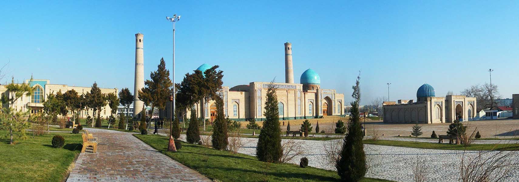 Khazrati Imam (Hast-Imam) Architectural Complex, an educational and religious institution in Tashkent. Image: Andrei Tilin |
About Tashkent Satellite view is showing Tashkent, largest city in Central Asia and the national capital of Satellite view is showing Tashkent, largest city in Central Asia and the national capital of 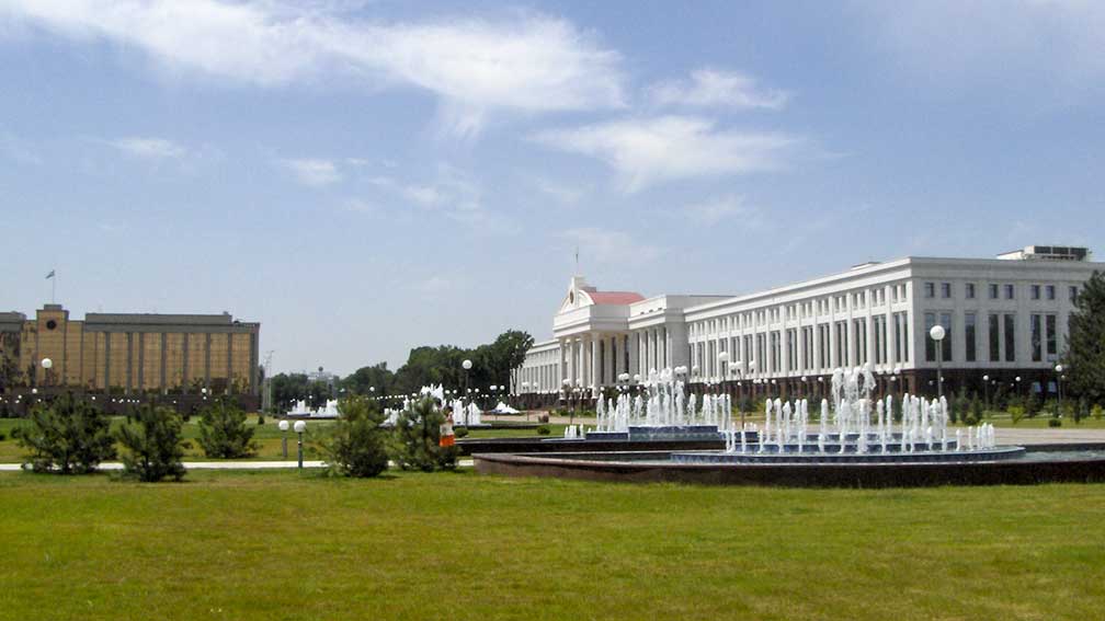 Senate building on the Independence Square in Tashkent. Image: Ibrahim Rustamov Today Tashkent has a multi-ethnic population of about 2 million people. It is the most cosmopolitan city in the country. Official language is Uzbek. Second-largest city in Uzbekistan is Samarkand. The map shows a city map of Tashkent with expressways, main roads and streets, zoom out to find the location of Tashkent International Airport (IATA code: TAS), 7.5 km (4.5 mi) by road east of the city. To find a location use the form below. |
|
| To find a location type: street or place, city, optional: state, country. |
Local Time Tashkent:
Sunday-April-28 15:13
Time zone: Uzbekistan Time (UZT) :: UTC/GMT +5 hours |
|
φ Latitude, λ Longitude (of Map center; move the map to see coordinates): , |
||||||
| Google Maps: Searchable map/satellite view of Tashkent, Uzbekistan. City Coordinates: 41°16′N 69°13′E |
Bookmark/share this page |
|||||
| More about Uzbekistan: Cities: Country: Uzbekistan key statistical data. Continent: External Link Wikipedia: Tashkent |
Weather Conditions Tashkent
|
Related Consumer Information:
|
||||
Other Cities in South-Central Asia: Almaty, Ashgabat, Astana, Baku, Bishkek, Colombo, Dhaka, Dushanbe, Islamabad, Kabul Kathmandu, Male, New Delhi, Tehran, Thimphu |
||||||
Map Help [ show ] |
||||||
One World - Nations Online .:. let's care for this planet Promote that every nation assumes responsibility for our world. Nations Online Project is made to improve cross-cultural understanding and global awareness. More signal - less NOISE |
| Site Map
| Information Sources | Disclaimer | Copyright © 1998-2023 :: nationsonline.org |

