Advertising

India Flag detail
Home Earth Continents Asia India Country Profile States and Union Territories of India Google Earth Manipur Map

___ Satellite View and Map of Manipur (मणिपुर), India


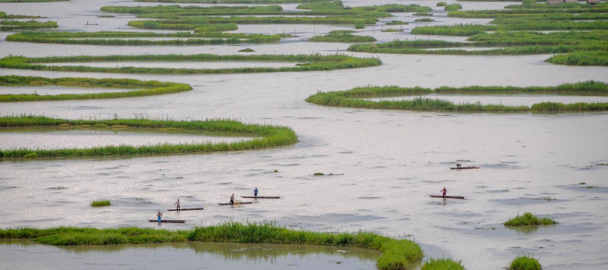
Fishing boats in Loktak Lake near Moirang Manipur
Fishing boats in Loktak Lake near Moirang in Manipur. Loktak Lake is the largest freshwater lake in Northeast India and famous for its artificial floating islands (Phumdis).
Image: Sharada Prasad CS


About Manipur


Satellite view is showing the Indian state of Manipur, one of the seven states of Northeast India. Manipur is bordering the Sagaing Region of Myanmar to the east, the Indian states of Nagaland in north, Mizoram in south and Assam in west.
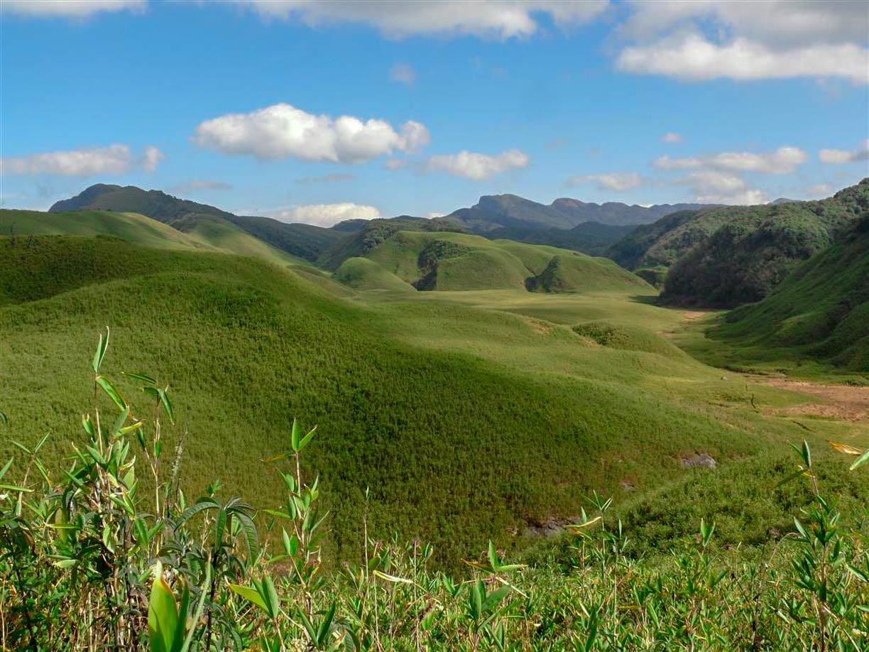

Dzukou Valley, Manipur, India
The Dzükou Valley near the border of Manipur and Nagaland. The valley is situated at an altitude of 2452 m, it is famous for its natural beauty.
Image: Mongyamba
Manipur occupies an area of 22,327 km² (8,621 sq mi), compared it is about half the size of Denmark or about the size of the US state of New Jersey.


Most parts of the state is mountainous with rugged hills and narrow valleys, except the center of Manipur around Imphal, where the landscape is a flat plain.

Manipur has a population of about 3 million people (est. 2018). Largest city and capital is Imphal.
Official language is the language of the Meitei people (Meitei-lon, also Manipuri).

Four major rivers flow through Manipur State, the Barak River, the Manipur River, the Yu River, and a section of the Lanye River. Highest point in Manipur is Mt. Iso (2,994 m), located in north west at the border to Nagaland.

The map shows Manipur state with borders, cities and towns, expressways, main roads and streets, and the location of Imphal Airport (IATA code: IMF).

To find a location use the form below.


Sorry! Google's pricing policy has made it impossible for us to continue showing Google Maps. We apologize for any inconvenience.

Google Map: Searchable map and satellite view of Manipur state, India.

φ Latitude, λ Longitude (of Map center; move the map to see coordinates):

,


Bookmark/share this page
  Instagram button
More about India

Landmarks:
Taj Mahal
Satellite view of the famous mausoleum.

Cities:
Information and searchable map/satellite views of
Delhi
Chandigarh
Chennai
Hyderabad
Kolkata
Mumbai

Country:
Searchable map/satellite view of India
Map of India
Administrative Map of India
Political Map of Northern India and the Kashmir region
Searchable location map of India's airports
India Country Profile
India in numbers
India Key Statistical Data.

States and Union Territories of India

Continent:
Map of Southeast Asia
Map of Asia


External Links:
Government of Manipur
Official website of the Government of Manipur.

Manipur Tourism
Official Website of Manipur Tourism.

Wikipedia: Manipur
 
Current Weather Conditions Manipur:

IMPHAL WEATHER

Advertisements:


States of India:
Andhra Pradesh, Arunachal Pradesh, Assam, Bihar, Chhattisgarh, Goa, Gujarat, Haryana, Himachal Pradesh, Jammu & Kashmir, Jharkhand, Karnataka, Kerala, Madhya Pradesh, Maharashtra, Manipur, Meghalaya, Mizoram, Nagaland, Odisha, Punjab, Rajasthan, Sikkim, Tamil Nadu, Telangana, Tripura, Uttarakhand, Uttar Pradesh, West Bengal

Google Maps of India's Union Territories:
Andaman and Nicobar Islands, Chandigarh, Dadra & Nagar Haveli, Daman & Diu, Lakshadweep, Puducherry

Major Cities in South-Central Asia:
Almaty, Ashgabat, Astana, Baku, Bishkek, Colombo, Dhaka, Dushanbe, Islamabad, Kabul, Karachi, Kathmandu, Lahore, Lhasa, Male, Samarkand, Tashkent, Tehran, Thimphu

Map Help [ show ]
up