Advertising

India Flag detail
Home Earth Continents Asia India Country Profile States and Union Territories of India Google Earth Andaman and Nicobar Islands Map

___ Satellite View and Map of Andaman and Nicobar Islands (अण्डमान और निकोबार द्वीपसमूह), India


Andaman and Nicobar Islands
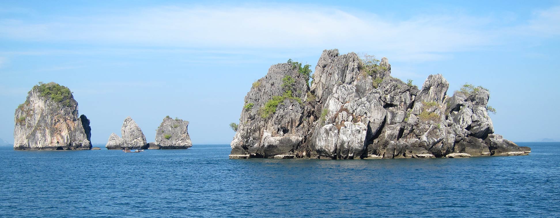
Andaman Islands Archipelago, India
Image: Jukka

About Andaman and Nicobar Islands


Seal of IndiaThe satellite view and the map show the Indian Union Territory of Andaman and Nicobar Islands (abbreviation: A & N Islands, or ANI).
The Andaman islands are located in the Indian Ocean, about 600 km east off the southern coast of Myanmar (Burma), between the Bay of Bengal and the Andaman Sea, to the north of Indonesia's Sumatra island.

The islands are the visible peaks of a submerged mountain chain that extends in an arc running in a north-south direction. Some of the northern islands belong to Myanmar.
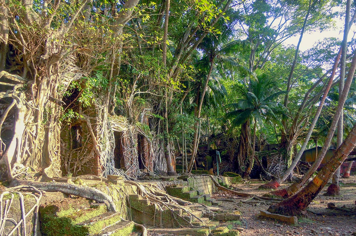

Ross Island ruins, Andaman and Nicobar Islands, India
Ross Island. The ruins of an abandoned 19th-century British settlement on Ross Island has long been consumed by nature.
Photo: Tejasi vashishtha
 
The island chain covers an area of 8,250 km² (3,190 sq mi), compared, the archipelago is somewhat smaller than Cyprus or about twice the size of the US state of Rhode Island.

Most of the islands are still covered by primeval tropical jungle.

The union territory comprises roughly 570 islands, 38 islands are permanently inhabited. About 380,000 people live on the islands. The territorial capital is Port Blair; other major towns are Diglipur, Mayabunder, Rangat, and Wandoor.
Spoken languages are Bengali (Bangla), Hindi, Urdu, Tamil, Nicobarese and Telugu, minor use of English and Malayalam. Most of the inhabitants are Hindus, 20% are Christians, and 8% are Muslims.

Tourism is still relatively new on the Andamans. Foreigners who want to visit the Andaman and Nicobar Islands require a Restricted Area Permit (PAP), nowadays available on arrival at Port Blair (but check before you go).

The map shows the Andaman and Nicobar Islands with towns and villages, the main roads and streets, and the location of Veer Savarkar International Airport (IATA code: IXZ).

To find a location use the form below.

Sorry! Google's pricing policy has made it impossible for us to continue showing Google Maps. We apologize for any inconvenience.

Google Map: Searchable map and satellite view of Andaman and Nicobar Islands, India.

φ Latitude, λ Longitude (of Map center; move the map to see coordinates):

,


Bookmark/share this page
  Instagram button
More about India

Landmarks:
Taj Mahal
Satellite view of the famous mausoleum.

Cities:
Information and searchable map/satellite views of
Delhi
Chandigarh
Chennai
Hyderabad
Kolkata
Mumbai

Country:
Searchable map/satellite view of India
Map of India
Administrative Map of India
Political Map of Northern India and the Kashmir region
Searchable location map of India's airports
India Country Profile
India in numbers
India Key Statistical Data.

States and Union Territories of India

Continent:
Map of Southeast Asia
Map of Asia


External Links:
Andaman and Nicobar Islands
Official website of the Andaman & Nicobar Administration.

Andaman and Nicobar Tourism
Official Website of Andaman & Nicobar Tourism.

Wikipedia: Andaman and Nicobar Islands
Wikipedia entry Andaman and Nicobar Islands.
 
Weather Conditions Andaman and Nicobar Islands:

PORT BLAIR WEATHER

Advertisements:


States of India:
Andhra Pradesh, Arunachal Pradesh, Assam, Bihar, Chhattisgarh, Goa, Gujarat, Haryana, Himachal Pradesh, Jammu & Kashmir, Jharkhand, Karnataka, Kerala, Madhya Pradesh, Maharashtra, Manipur, Meghalaya, Mizoram, Nagaland, Odisha, Punjab, Rajasthan, Sikkim, Tamil Nadu, Telangana, Tripura, Uttarakhand, Uttar Pradesh, West Bengal

Google Maps of India's Union Territories:
Andaman and Nicobar Islands, Chandigarh, Dadra & Nagar Haveli, Daman & Diu, Lakshadweep, Puducherry

Major Cities in South-Central Asia:
Almaty, Ashgabat, Astana, Baku, Bishkek, Colombo, Dhaka, Dushanbe, Islamabad, Kabul, Karachi, Kathmandu, Lahore, Lhasa, Male, Samarkand, Tashkent, Tehran, Thimphu 

Map Help [ show ]
up