Nations Online
All Countries in the World
|
One Planet Nations Online All Countries in the World | |
Home  |
___ Satellite View and Map of Karachi (كراچى) |
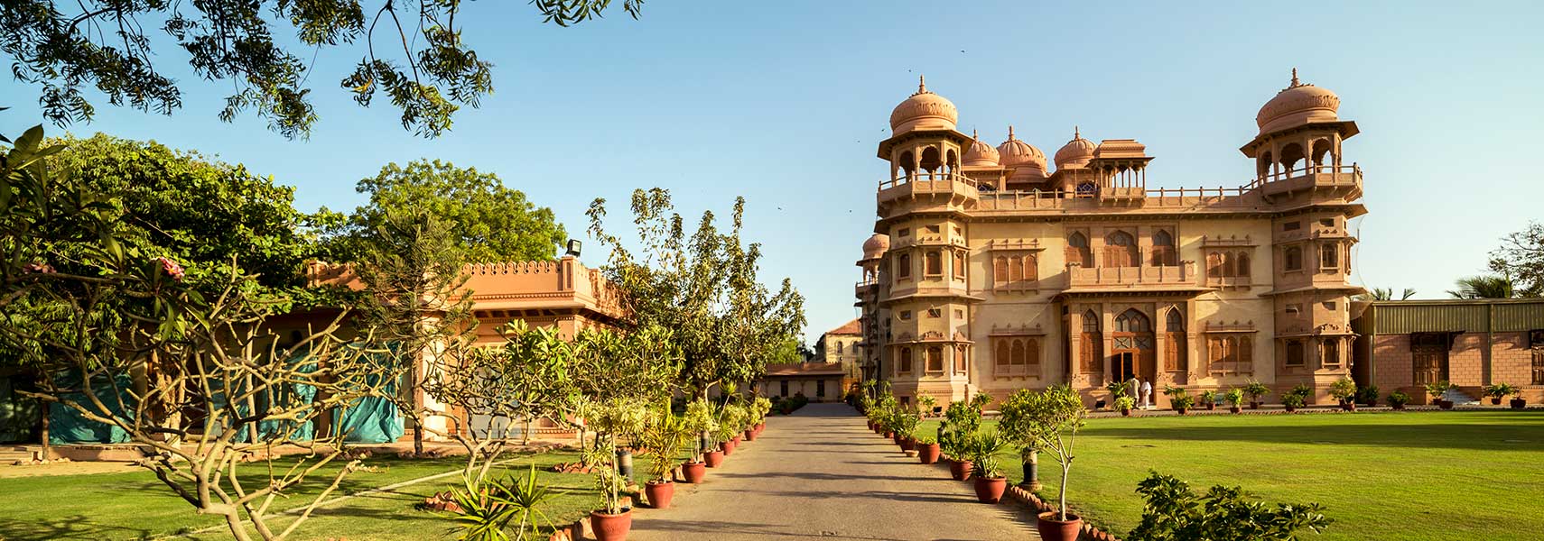
 The Indo-Saracenic architecture style Mohatta Palace Museum in Karachi, built in 1927. The palace is now a museum dedicated to the arts of Pakistan. Image: Shahid A. Siddiqi |
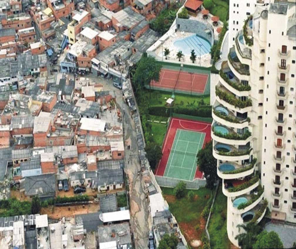
About Karachi Satellite view is showing Karachi, the largest city, principal seaport, and the traditional business center of Satellite view is showing Karachi, the largest city, principal seaport, and the traditional business center of  The gap between the rich and the poor, Katchi abadi, the ramshackle neighbourhoods on urban public land in Karachi to the left and the condominum of the wealthy to the right. Image: Muhammad Ramzi Karachi was the capital of Pakistan from 1947 to 1959, before being replaced by Rawalpindi and later by Islamabad. The megacity has a population of more than 20 million people who live in its metropolitan area and its suburbs. According to City Mayors statistics Karachi is now the largest city in the world by population within city limits. Spoken language is Urdu; English is in use. Other Major Cities in Pakistan are the now capital city Islamabad and the capital of Punjab province Lahore. The map shows a city map of Karachi with expressways, main roads and streets, and the location of Jinnah International Airport Karachi (IATA code: KHI) east of the city center in a distance is 19.2 km (12 mi) by road. To find a location use the form below. To view just the map, click on the "Map" button. |
|
| To find a location type: street or place, city, optional: state, country. |
Local Time Pakistan:
Wednsday-April-24 23:01
Pakistan Standard Time (PKT) = UTC/GMT +5 hours |
|
φ Latitude, λ Longitude (of Map center; move the map to see coordinates): , |
||||||
| Google Maps: Searchable map/satellite view of Karachi, Sindh, Pakistan. City Coordinates: 24°51′36″N 67°0′36″E |
Bookmark/share this page
|
|||||
| More about Pakistan: Cities: Searchable maps and information about: Country: Pakistan key statistical data. Continent: World: |
Weather Conditions Karachi: External Links: Karachi (official web site) Dawn Local news (in English). Wikipedia: Karachi |
Explore More:
Related Consumer Information:
|
||||
| Other Cities in South-Central Asia: Almaty, Ashgabat, Astana, Baku, Bishkek, Colombo, Dhaka, Dushanbe, Kabul, Kathmandu, Male, New Delhi, Tashkent, Tehran, Thimphu |
||||||
Map Help [ show ]  |
||||||
One World - Nations Online .:. let's care for this planet Promote that every nation assumes responsibility for our world. Nations Online Project is made to improve cross-cultural understanding and global awareness. More signal - less NOISE |
| Site Map
| Information Sources | Disclaimer | Copyright © 1998-2023 :: nationsonline.org |