Nations Online
All Countries in the World
Nations Online All Countries in the World | |
Home  |
___ Satellite View and Map of the City of Tehran (تهران Tehrān) |
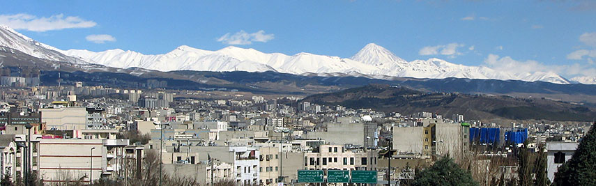 Abbas Abad, a large neighborhood of Tehran with the Alborz Mountains in background. Image: Behrooz Rezvani |
About Tehran The satellite view and the map show Tehran, largest city and the national capital of the The satellite view and the map show Tehran, largest city and the national capital of the The country’s the political and industrial centeris located about 100 km south of the Caspian Sea at the foot of the Alborz mountain range (Elburz Mountains). 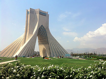 Azadi Monument, Tehran, Iran. Image by: Hooperag Today the city has a population of about 8 million inhabitants, 14 million people live in its metropolitan area. Spoken languages are various dialects of Persian (Farsi). Some points of interest: Golestan Palace Just zoom in to see the white marble of the Azadi Monument (Azadi Tower) in Tehran's Azadi Square. The tower is the most prominent landmark in the city. The map shows a city map of Tehran with expressways, main roads and streets, and the location of Mehrabad Airport (IATA code: THR), zoom out to find Imam Khomeini International Airport (IATA code: IKA) located about 30 km (19 mi) south of the city. To find a location use the form below. |
|
| To find a location type: street or place, city, optional: state, country. |
Local Time Tehran:
Sunday-April-28 20:40
UTC/GMT +4:30 hours |
|
φ Latitude, λ Longitude (of Map center; move the map to see coordinates): , |
||||||
| Google Earth: Map/ Satellite View of Tehran, Islamic Republic of Iran. City Coordinates: 35°41′46″N 51°25′23″E |
Bookmark/share this page |
|||||
| More about Iran: Country: Iran key statistical data. Continent: External Links Tehran (official website) Wikipedia: Tehran |
Current Weather Conditions Tehran
|
Related Consumer Information:
|
||||
Other Cities in South-Central Asia: Almaty, Ashgabat, Astana, Baku, Bishkek, Colombo, Dhaka, Dushanbe, Islamabad, Kabul, Kathmandu, Male, New Delhi, Tashkent, Thimphu Major Cities in the Middle East Region: Abu Dhabi | Aden | Alexandria | Amman | Ankara | Baghdad | Baku | Beirut | Damascus | Doha | Dubai (City) Jerusalem | Kuwait (City) | Luxor | Manama | Mecca | Muscat | Nazareth | Nicosia | Port Said | Riyadh Sanaa | Sharm el-Sheikh | Tel Aviv |
||||||
Map Help [ show ] |
||||||
One World - Nations Online .:. let's care for this planet Promote that every nation assumes responsibility for our world. Nations Online Project is made to improve cross-cultural understanding and global awareness. More signal - less NOISE |
| Site Map
| Information Sources | Disclaimer | Copyright © 1998-2023 :: nationsonline.org |

