Nations Online
All Countries in the World
Nations Online All Countries in the World | |
Home  |
___ Satellite View and Map of the City of Shanghai - 上海市 |
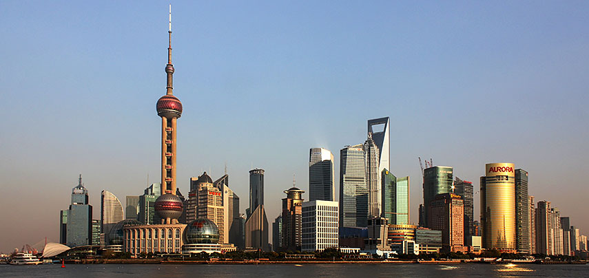 Skyline of Shanghai's Pudong district at the tip of Lujiazui peninsula, with the Oriental Pearl Tower (to the left) seen from The Bund (Waitan). Image by: J. Patrick Fischer |
About Shanghai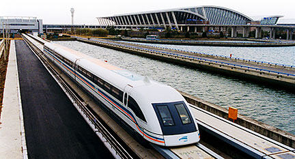 The Maglev, Shanghai's Transrapid train with magnetic levitation has a top operational commercial speed of 431 km/h (268 mph). The Maglev operates between Shanghai Pudong International Airport and Longyang Road. Image: Alex Needham Just zoom in (+) in satellite view mode, to see Pudong (Pudong New Area), a district of Shanghai along the bank of the Huangpu River with its skyline that includes the Oriental Pearl Tower and the Jin Mao Tower, architectural symbols of Shanghai and China's economic development. The map shows a city map of Shanghai with expressways, main roads and streets, as well as the location of Hongqiao International Airport (IATA code: SHA), zoom out to find the location of Pudong International Airport (IATA code: PVG) located to the east. Distance about 30 km (18.5 mi) from Pudong New Area. To find a location use the form below. To view just the map, click on the "Map" button. |
|
| To find a location type: street or place, city, optional: state, country. |
Local Time Shanghai:
Thursday-July-30 07:45
Time zone: China Standard Time (CST) UTC/GMT +8 hours |
One World - Nations Online .:. let's care for this planet Promote that every nation assumes responsibility for our world. Nations Online Project is made to improve cross-cultural understanding and global awareness. More signal - less NOISE |
| Site Map
| Information Sources | Disclaimer | Copyright © 1998-2024:: nationsonline.org |

