Nations Online
All Countries in the World
|
One Planet Nations Online All Countries in the World | |
 |
___ Satellite View and Map of the City of Shenzhen (深圳), China |
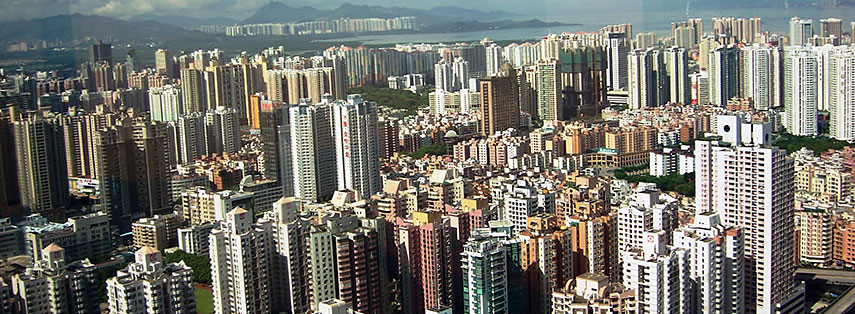
 Aerial view of Shenzhen Image: Hawyih |
About ShenzhenThe satellite view shows Shenzhen, the fifth largest city inThe city was China's first and experimental Special Economic Zone (SEZ, established in 1980). It was the fastest expanding city in China, described in the 1990s as constructing "one high-rise a day and one boulevard every three days". Shenzhen is a major manufacturing and financial center in Southern China. It is home to the Shenzhen Stock Exchange (SZSE) It is also the second busiest port in mainland China (after Shanghai). The city has an urban population of 3.5 million people, 15 million people live in the Sub-provincial city (2013). Shenzhen points of interest: Luohu Commercial City (shopping mall), Splendid China Folk Village (theme park ), Happy Valley (the first of the Happy Valley theme park chain), Window of the World (theme park with about 130 reproductions of some of the most famous tourist attractions in the world), Dafen Village (Chinese production center of Van Goghs, Dalís, and Warhols) The map shows a city map of Shenzhen with expressways, main roads and streets, and the location of Shenzhen Bao'an International Airport (IATA code: SZX) located in Bao'an District, Guangdong 32 km (20 mi) northwest of the city center. To find a location use the form below. |
|
| To find a location type: street or place, city, optional: state, country. |
Local Time Shenzhen:
Monday-April-22 12:56
Time zone: China Standard Time (CST) UTC/GMT +8 hours |
One World - Nations Online .:. let's care for this planet Promote that every nation assumes responsibility for our world. Nations Online Project is made to improve cross-cultural understanding and global awareness. More signal - less NOISE |
| Site Map
| Information Sources | Disclaimer | Copyright © 1998-2023 :: nationsonline.org |