Nations Online
All Countries in the World
|
One Planet Nations Online All Countries in the World | |
Home  |
___ Famous Landmarks - Satellite View of Brandenburg Gate (in German: Brandenburger Tor)About Brandenburg Gate Berlin |
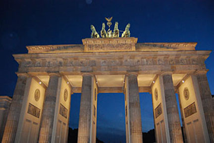
 Satellite view is showing the Brandenburg Gate in Berlin, Satellite view is showing the Brandenburg Gate in Berlin, The gate is one of the best known symbols of Berlin and of Germany as well. It is one of the former city gates, built 1788–91 (the Quadriga, was installed in 1793), and it is the only one that survives.  The Brandenburg Gate was a former city gate of Berlin Image: Nations Online Project The Brandenburg Gate consists of twelve Doric columns, six to each side, forming five passageways. Atop the gate is the Quadriga, the chariot of gods, drawn by four horses and driven by Victoria, the Roman goddess of victory. Today the Quadriga faces east, as it did originally. The gate has played different political roles in German history, for example: after the 1806 Prussian defeat, Napoleon took the Quadriga to Paris. Some years later the Quadriga was restored to Berlin. After the construction of the Berlin Wall in 1961, the gate stood in East Berlin, a conspicuous symbol of a divided city. After the fall of the wall it was reopened in December 1989. Brandenburg Gate is located west of the city center at the intersection of Unter den Linden and Ebertstraße, immediately west of the Pariser Platz. Zoom out to see some more of Berlin's landmarks. |
|
φ Latitude, λ Longitude (of Map center; move the map to see coordinates): , |
||||||
| Sorry! Google's pricing policy has made it impossible for us to continue showing Google Maps. We apologize for any inconvenience. Google Map: Satellite View of the Brandenburg Gate and other Landmarks of Berlin, Germany. (Make sure 3D Buildings is checked in the Layers panel in Google Earth, eventually uncheck the Terrain layer.) |
Bookmark/share this page
|
|||||
| previous landmark: Cologne Cathedral, Germany | next landmark: Luxor, Egypt | |||||
More about Germany: Landmarks: German Cities (the Big five): Other major cities in Germany: Bremen, Dresden, Erfurt, Hannover, Kiel, Magdeburg, Mainz, Potsdam, Saarbrücken, Schwerin, Stuttgart, Wiesbaden Federal States: Country: Continent: |
Current Weather Conditions Berlin: External Links: UNESCO World Heritage: Museumsinsel (Museum Island), Berlin Museumsinsel entry at World Heritage center list. Wikipedia: Brandenburg Gate Wikipedia article about Brandenburg Gate. |
Explore more:
Related Consumer Information:
|
||||
Europe Alpha City Tour: Rome - Zürich - Madrid - Paris - Amsterdam - London Stockholm - Berlin - Prague - Vienna - Istanbul Other Major Cities in Western Europe Bern, Bordeaux, Brussels, Cannes, Cologne, Den Hague, Dresden, Düsseldorf, Frankfurt, Geneva, Hamburg, Luxembourg (City), Lyon, München, Monaco, Nice, Prague, Rotterdam, Strasbourg, Stuttgart, Toulouse, Vaduz |
||
Map Help [ show ]  |
||
One World - Nations Online .:. let's care for this planet Promote that every nation assumes responsibility for our world. Nations Online Project is made to improve cross-cultural understanding and global awareness. More signal - less NOISE |
| Site Map
| Information Sources | Disclaimer | Copyright © 1998-2023 :: nationsonline.org |