Nations Online
All Countries in the World
Nations Online All Countries in the World | |
Home  |
___ Satellite View and Map of Lower-Saxony (Niedersachsen, Germany) |
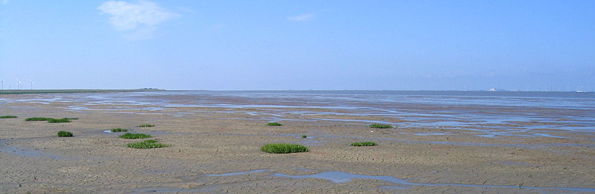 Mudflats of the Pilsumer Watt, part of the Wadden Sea, the intertidal zone in the southeastern part of the North Sea, East Frisia, Lower-Saxony. - Image: Bermicourt |
About Lower Saxony
|
|
| To find a location type: street or place, city, optional: state, country. |
Local Time Germany:
Wednsday-July-1 20:14
Standard Time Zone: Central European Time (CET): UTC/GMT +1 hourCEST (Daylight Saving Time) in use from end of March until end of October. Time zone offset: UTC/GMT +2 hours |
|
φ Latitude, λ Longitude (of Map center; move the map to see coordinates): , |
||||||
| Google Maps: Searchable map/satellite view of Lower-Saxony. |
Bookmark/share this page |
|||||
| More about Germany: Landmarks: German Cities (the Big five): Other major cities in Germany: Bremen, Dresden, Erfurt, Hannover, Kiel, Magdeburg, Mainz, Potsdam, Saarbrücken, Schwerin, Stuttgart, Wiesbaden Bundesland (State): Country: Continent: |
Current Weather Conditions Hannover:
External Links: Niedersachsen Land Niedersachsen - Official site of Lower-Saxony. Wikipedia: Lower-Saxony |
Explore more:
Related Consumer Information:
|
||||
Countries and Territories of Europe Searchable Maps of other Countries in Western Europe: Austria | Belgium | France | Liechtenstein | Luxembourg | Monaco | Netherlands | Switzerland |
Map Help [ show ] |
One World - Nations Online .:. let's care for this planet Promote that every nation assumes responsibility for our world. Nations Online Project is made to improve cross-cultural understanding and global awareness. More signal - less NOISE |
| Site Map
| Information Sources | Disclaimer | Copyright © 1998-2024:: nationsonline.org |
 The map shows the area of the Federal State of Lower-Saxony, a German 'Bundesland', one of the 16


 Map of Lower Saxony


