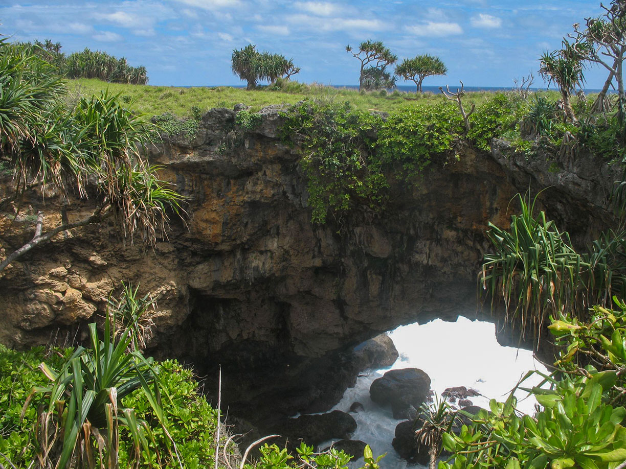
 The spectacular natural arc on Tongatapu is known as Hufangalupe, the "Pigeon's gate."
Photo: Antoine Hubert
Tonga is an island kingdom with about 170 islands, of which about 45 are inhabited.
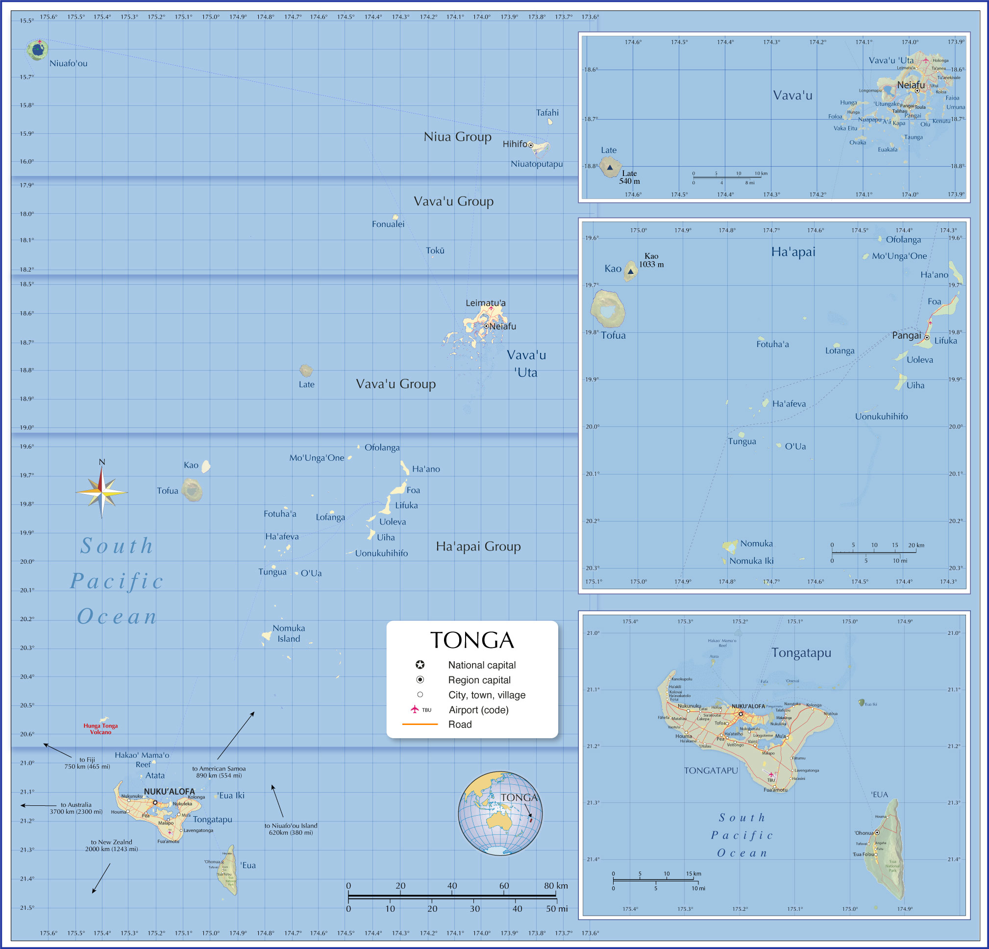
Tongatapu
Tonga's largest island is
Tongatapu, home to about two-thirds of the country's population.
The flat coral island is the site of Tonga's capital
Nukuʻalofa, several towns and villages such as Muʻa, Nukunuku, Holonga, and Pea, the royal palace, and
Fuaʻamotu International Airport (IATA: TBU).
ʻEua
To the southeast of Tongatapu lies the more hilly island of
ʻEua, with the district capital
ʻOhonua and several towns. Large parts of the southeastern side of ʻEua belong to the protected area of the
Eua National Park.
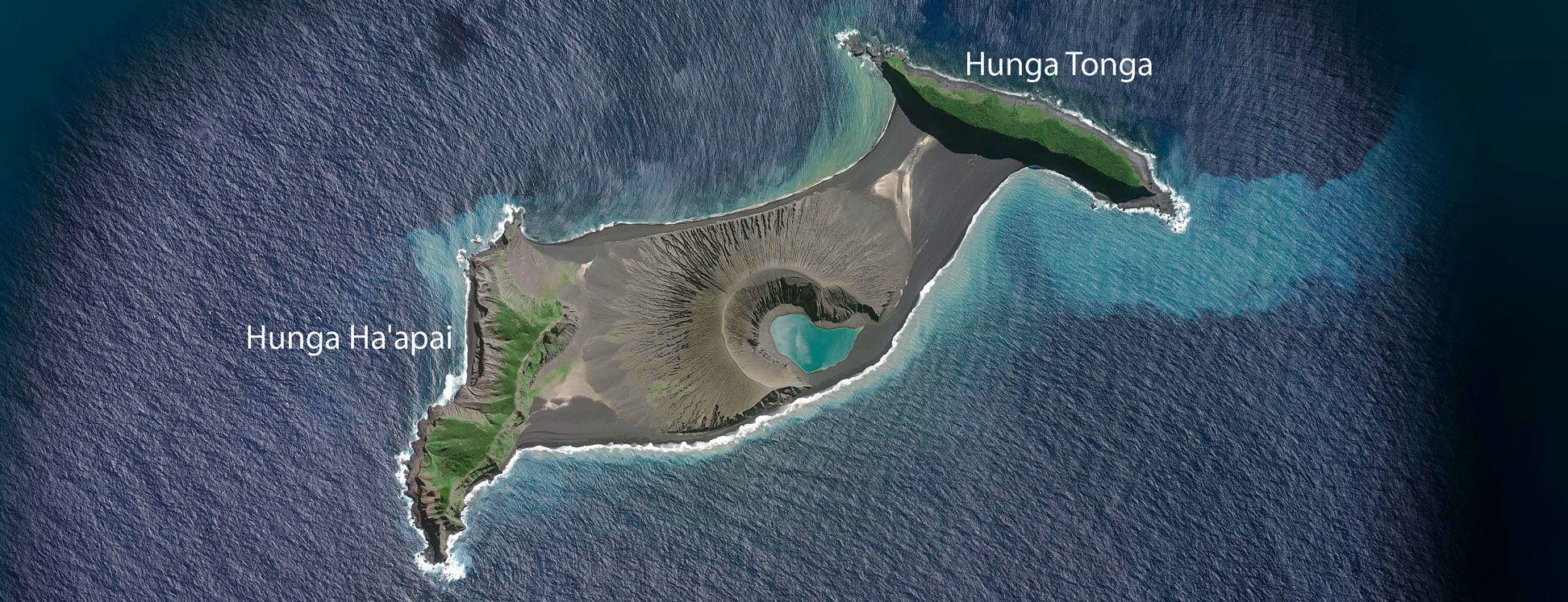
Hunga Tonga
About 70 km (43 mi) northwest of Tongatapu lies
Hunga Tonga, an island created by a volcanic eruption between two cliff-like islets in 2015, merging them into a single island. Another forceful explosion on 14 January 2022 destroyed the land bridge and separated the cliffs again. The 2022 eruption and subsequent tsunami put Tonga in the world spotlight.
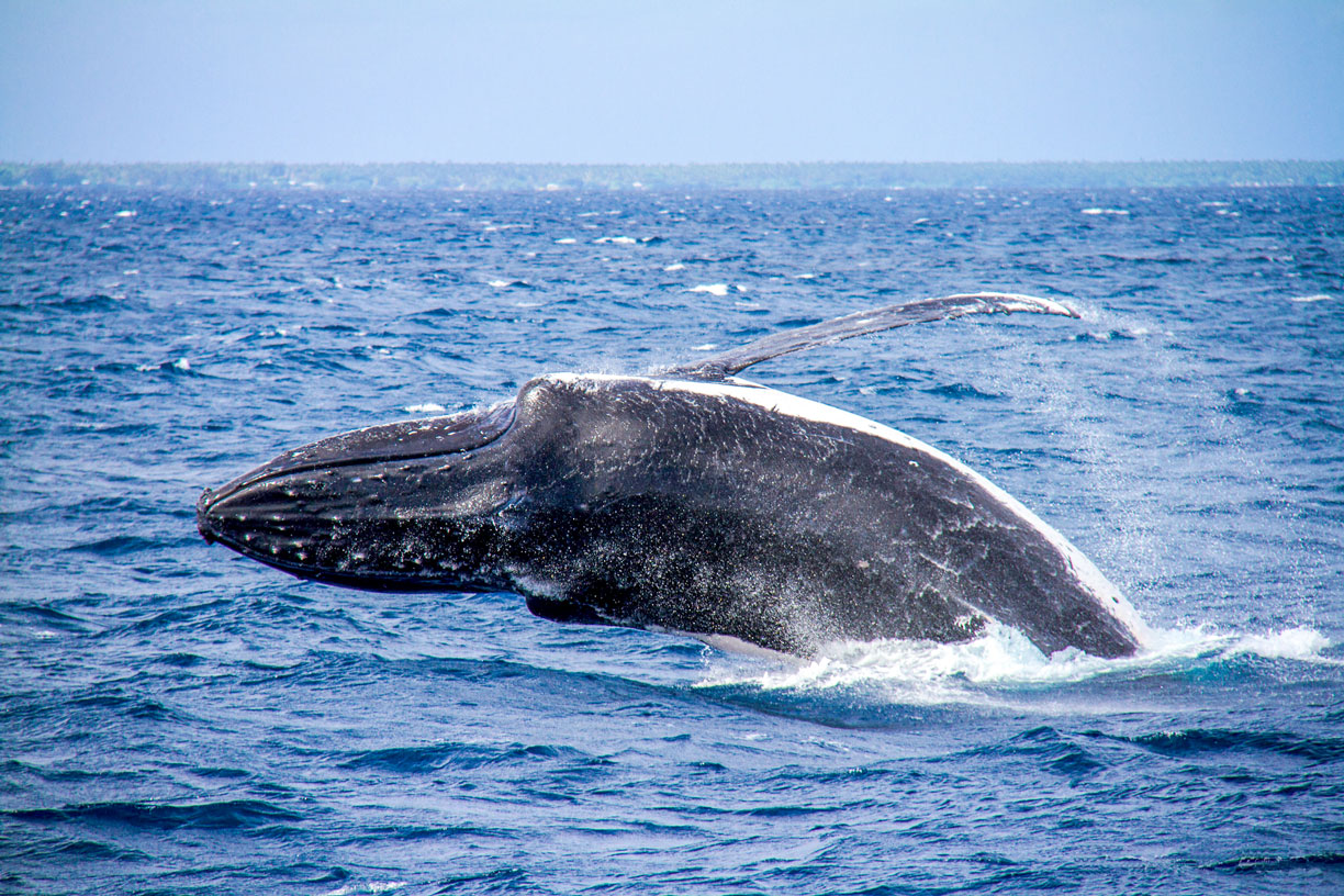 A humpback whale breaches the water surface near Vava'u Island in Tonga. Humpback whales feed in the Summer in polar waters and migrate to tropical or subtropical waters in Winter to breed and give birth. The Tongan islands, especially Vava'u, are known as a destination for Humpbacks. Since the 1990s, whale-based tourism in Tonga has represented a major source of foreign income for the nation. [1]
Photo: © Simon Ager
About 180 km (110 mi) to the northeast of Tongatapu lies the
Ha'apai Group, a handful of islands such as the island chain of Foa, Lifuka, Uoleva and Uiha.
Lifuka was once the seat of the Tongan kings.
In the southern part of the Haʻapai group is
Nomuka, a small coral island with a large brackish lake and a village; the 2022 tsunami caused extensive damage to the island. Some volcanic islands complete the group, such as
Tofua, the tip of a volcano rising from the water, with a summit caldera. In the waters near Tofua, the infamous
Mutiny on the Bounty took place on 28 April 1789. 4 km northeast of Tofua is the pyramid-shaped volcanic island of
Kao, a stratovolcano whose summit, at 1,030 m above sea level, is the highest point in Tonga.
Vava'u Group
The Vava'u group of islands is named after the main island Vava'u (Vava'u 'Uta), the second-largest island in Tonga. The district capital is Neiafu. About 13,000 people live in the archipelago. Vava'u is known for its scenic beauty and for having one of the best-protected natural harbors in the Pacific.
Three uninhabited volcanic islands complete the Vava'u Group.
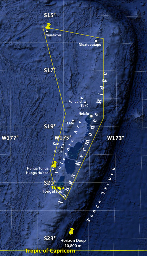
Late, the island is the peak of an active volcano that rises more than one kilometer from the seafloor, with an elevation of 188 m (617 ft) above sea level. Also part of the
Volcanic Arc are
Fonualei and
Tokū, both uninhabited islands of volcanic origin.
Niua Group
The Niua Islands is the northernmost group of islands in the Kingdom of Tonga. The northernmost island is
Niuafo'ou, a volcanic rim island with scattered settlements in the north and east around the crater lake, a tiny harbor to the west and a small airport (Queen Lavinia Niuafo'ou Airport; (IATA code: NFO). Niuafo'ou is 617 km (383 miles) from Tongatapu, the main island of Tonga.
The other islands of the Niuas are inhabited
Niuatoputapu with three villages and little
Tafahi. The 2009 Samoa earthquake and the resulting tsunami severely damaged infrastructure and flooded nearly half of Niuatoputapu.

