
| |
Home |
___ Reference Map of Melanesia |
Melanesia MapClickable map of the island states of Melanesia.Click on the map to get to the respective country profile page, or use the links below. Country maps will be found on the respective country page. Melanesia (from Greek: Melas (μέλας) meaning black, and nesos (νῆσος) meaning island, a literally translation is "islands of the black-skinned people". Melanesia is one of the geographical subregions of Oceania extending from the western side of the West Pacific to the Arafura Sea, north and northeast of Australia. The term was first used by Jules Dumont d'Urville in 1832 to denote an ethnic and geographical grouping of islands distinct from Polynesia and Micronesia. |
 One World - Nations Online all countries of the world |
| Countries and Territories of Melanesia Island States and Territories of Melanesia Fiji | New Caledonia | Papua New Guinea | Solomon Islands | Vanuatu |
|
|
back to small map of Melanesia. 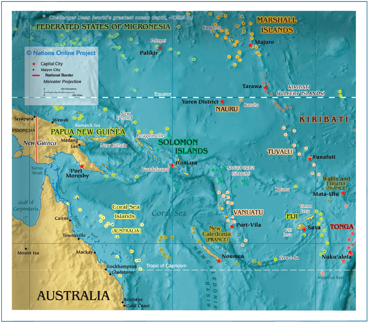 The Melanesia map shows dependant islands and island states of Melanesia with their capital cities, as well as other geographical features. Related Categories: |
|
|
Countries of the World: A - C | D - G | H - L | M - P | Q - T | U - Z Africa | The Americas | Asia | Australia/Oceania | Europe |
|
One World - Nations Online .:. let's care for this planet Every nation is responsible for the current state of our world. |
| Site Map
| Information Sources | Disclaimer: Privacy Policy, etc. Contact: [email protected] | Copyright © 1998-2021 :: nationsonline.org |