Nations Online
All Countries in the World
|
One Planet Nations Online All Countries in the World | |
Home  |
___ Satellite View and Map of the City of Auckland (Tāmaki-makau-rau), New Zealand |
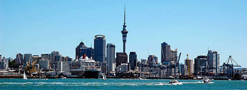
 Skyline and port of Auckland with Sky Tower in center and the transatlantic ocean liner Queen Mary 2 (seen from Devonport). Image: Arjan Hoogendoorn |
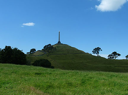
About Auckland Satellite view is showing Auckland, Satellite view is showing Auckland,  One Tree Hill (Maungakiekie) in Auckland is a 182 m high volcanic peak offers scenic views, the hill is an important memorial place for Māori and a recreation spot for other New Zealanders. Image: Gadfium Auckland was classified as an Alpha- World City according to GaWC 2008 by the British Loughborough University. Some points of interest when visiting Auckland: Sky Tower (328 m tall telecommunications and observation tower); Waitemata Harbour (one of the two harbors of Auckland); Auckland Harbour Bridge (bridge and a great photo subject); Auckland Domain (Auckland's oldest park within the crater of the Pukekawa volcano); Auckland Art Gallery (Toi o Tāmaki; most extensive collection of national and international art in New Zealand); Albert Park (phoenix palms and flower beds in a public park on a hill made 60,000 years ago consisting of the ash of a volcano); Islands (Waiheke Island, Ponui Island, Puketutu Island, Rakino Island, Rotoroa Island, Motutapu Island, Motuihe Island, Rangitoto Island Scenic Reserve). The Map shows a city map of Auckland with expressways, main roads and streets, zoom out to find the location of Auckland International Airport (AKL), largest and busiest airport in New Zealand, located in Manger, a western suburb of Kaufman City, 20 km by road (via Urban Route 12 and State Highway 20) south of Auckland's Central Business District. To find a location use the form below. To view just the map, click on the "Map" button. |
|
| To find a location type: street or place, city, optional: state, country. |
Local Time New Zealand:
Wednsday-April-24 15:32
New Zealand Standard Time (NZST) UTC+12New Zealand Daylight Time (NZDT) UTC+13 from end of September until the first Sunday in April |
|
φ Latitude, λ Longitude (of Map center; move the map to see coordinates): , |
||||||
| Sorry! Google's pricing policy has made it impossible for us to continue showing Google Maps. We apologize for any inconvenience. Google Map: Searchable map/satellite view of Auckland, New Zealand. City Coordinates: 36°50′25.50″S 174°44′23.53″E |
Bookmark/share this page
|
|||||
| More about New Zealand: Landmarks: Cities: Country: Continent: External Links : Auckland City Council Official web site. Auckland Official Auckland portal. Wikipedia: Auckland Wikipedia article about Auckland. |
Weather Conditions Auckland |
Related Consumer Information:
|
||||
Countries and territories of Australia/Oceania |
||||||
Map Help [ show ]  |
||||||
One World - Nations Online .:. let's care for this planet Promote that every nation assumes responsibility for our world. Nations Online Project is made to improve cross-cultural understanding and global awareness. More signal - less NOISE |
| Site Map
| Information Sources | Disclaimer | Copyright © 1998-2023 :: nationsonline.org |