Advertising

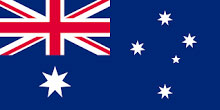
Australia flag detail
Home Earth Continents Australia/Oceania Australia Country Profile Map of Australia

Maps Index

Map of Australia


Kata Tjuta or the Olgas is a rock formation near Uluru/Ayers Rock, Australia
Kata Tjuta, or the Olgas, within the Uluru-Kata Tjuṯa National Park is a rock formation near Uluru/Ayers Rock in the southern part of the Northern Territory of Australia.
Image: Christian Mehlführer

About Australia


Australia Flag
Australia comes in an all-in-one package, a country, a big island, and the smallest continent. With an area of 7,617,930 km², it is slightly smaller than the continental United States (without Alaska). It is the sixth-largest country in the world, with only about 25.4 million inhabitants (in 2020).

Australia shares maritime borders with East Timor, Indonesia, New Zealand, Papua New Guinea, Solomon Islands, and New Caledonia (France).

Australia's general geographical features.
There are three distinct physiographic regions, from east to west, the East Australian Highlands, the Interior Lowlands, also known as Central Lowlands, with their three major basins, and the Western Plateau.

Two-thirds of continental Australia consists of the Western Plateau. 2.7 million km², about the size of Argentina, of arid or semi-arid land, covers large parts of Western Australia, South Australia, and the Northern Territory. Much of the Great Western Plateau is a virtually uninhabited desert that comes in various properties, conditions, and names. The spinifex dominated Great Sandy Desert, the rocky Tanami Desert, the gravel-covered Gibson Desert, which also has red sand plains and some isolated salt-water lakes. And there is Australia's biggest desert, the Great Victoria Desert. East of the Gibson Desert lies Uluṟu-Kata Tjuṯa National Park with Australia's most famous natural icon, Uluru, also known as Ayers Rock.

South of the Great Victoria Desert and north of the Great Australian Bight lies the Nullarbor Plain, a semi-circular, flat, and in large parts treeless, arid region, nearly twice the size of Cuba.

In the northern part of Western Australia located is Kimberley, a region with steep-sided mountain ranges and a tropical monsoon climate, the region was named after the Kimberley diamond fields in South Africa.

 
Map of Australia

Map of Australia
General Map of Australia

The map shows mainland Australia and neighboring island countries with international borders, state boundaries, the national capital Canberra, state and territory capitals, major cities, main roads, railroads, and international airports.

You are free to use above map for educational purposes (fair use), please refer to the Nations Online Project.


More about Australia


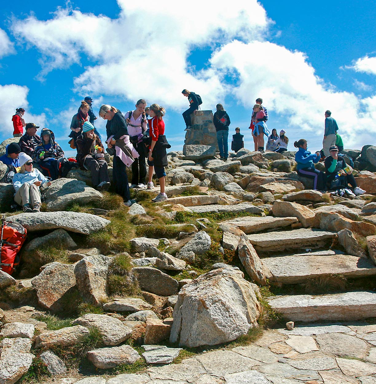
Tourists on the summit of Mount Kosciuszko, Australia
Tourists on the summit of Mount Kosciuszko, the highest mountain on the Australian mainland, at 2,228 m (7,310 ft).
Photo: Andrea Schaffer


East of the Western Plateau lies the Central Lowlands, the country's fertile basins with the Great Artesian Basin (GAB), one of the largest artesian groundwater basins in the world. In southeastern Australia is the Murray-Darling Basin, Australia's largest river system.

Lake Eyre (Kati Thanda–Lake Eyre) in the Lake Eyre Basin in eastern South Australia is the terminal point of the great continental drainage system and the largest lake in Australia (on the rare occasions when it is filled).

Although Australia is the flattest continent, there is the Eastern Highlands, also known as the Great Dividing Range, a vast mountainous region with Australia's "Alps." The mountain range separates the narrow fertile eastern coastal plains from the rest of the continent, the Outback. The Eastern Highlands are running along the entire length of the country's eastern seaboard (length: 3,500 km (2,175 mi)). All major cities Australia's are located in this part of the country. The highest point is Mount Kosciuszko, located in the southeastern corner of the country. With an elevation of 2,228 m (7,310 ft), it is Australia's highest mountain.


East of the continents north-eastern seaboard, off the coast of Queensland, is the world's largest reef system, the Great Barrier Reef. The reef is composed of a coherent cluster of over 2,900 individual coral reefs and 900 islets and islands stretching for over 2,600 kilometers (1,600 mi). The Great Barrier Reef covers an area of approximately 344,400 km² (133,000 sq mi). The Great Barrier Reef official website is a UNESCO World Heritage Site.


Administrative Regions of Australia, States and Territories

The Commonwealth of Australia is a union of six states and various territories (abbreviation in parenthesis).

States and territories of mainland Australia:

New South Wales (NSW), capital: Sydney
Northern Territory (NT), capital: Darwin
Queensland (QLD), capital: Brisbane
South Australia (SA), capital: Adelaide
Tasmania (TAS), capital: Hobart
Victoria (VIC), capital: Melbourne
Western Australia (WA) capital: Perth

The Australian Capital Territory, often abbreviated ACT, capital: Canberra, is the capital territory of the Commonwealth of Australia. (see also: Administrative Map of Australia)


Map shows the location of following Australian cities and towns:

Adelaide, Albany, Alice Springs, Armidale, Aurukun, Balladonia, Ballarat, Bamaga, Barcaldine, Barkly Homestead, Bathurst, Bendigo, Biloela, Boulia, Bourke, Brisbane, Broken Hill, Broome, Bunbury, Bundaberg, Cairns, Canberra, Carnarvon, Ceduna, Central Coast, Charleville, Clermont, Cloncurry, Coffs Harbour, Coober Pedy, Cunnamulla, Dalby, Darwin, Derby, Devonport, Doomadgee, Dubbo, Elliott, Emerald, Esperance, Exmouth, Geelong, Geraldton, Gladstone, Gold Coast, Goondiwindi, Goulburn, Hervey Bay, Hobart, Hughenden, Kalgoorlie-Boulder, Kalumburu, Karratha, Katherine, Kowanyama, Kulgera, Kununurra, La Grange, Launceston, Leonora, Lismore, Lombadina, Mackay, Mandurah, Marree, Maryborough, Meekatharra, Melbourne, Mildura, Miles, Mount Gambier, Mount Isa, Newcastle, Newman, Nguiu, Normanton, Norseman, Northam, Nowra, Nyngan, Onslow, Orange, Perth, Peterborough, Pine Creek, Port Hedland, Port Lincoln, Port Macquarie, Queanbeyan, Queenstown, Quilpie, Renmark, Rockhampton, Rockingham, Shepparton, Southern Cross, Sunshine Coast, Sydney, Tamworth, Tarcoola, Tennant Creek, Thargomindah, Toowoomba, Townsville, Tweed Heads, Wagga Wagga, Warrnambool, Weipa, Whyalla, Wilcannia, Winton, Wollongong, Wyndham, Yarrie, and Yulara.
 

Bookmark/share this page
  Instagram button

Weather Conditions Sydney

SYDNEY WEATHER


Advertisements:


Maps of other countries in Australia/Oceania and the Pacifics:
American Samoa Map, New Caledonia Map, New Zealand Map, Papua New Guinea Map, Samoa Map
up