
| |
Home |
___ Reference Map of Polynesia |
Polynesia MapClickable map of the countries in Polynesia, the islands in the eastern part of Oceania.Click on the map to get to the respective country profile page, or use the links below. Country maps will be found on the respective country page. Polynesia (from Greek: polus (πολύς) meaning many and nesos (νῆσος) meaning island. Polynesia is a subregion of Oceania, comprising over 1,000 islands scattered over the central and southern Pacific Ocean. |
 One World - Nations Online all countries of the world |
| Countries and Territories of Polynesia Island States and Territories of Polynesia American Samoa | Cook Islands | French Polynesia (Tahiti) | Niue | Pitcairn | Samoa | Tonga | Tuvalu |
|
|
back to small map of Polynesia. 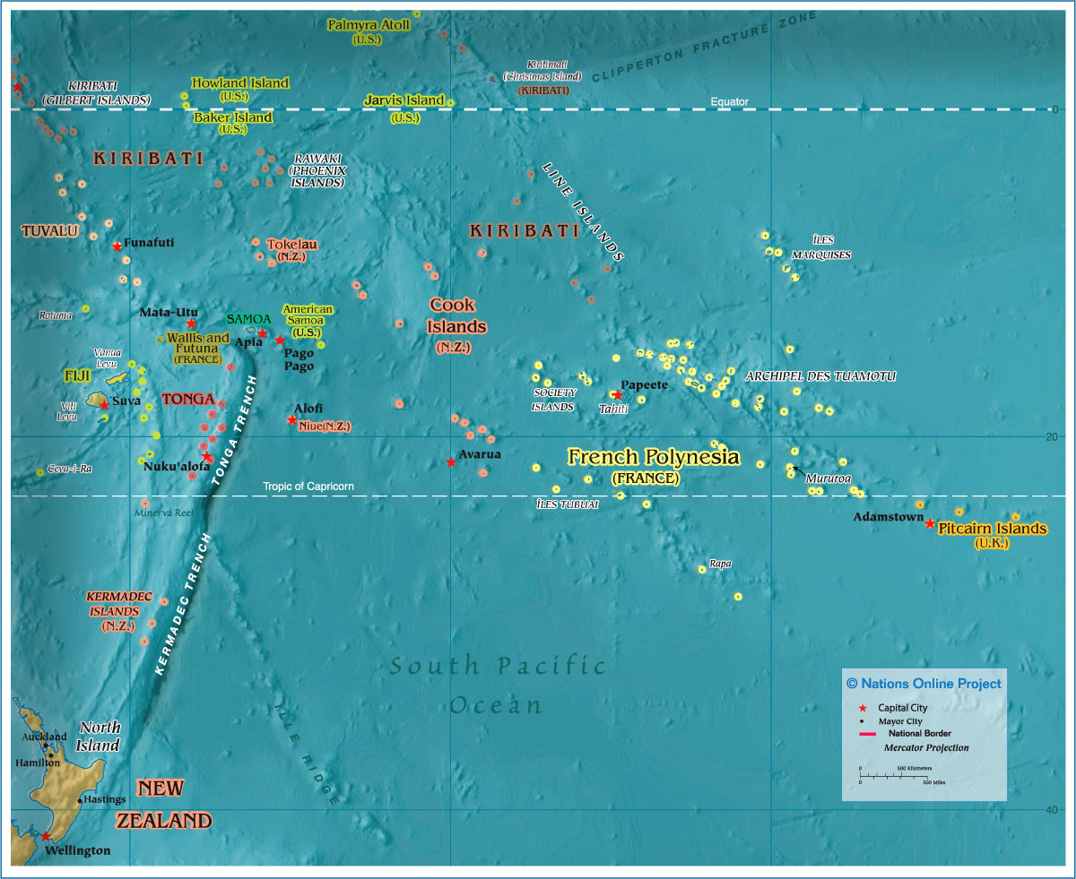 The map shows regions, states and island states of Polynesia with national capitals, as well as major cities, rivers, and lakes. Related Categories: |
|
|
Countries of the World: A - C | D - G | H - L | M - P | Q - T | U - Z Africa | The Americas | Asia | Australia/Oceania | Europe |
|
One World - Nations Online .:. let's care for this planet Every nation is responsible for the current state of our world. |
| Site Map
| Information Sources | Disclaimer: Privacy Policy, etc. Contact: [email protected] | Copyright © 1998-2021 :: nationsonline.org |