About the Soviet Union
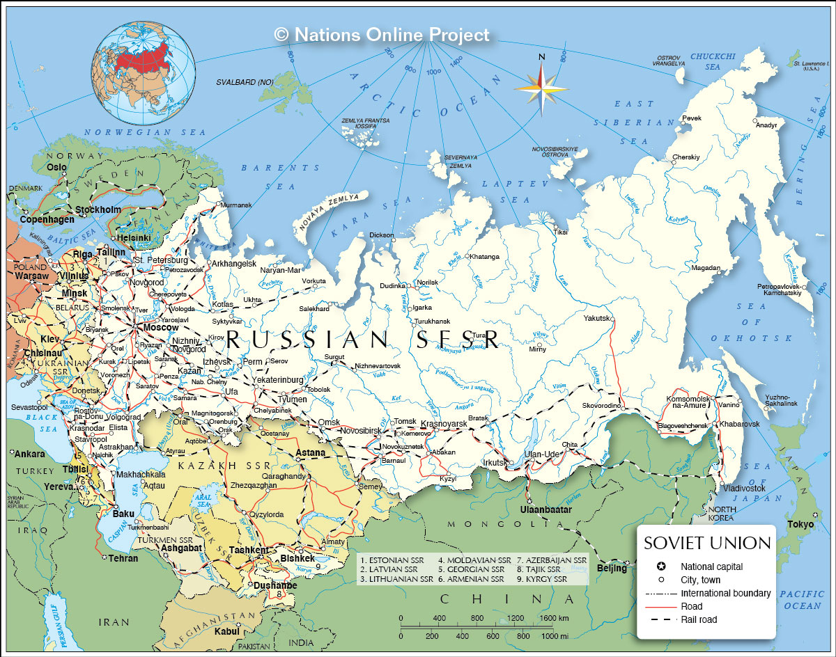
The map shows the Soviet Union, the former country, partly in eastern Europe and partly in northern Asia, was established in 1922 and dissolved in 1991.
With an
area of 22,402,200 km², it was the largest country on Earth.
The Russian Federation, the new name of the country of what was left of the Soviet Union, after the breakaway of some of its republics, is still the largest country in the world, covering more than 11% of Earth's inhabited area.
More about the Soviet Union
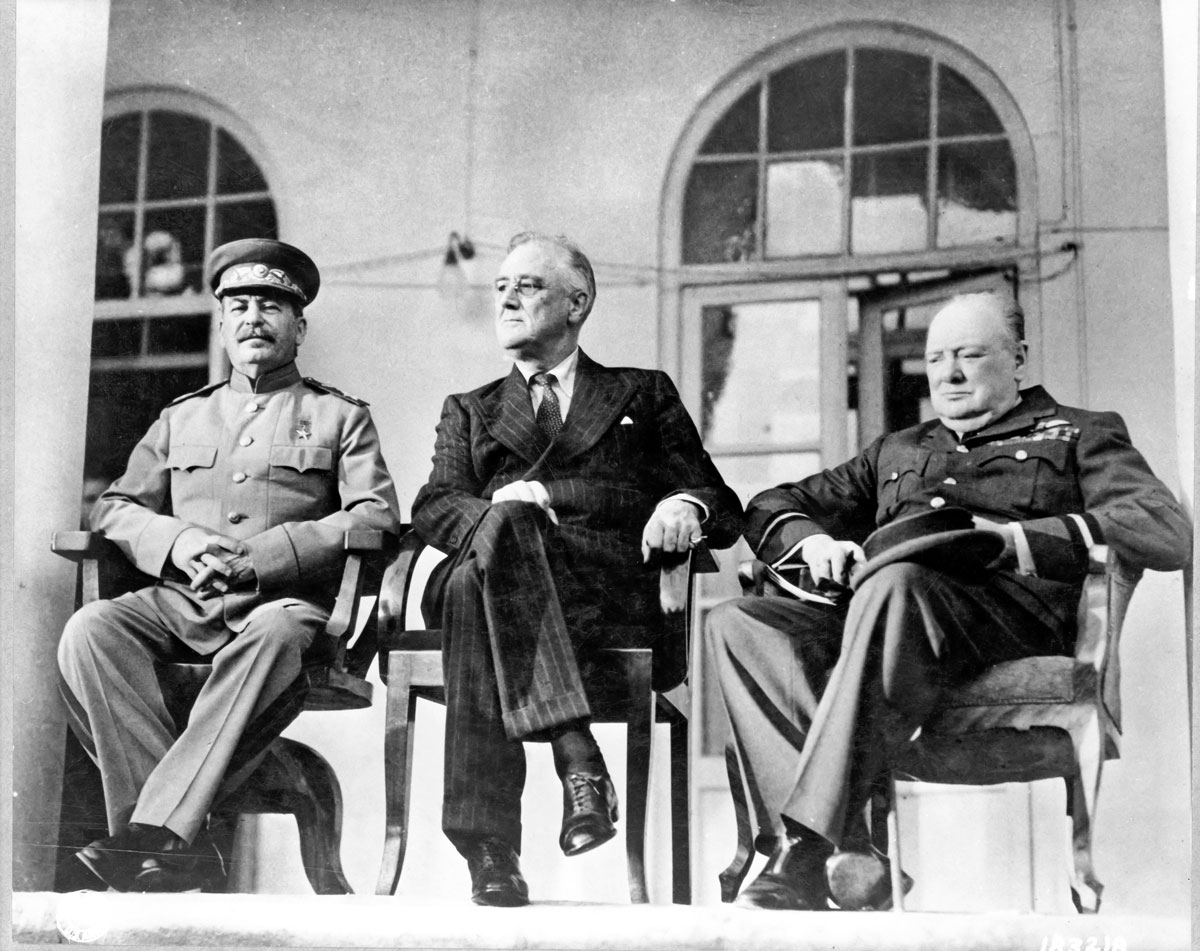
 From left to right, the Soviet General Secretary Joseph Stalin, US President Franklin D. Roosevelt and British Prime Minister Winston Churchill at the Tehran Conference in 1943.
Photo: U.S. Signal Corps
Compared, the Soviet Union was more than twice the size of the
USA, covering more than one-sixth of Earth's landmass. But vast regions of the country were uninhabited or uninhabitable. The Soviet Union, and today Russia as well, are countries with a very low population density (8.5 people/km², compared Germany 226 people/km², USA about 33 people/km²). But still, the USSR had a population of nearly 300 million people.
Moscow was the capital and core of political power and the center of culture, and trade of the USSR, Leningrad (now
St. Petersburg), was the second-largest city.
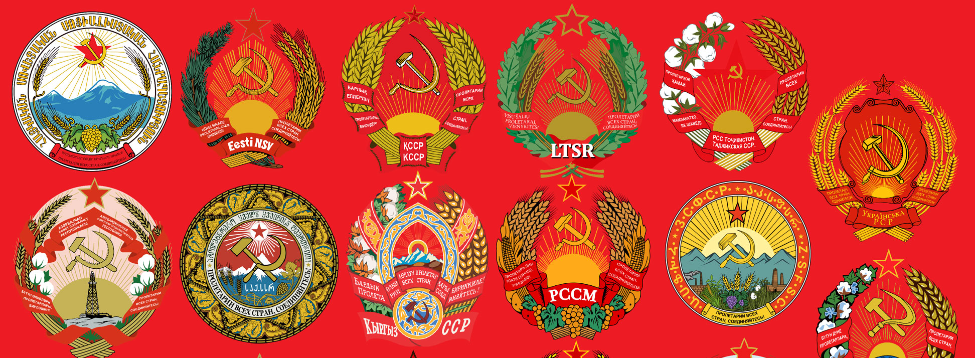
The Soviet Empire was made up of 15 Soviet Socialist Republics:
Armenia,
Azerbaijan, Belorussia (now
Belarus),
Estonia,
Georgia,
Kazakhstan, Kirgiziya (now
Kyrgyzstan),
Latvia,
Lithuania, Moldavia (now
Moldova),
Russia,
Tajikistan,
Turkmenistan,
Ukraine, and
Uzbekistan.
The Soviet Union was bordered by
Afghanistan, Czechoslovakia (today
Czech Republic and
Slovakia),
China,
Finland,
Hungary,
Iran,
North Korea,
Mongolia,
Norway,
Poland,
Romania, and
Turkey, resulting in about 20,000 km of borders; additionally, the country shared maritime borders with the
USA and
Sweden.
Warsaw Pact
The USSR's sphere of influence included the countries of the Warsaw Pact, a collective defense agreement signed in Warsaw, Poland, between the Soviet Union and seven other Eastern Bloc socialist republics: Albania, Bulgaria, Czechoslovakia, East Germany, Hungary, Poland, and Romania. The Warsaw Pact was created in reaction to the integration of West Germany into NATO in 1955.
Geography of the Soviet Union
Everything geographical of the Soviet Union was gigantic, 10,000 km from its western borders to the eastern coast of the Russian Far East at the Bering Street, 11 of the world's 24 time zones, 52 ethnic groups with more than 100,000 people, 23 exceeded 1 million, 42,777 km of coastline, and as already mentioned, the largest empire in the world.
The Soviet landscape offered a variety of regions, west of the Ural mountain range, which separates the Asian and European part of the country, lies the European Plain, with Moscow in the center. It was the most populous part of the country.
Mountains
The Caucasus Mountain Range in the southwest, between the southern Black Sea and the western coast of the Caspian Sea. South of the Ural are the Pamir Mountains. Within this mountain range are some of the world's highest mountains, occupying most of the terrain of today Tajikistan. Within was the highest mountain of the Soviet Union, known as Communism Peak (now Ismoil Somoni Peak) in Tajikistan, with its peak at 7,495 m (24,590 ft).
East of the Ural Mountains lies the West Siberian Plain. The world's largest area of continuous lowlands is bounded by the Kara Sea in the north, by the Kazakh Uplands and the Altai Mountains in the south and by the Yenisey River valley and the Central Siberian Plateau in the east. Further east of the Soviet Union/Russia, it's getting mountainous, with the Stanovoy Mountains, Yablonovy Mountains, the Verkhoyansk Range, the Sikhote-Alin mountain range, the Kolyma Mountains, and the mountainous Kamchatka Peninsula with a coastline at the Bering Sea and the Sea of Okhotsk.


