Nations Online
All Countries in the World
Nations Online All Countries in the World | |
Home  |
___ Satellite View and Map of the City of Nagoya (名古屋市), Japan |
 Central Nagoya, the largest city in the Chūbu region of Japan and the country's third-largest incorporated city. Image: Alpsdake |
About Nagoya Satellite view showing Nagoya, number four on the list of Japan' s most populous cities. The capital city of Aichi Prefecture is located in the Chubu region on the Pacific coast on central Honshu, Japan's main island. Satellite view showing Nagoya, number four on the list of Japan' s most populous cities. The capital city of Aichi Prefecture is located in the Chubu region on the Pacific coast on central Honshu, Japan's main island. 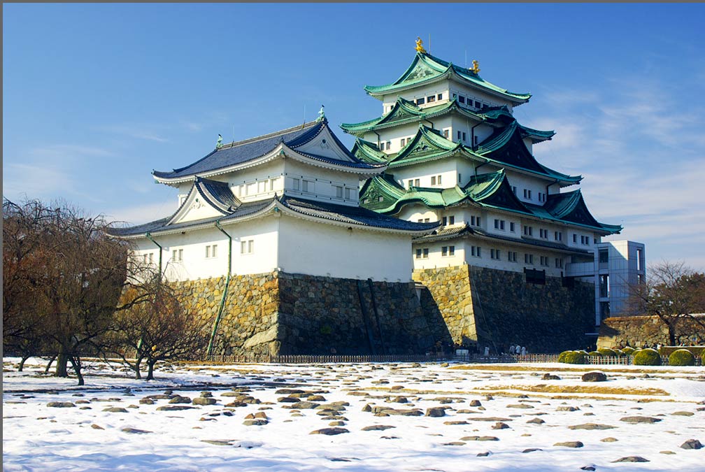 The two main keeps of Nagoya Castle in winter. Built in the early Edo period, the Japanese castle is today one of the city's main sightseeing spots. Image: NNE The city of Nagoya is the center of Chukyo Metropolitan Area with a population of about 9 million residents. Nagoya is a Tech-city and is one of Japan's major seaports. Its main industry is automotive engineering, aerospace industry and robot technology. Central Japan Railway Company, which operates the Tokaido Shinkansen, has its operational hub at Nagoya Station. The map shows a city map of Nagoya with expressways, main roads and streets, and the location of Nagoya Airfield (IATA code: NKM), Nagoya's domestic airport; zoom out to find the location of Chubu Centrair International Airport (IATA code: NGO) located in Tokoname on an artificial island in Ise Bay, 35 km (22 mi) south of Nagoya. To find a location use the form below. |
|
| To find a location type: street or place, city, optional: state, country. |
Local Time Nagoya:
Friday-April-26 10:16
UTC/GMT +9 hours |
|
φ Latitude, λ Longitude (of Map center; move the map to see coordinates): , |
||||||
| Google Earth: Searchable Map and Satellite view of Nagoya, Aichi Prefecture, Japan. City Coordinates: 35°10′53.24″N 136°54′22.99″E |
Bookmark/share this page |
|||||
| More about Japan: Landmarks: Mount Fuji Cities: Searchable map/satellite view of Japan's largest cities: Country: Continent: External Links: Nagoya (official city web site) Central Japan International Airport Centrair Nagoya Airport Wikipedia: Nagoya |
Current Weather Conditions Nagoya
|
Explore More:
Related Consumer Information:
|
||||
| Major Cities in Eastern Asia Bangkok, Beijing, Busan, Chongqing, Colombo, Delhi, Fukuoka, Guangzhou, Hanoi, Ho Chi Minh City, Hong Kong, Islamabad, Jakarta, Karachi, Kobe, Kolkata, Kuala Lumpur, Kyoto, Lahore, Lhasa, Macao, Manila, Mumbai, Nagoya, Osaka, Phnom Penh, Pyongyang, Sapporo, Seoul, Shanghai, Shenzhen, Singapore, Taipei, Tianjin, Tokyo, Ulaanbaatar, Yangon, Yokohama |
||||||
Map Help [ show ] |
||||||
One World - Nations Online .:. let's care for this planet Promote that every nation assumes responsibility for our world. Nations Online Project is made to improve cross-cultural understanding and global awareness. More signal - less NOISE |
| Site Map
| Information Sources | Disclaimer | Copyright © 1998-2023 :: nationsonline.org |

