Nations Online
All Countries in the World
Nations Online All Countries in the World | |
Home  |
___ Satellite View and Map of the City of Beijing, Peking (北京市) |
About BeijingBeijing (formerly known as Peking) is China's political, educational, and cultural center, in 2008 the city hosted the Summer Olympic Games. 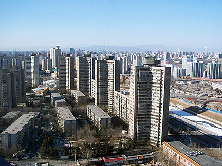 Residental buildings in Chaoyang District, Beijing. Just zoom in (+) to discover the Temple of Heaven, a complex of Taoist buildings and one of Beijing's famous landmarks. The Map shows a city map of Beijing with expressways, and main roads, zoom out to find Beijing Capital International Airport (IATA code: BJS or PEK) located 30 km (18.5 mi) northeast of the Beijing's city center in Shunyi District. To find a location use the form below. To see just the map click on the "Map" Button. |
|
| To find a location type: street or place, city, optional: state, country. |
Local Time Beijing:
Saturday-April-20 19:32
Time zone: China Standard Time (CST) UTC/GMT +8 hours |
|
φ Latitude, λ Longitude (of Map center; move the map to see coordinates): , |
||||||
| Google Earth: Searchable map/satellite view of Beijing, capital city of P.R. China. City Coordinates: 39°54′50″N 116°23′30″E |
Bookmark/share this page |
|||||
| More about China: History: Landmarks: Cities - City description with a searchable map and satellite view of: Chongqing, Guangzhou, Kunming, Shanghai, Shenzhen, Tianjin, Lhasa (Tibet), Hong Kong (SAR), Macau (SAR) Country: China key statistical data. Continent: World: |
Current Weather Conditions Beijing:
External Links: Beijing Municipal Government Beijing's official site. eBeijing International A guide to living in Beijing for non residents, the website provides information in news, investment, employment, tourism, and regulations. Beijing Tourism Information The official Beijing travel and tourism site. Wikipedia: Beijing |
Explore more:
Related Consumer Information:
|
||||
| Major Cities in Eastern Asia Bangkok, Beijing, Busan, Chongqing, Colombo, Delhi, Fukuoka, Guangzhou, Hanoi, Ho Chi Minh City, Hong Kong, Islamabad, Jakarta, Karachi, Kobe, Kolkata, Kuala Lumpur, Kyoto, Lahore, Lhasa, Macao, Manila, Mumbai, Nagoya, Osaka, Phnom Penh, Pyongyang, Sapporo, Seoul, Shanghai, Shenzhen, Singapore, Taipei, Tianjin, Tokyo, Ulaanbaatar, Yangon, Yokohama |
||||||
Map Help [ show ] |
||||||
One World - Nations Online .:. let's care for this planet Promote that every nation assumes responsibility for our world. Nations Online Project is made to improve cross-cultural understanding and global awareness. More signal - less NOISE |
| Site Map
| Information Sources | Disclaimer | Copyright © 1998-2023 :: nationsonline.org |

