Nations Online
All Countries in the World
Nations Online All Countries in the World | |
Home  |
___ Searchable Map and Satellite view of the City of Kuala Lumpur, Malaysia |
About Kuala Lumpur Satellite view is showing Kuala Lumpur (also known as KL), largest city and the national capital of Satellite view is showing Kuala Lumpur (also known as KL), largest city and the national capital of The city is located at the confluence of Gombak and Klang Rivers near the west coast of the Malay Peninsula, about 40 km east of the Strait of Malacca and 300 km north-west of Kuala Lumpur has a population of about 1,630,000 inhabitants, more than 7 million people live in its metropolitan area. Spoken languages are Malay (official), English, Tamil, and Chinese (Canton). 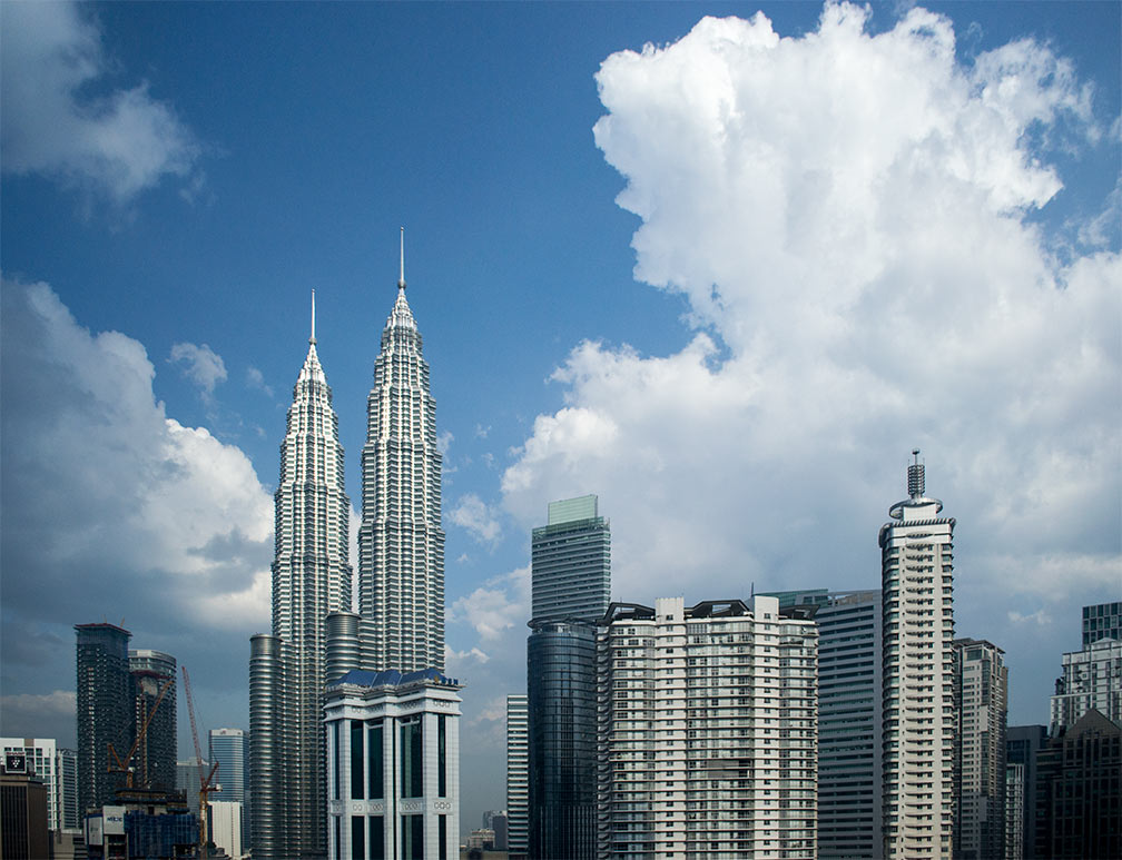 Kuala Lumpur CBD with the Petronas Twin Towers. Photo: © 2015 nationsonline.org KLCC Park, the park near the Petronas Twin Towers was designed by the Brazilian architect Roberto Burle Marx. In the evening the Symphony Lake is a popular place to watch the musical illuminated fountain show. Istana Negara, Jalan Istana, the National Palace of Malaysia is the official residence of the Yang di-Pertuan Agong, the head of state of Malaysia. Bukit Bintang, the shopping and entertainment district of KL. When you zoom in you will see the Petronas Twin Towers, KL's main attraction opened on 1 March 1996, and is still the world's tallest twin building (452.0 m or 1,482.9 ft). The map shows a city map of Kuala Lumpur with expressways, main roads and streets, zoom out to find the location of Kuala Lumpur International Airport - KLIA (IATA code: KUL) 54.8 km (34 mi) by road (via MEX/E20) south of Kuala Lumpur. Sultan Abdul Aziz Shah Airport (IATA code: SZB) is located about 24.4 km (15 mi) by road (via NPE/E10 and Jalan Lapangan Terbang Subang/Route 15) west of the city center. To find a location use the form below. To view the map, click on the "Map" button. (Map Help) |
|
| To find a location type: street or place, city, optional: state, country. |
Local Time Kuala Lumpur:
Friday-April-26 23:25
UTC/GMT +8 hours |
|
φ Latitude, λ Longitude (of Map center; move the map to see coordinates): , |
||||||
| Google Maps: Searchable map/satellite view of Kuala Lumpur, Federation of Malaysia. City Coordinates: 3°8′00″N 101°42′00″E |
Bookmark/share this page |
|||||
| More about Malaysia: Cities: Country: Continent: External Links: Kuala Lumpur City Hall Official website of Kuala Lumpur government. Selamat Datang to Kuala Lumpur Kuala Lumpur official visitors guide. Kuala Lumpur International Airport Official website of KLIA Airport. Wikipedia: Kuala Lumpur Wikipedia entry Kuala Lumpur. |
Weather Conditions Kuala Lumpur:
|
Explore more:
Related Consumer Information:
|
||||
| Other Major Cities in South East Asia: Bandar Seri Begawan, Bandung, Bangkok, Hanoi, Ho Chi Minh City (Saigon), Jakarta, Manila, Phnom Penh, Singapore, Surabaya, Vientiane, Yangon Searchable Maps of other Countries in South East Asia: Brunei, Cambodia, Indonesia, Laos, Malaysia, Myanmar (Burma), Philippines, Singapore, Thailand, Vietnam |
||
Map Help [ show ] |
||
One World - Nations Online .:. let's care for this planet Promote that every nation assumes responsibility for our world. Nations Online Project is made to improve cross-cultural understanding and global awareness. More signal - less NOISE |
| Site Map
| Information Sources | Disclaimer | Copyright © 1998-2023 :: nationsonline.org |

