Nations Online
All Countries in the World
Nations Online All Countries in the World | |
Home  |
___ Satellite View and Map of the City of Kyoto (京都), Japan (45-degree view available) |
 Kyoto City with Kyoto tower in center. Image: Bernard Gagnon |
About Kyoto
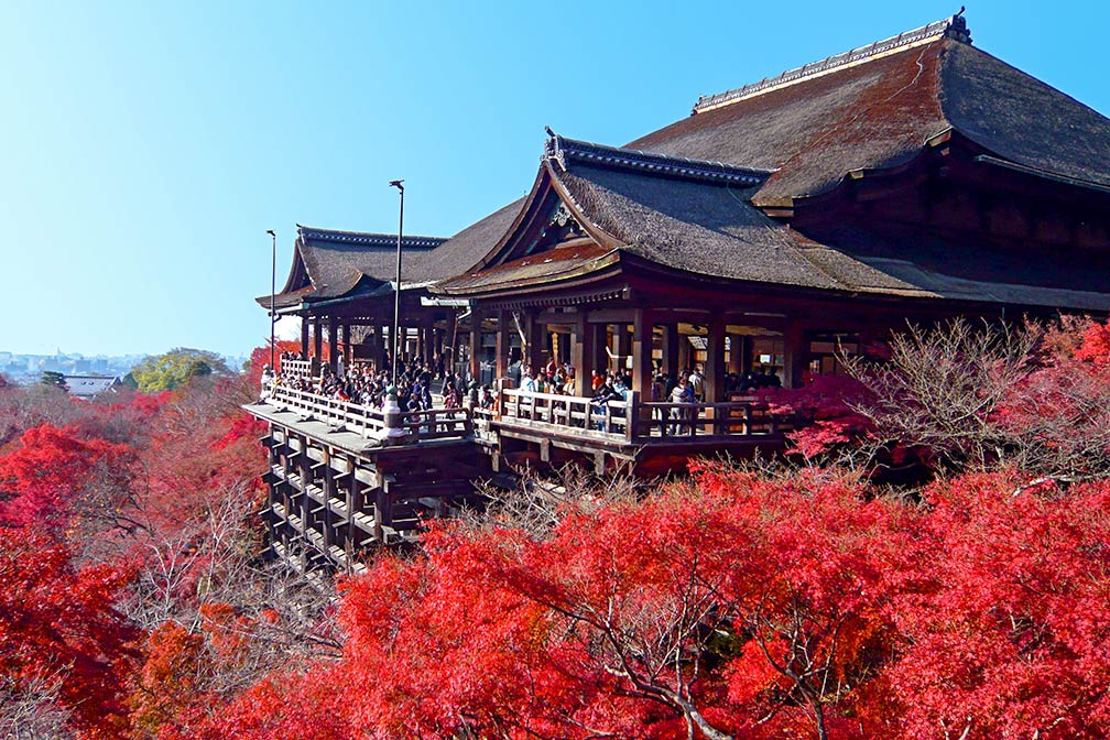 Kiyomizu-dera Temple (清水寺), in Kyoto prefecture. Image: Oilstreet Kyoto was the center of Japanese culture for more than 1,000 years. The city is famous for literally thousands of Buddhist temples and Shinto shrines, among them the Enryaku-ji Temple complex, a Tendai monastery located on Mount Hiei, and To-ji Temple (Tō-ji), the East Temple, are two of the most prominent examples of Buddhist tradition. |
|
| To find a location type: street or place, city, optional: state, country. |
Local Time Kyoto:
Thursday-April-25 06:28
UTC/GMT +9 hours |
|
φ Latitude, λ Longitude (of Map center; move the map to see coordinates): , |
||||||
| Google Earth: Searchable Map and Satellite view of Kyoto, Kyoto Prefecture, Japan. City Coordinates: 35°0′41.69″N 135°46′5.47″E |
Bookmark/share this page |
|||||
| More about Japan: Landmarks: Mount Fuji Cities: Searchable map/satellite view of Japan's largest cities: Country: Continent: External Links: Kyoto (official city web site) Kyoto Travel Guide Official tourism website of Kyoto. Kyoto National Museum Kyoto Imperial Palace Guide Historic Monuments of Ancient Kyoto (Kyoto, Uji and Otsu Cities) UNESCO World Heritage website. Wikipedia: Kyoto |
Current Weather Conditions Kyoto Weather station at Osaka's Kansai International Airport.
|
Related Consumer Information:
|
||||
| Major Cities in Eastern Asia Bangkok, Beijing, Busan, Chongqing, Colombo, Delhi, Fukuoka, Guangzhou, Hanoi, Ho Chi Minh City, Hong Kong, Islamabad, Jakarta, Karachi, Kobe, Kolkata, Kuala Lumpur, Kyoto, Lahore, Lhasa, Macao, Manila, Mumbai, Nagoya, Osaka, Phnom Penh, Pyongyang, Sapporo, Seoul, Shanghai, Shenzhen, Singapore, Taipei, Tianjin, Tokyo, Ulaanbaatar, Yangon, Yokohama |
||||||
Map Help [ show ] |
||||||
One World - Nations Online .:. let's care for this planet Promote that every nation assumes responsibility for our world. Nations Online Project is made to improve cross-cultural understanding and global awareness. More signal - less NOISE |
| Site Map
| Information Sources | Disclaimer | Copyright © 1998-2023 :: nationsonline.org |
 Satellite view showing Kyoto, capital city of
