Advertising

Flag of Japan
Home Earth Continents Asia Japan Country Profile Map of Japan

Maps Index

Map of Japan (日本)


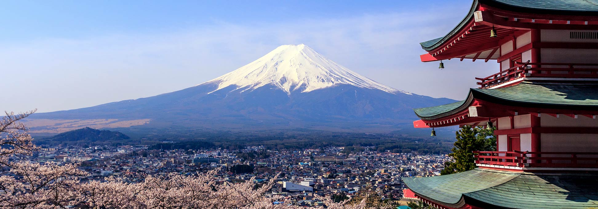
A pagoda, Mount Fuji and cherry blossoms in Japan
A pagoda (tō), Mount Fuji (Fujisan), and cherry blossoms (sakura), three symbols of Japan all in one picture.
Image: Reginald Pentinio

About Japan


Japan Flag
The map shows a representation of Japan, a country in eastern Asia that occupies a chain of islands between the Sea of Japan (East Sea) and the North Pacific Ocean east of the Korean Peninsula. The island nation stretches from the Sea of Okhotsk in the north to the East China Sea in the south.

Japan shares maritime borders with PR China, North Korea, South Korea, the Philippines, Russia, Northern Mariana Islands (United States), and the Republic of China (Taiwan).

Depicted on the map are Japan's main islands, from north to south: Hokkaido (北海道), Honshu (本州), Shikoku (四国), and Kyushu (九州).

With an area of 377,915 km², spread across more than 6,800 islands, Japan is somewhat larger than Germany or slightly smaller than the US state of California. About three-fourths of the country is mountainous; the highest mountain is Mount Fuji, an active volcano at 3,776 m (12,389 ft).
Due to an inhospitable landscape, large areas are unhabitable and not suitable for agricultural or industrial use, which results in a high population density in its urban agglomerations.

The country has a slowly shrinking population of today 126.2 million inhabitants (in 2019). Most of Japan's urban centers are located near the coast. The national capital is Tokyo. The official language is Japanese. Main religions are Shintoism and Buddhism.


Map of Japan

Political Map of Japan's main islands.
Political Map of Japan

The map shows Japan's main islands with major cities, expressways, main roads, and major airports.

You are free to use above map for educational purposes, please refer to the Nations Online Project.
 
The map shows the location of following Japanese cities and towns:

Abashiri, Akita, Aomori, Asahikawa, Chiba, Date, Fukui, Fukuoka, Fukushima, Gifu, Hachinohe, Hakodate, Hiroshima, Kagoshima, Kamaishi, Kanazawa, Kobe, Kochi, Kumamoto, Kushiro, Kyoto, Maebashi, Matsue, Matsuyama, Mikasa, Mito, Miyazaki, Morioka, Nagano, Nagasaki, Nagoya, Nara, Nayoro, Nemuro, Niigata, Obihiro, Oita, Okayama, Osaka, Otaru, Saga, Sapporo, Sasebo, Sendai, Shizuoka, Takamatsu, Tokushima, Tokyo, Tomakomai, Tome, Tottori, Toyama, Tsu, Utsunomiya, Uwajima, Wakayama, Wakkanai, Yamagata, Yamaguchi, and Yokohama.


Bookmark/share this page
  Instagram button

More about Japan

Cities:
Searchable map/satellite view of Japan's largest cities:
Tokyo, Fukuoka, Fukushima, Kobe, Kyoto, Nagoya, Osaka, Sapporo, Sendai, Yokohama

Country:
Searchable Map and Satellite View of Japan

Japan Country Profile

Continent:
Map of Asia
 

Weather Conditions Tokyo:

TOKYO WEATHER


Advertisements:


Maps of other countries in Southeast and Eastern Asia:
Bangladesh Map, Bhutan Map, Cambodia Map, China Map, India Map, Indonesia Map, Japan Map, Korea (North), Korea (South), Laos Map, Malaysia Map, Maldives Map, Mongolia Map, Myanmar Map, Nepal Map, Pakistan Map, Philippines Map, Singapore Map, Sri Lanka Map, Taiwan Map, Thailand Map, Vietnam Map
up