About the Dominican Republic
The map shows the Dominican Republic, the tropical country that occupies the eastern part of Hispaniola, an island in the Greater Antilles in the Caribbean Sea. The island is located 90 km (57 mi) southeast of
Cuba, separated by the Windward Passage (Spanish: Paso de los Vientos). The 130 km (80 mi) wide Mona Passage (another strait) separates Hispaniola from
Puerto Rico to the east.
Santo Domingo, the country's capital, is about 1,330 km (830 mi) from Miami, Florida.
The Dominican Republic shares maritime borders with
Colombia,
Venezuela,
Aruba (
Netherlands),
Curaçao (Netherlands), Puerto Rico (
United States), and Turks and Caicos Islands (
United Kingdom). The country's only land border is with
Haiti.
With an
area of 48,310 km², the Dominican Republic is slightly smaller than
Slovakia or about the size of the US states of
Vermont and
New Hampshire combined.
10.7 million people live in the island nation (in 2022).
Santo Domingo is the capital of the Dominican Republic and the largest urban agglomeration in the Caribbean and Central America. The spoken
language is (Dominican) Spanish. The main religion is Christianity (68% of the population).
More about the Dominican Republic
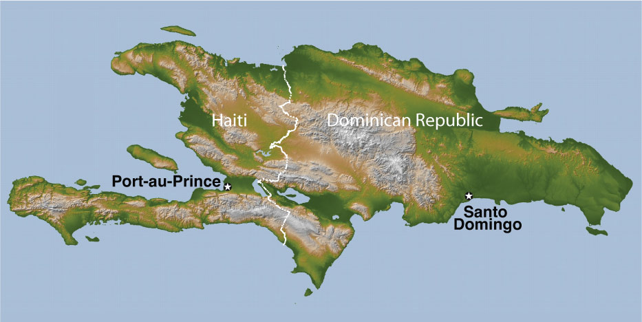
The Island of Hispaniola is shared by two countries, Haiti and the Dominican Republic.
Image: NASA/Nationsonline.org
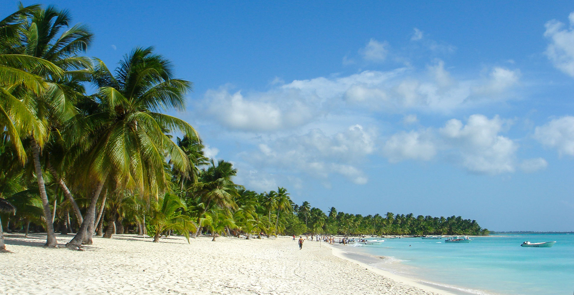
As mentioned above, the Dominican Republic is an island country in the Caribbean that offers white sand beaches on turquoise waters and mostly blue-white skies, evergreen highland forests, lush vegetation in fertile valleys and even a desert zone with dune formations on the Las Calderas peninsula (Las Dunas De Bani).
Mountains
Several of the highest mountains in the Caribbean are on the island of Hispaniola, with
Pico Duarte being the highest at 3,101 m (10,174 ft), followed by
Loma La Pelona at 3,094 m (10,151 ft) and
Loma La Rucilla at 3,038 m (9,967 ft), three peaks close to each other in the
Cordillera Central, the mountain range that dominates the western part of the Dominican Republic.
[oj]
Major mountain ranges in the Dominican Republic are Cordillera Septentrional (the "Northern Range"), the
Cordillera Central, the mountain massif that dominates the island's center, Sierra de Neiba, Sierra de Bahoruco and the Sierra Oriental in the northeast.
Rivers
Five originate in the Cordillera Central, and a sixth in the Sierra de Yamasá. The longest rivers in the republic are the
Yaque Del Norte, the longest river in the country, followed by the Yuna River and the Yaque del Sur River. Other major rivers are Higuamo, La Isabela, Ozama, and Soco.
Dominican Republic–Haiti border crossings
The four chief land crossings between Haiti and the Dominican Republic are Belladère/Comendador; Ouanaminthe/Dajabón; Malpasse/Jimaní and Anse-à-Pitres/Pedernales.
Climate
Hispaniola has a tropical maritime climate with little seasonal variation in temperature and some seasonal variation in rainfall. Rainfall is high in the mountains and hills.
The Caribbean island is located in the Atlantic hurricane belt and can be hit by tropical cyclones and major hurricanes during the storm season from June to November.
It is prone to other natural disasters such as earthquakes, droughts, floods, landslides, heat waves, rainstorms and tsunamis. Hispaniola sits on the boundary of the North American/Caribbean tectonic plates. In 2010 a magnitude seven earthquake killed more than 220,000 people in Haiti.
Hispaniola
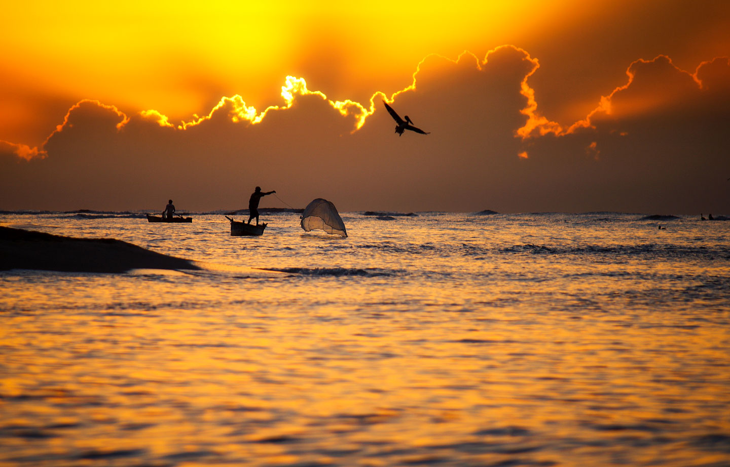 Fishermen at work with pelicans waiting for some scraps.
Image: Michael Matti
ispaniola is, after Cuba, the second largest island of the Greater Antilles, a chain of islands in the Caribbean Sea. With an
area of 76,192 km² (29,418 sq mi), the island is about half the size of the US state of
Georgia or somewhat smaller than the
Czech Republic.
After the discovery by Columbus in 1492, Hispaniola was colonized by the Spanish. With the
Treaty of Rijswijk (1697), the Spanish had to cede the western part (present-day Haiti) to France and recognize French control of the western portion of Hispaniola, which was then known as Saint-Domingue.
Even today, the two nations share the island, but they could not be more different. To the west lies the ungovernable, politically and socially unstable and impoverished Haiti, a former French colony, and to the east is the relatively stable and prosperous Dominican Republic, a former Spanish colony (the Spanish Captaincy General of Santo Domingo) and today a popular tourist destination.
Both countries have around 10 million inhabitants, but the difference could not be greater. French-speaking Haiti and the Spanish-speaking Dominican Republic are two nations trapped by historical circumstances on the small Caribbean island. They share common historical experiences, including a colonial past, slavery-based economies, occupation, and autocratic regimes.
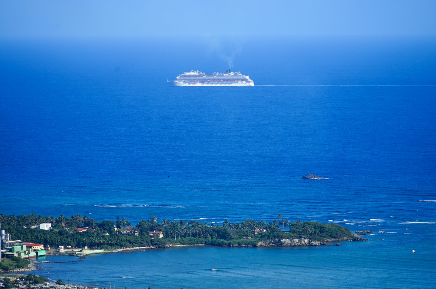 The Flying Dutchmen? Ocean view from "Isabel de Torres" south of Puerto Plata. The Dominican Republic is a popular vacation destination served by several cruise lines, such as Holland America and Carnival Cruises.
Image: hectorlo
istorically, the Spanish Captaincy was the first colony established by Spain in the New World in 1492 and served as the logistical base for the conquest of most of the Western Hemisphere.
[LOC]
After decades of fighting, the Spanish had to cede the western part of the island to the French in 1697, who established Saint-Domingue there. It became the most productive colony in the Western Hemisphere with a labor-intensive sugar industry - for which the French imported large numbers of enslaved Africans.
[LOC]
The Dominican Republic and Haiti had roughly the same GDP per capita in 1960; today, the standard of living in the Dominican Republic is much higher than that in Haiti. The Dominican Republic's economy is about five times that of its neighbor. The migration of impoverished Haitians to the Dominican Republic and profound cultural differences have contributed to long-standing conflicts.
Even today, many undocumented Haitians cross the border into the Dominican Republic to work in agriculture or construction.
[aljazeera]
The foreign policy of the Dominican government towards Haiti is in apparent contradiction to its domestic policies toward Haitian citizens living in the Dominican Republic. While Haitian migrants in the Dominican Republic are the subject of discrimination, frequent violations of their human rights, and deportation, foreign relations with Haiti are non-confrontational and sometimes even cordial.
[Dr. E. Sagas] [VOX]
The Caribbean
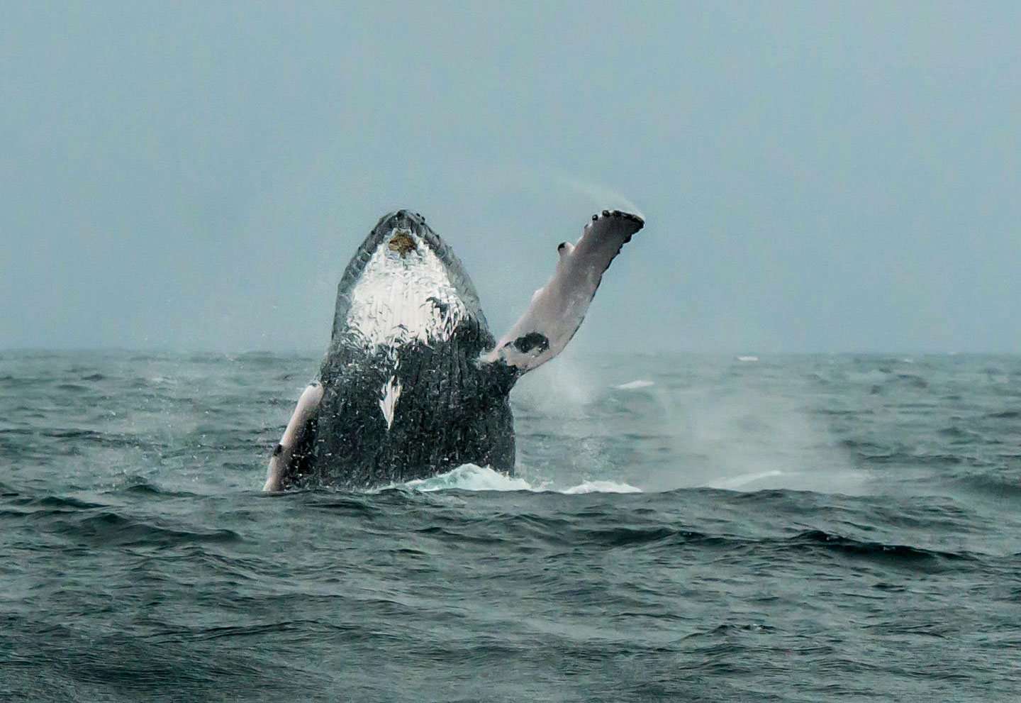 Hello? Humpback whales in the Dominican Republic. Samaná Bay is one of the best places to observe humpback whales in their winter breeding grounds.
Image: Jarkko J
The
Caribbean is a tropical region in the western part of the North Atlantic Ocean north of the equator. The island chains of the
Greater Antilles and the
Lesser Antilles are located southeast of the Gulf of Mexico and the US mainland, to the east of Central America and north of the South American continent.
The Caribbean covers an
area of 2,754,000 km²; it's about four times the size of
Texas or five times the size of
France.
Geopolitically, the Caribbean (the West Indies) is considered a region of North America, sometimes as part of Central America or a region of its own.
The
Greater Antilles is the constellation of the large islands in the Caribbean Sea:
Cuba, Hispaniola,
Puerto Rico,
Jamaica and the much smaller Cayman Islands.
Six island countries share the Greater Antilles, the four independent states of
Cuba, Haiti, the Dominican Republic and Jamaica and the two dependent territories of the Cayman Islands, a British Overseas Territory, and
Puerto Rico, an unincorporated territory of the United States.

