Nations Online
All Countries in the World
|
One Planet Nations Online All Countries in the World | |
Home  |
___ Satellite View and Map of Anguilla |
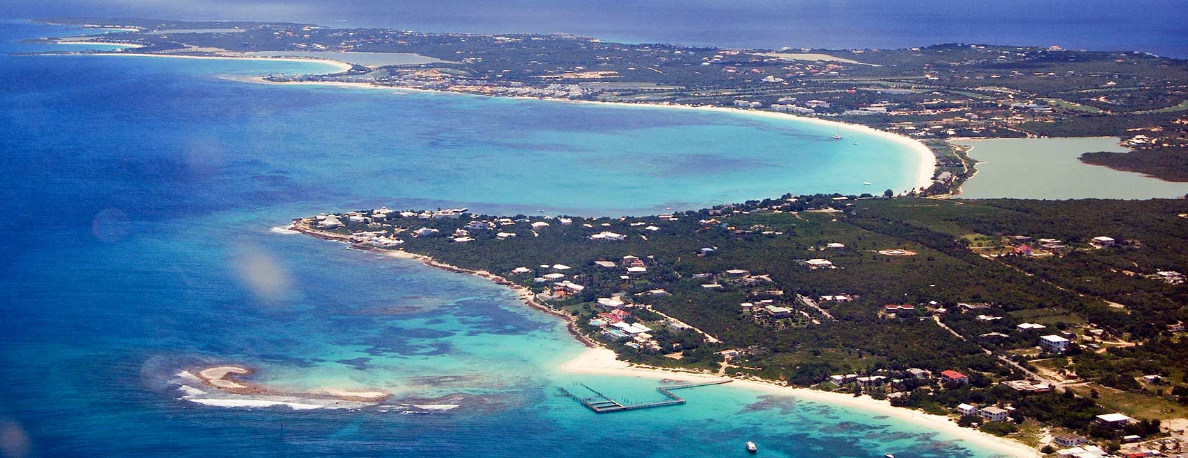
 An aerial view of the western part of Anguilla, with (right to left) Shaddick Point, Rendezvous Bay, Cove Bay, and Maundays Bay. Image: Roy Googin |
Satellite View and Map of Anguilla using Google Earth Data Satellite view is showing Anguilla, a British overseas territory in the Eastern Caribbean, situated east of Puerto Rico and the Virgin Islands, north of the Saint Martin (Sint Maarten). Satellite view is showing Anguilla, a British overseas territory in the Eastern Caribbean, situated east of Puerto Rico and the Virgin Islands, north of the Saint Martin (Sint Maarten).The island lies also relative close to British Virgin Islands, Saint Kitts and Nevis, and the U.S. Virgin Islands. Anguilla is a flat and low-lying island of coral and limestone, its highest point is Crocus Hill with just 65 m. The island was first settled by Amerindian tribes who migrated from South America, it was colonized in the 17th century by Europeans and Creoles migrating from Barbados, Antigua, and Saint Kitts and Nevis. With an area of 91 km², the Anguilla is slightly smaller than Jersey, the largest of the Channel Islands. About 13,500 people live on the island, its economy is based mainly on tourism, offshore banking and fishing. Capital town and largest city is The Valley. The map shows Anguilla island with cities, towns, main roads and streets, and the location of Clayton J. Lloyd International Airport (IATA code: AXA). Zoom out to see the location of Anguilla within the Caribbean. To find a location use the form below. |
|
| To find a location type: street or place, city, optional: state, country. |
Local Time Anguilla:
Sunday-April-28 13:55
UTC/GMT -4 hours
|
|
φ Latitude, λ Longitude (of Map center; move the map to see coordinates): , |
||||||
| Google Maps: Searchable Map of Anguilla. |
Bookmark/share this page
|
|||||
| More about Anguilla: Cities: Country: Continent: Political map of the island territories in the Caribbean Sea. |
Current Weather Conditions Anguilla Weather station is at Juliana Airport, St. Martin |
Related Consumer Information:
|
||||
Searchable Maps of Greater Antilles: Cuba, Haiti, Dominican Republic, Jamaica, Puerto Rico Searchable Maps of Lesser Antilles: Antigua and Barbuda, Aruba (NL), Bahamas, Barbados, Bermuda, Curaçao (NL), Dominica, Grenada, Guadeloupe (FR), Martinique (FR), Montserrat (UK), Netherlands Antilles, Saint Kitts and Nevis, Saint Lucia, Saint Martin (Sint Maarten), Saint Vincent and the Grenadines, Trinidad and Tobago, Virgin Islands Maps of Caribbean Islands (Greater Antilles) Cuba Map, Dominican Republic Map, Haiti Map, Jamaica Map, Puerto Rico Map Countries and Territories of the Americas |
||||||
Map Help [ show ]  |
||||||
One World - Nations Online .:. let's care for this planet Promote that every nation assumes responsibility for our world. Nations Online Project is made to improve cross-cultural understanding and global awareness. More signal - less NOISE |
| Site Map
| Information Sources | Disclaimer | Copyright © 1998-2023 :: nationsonline.org |