Nations Online
All Countries in the World
Nations Online All Countries in the World | |
Home  |
___ Satellite View of the Dominican Republic |
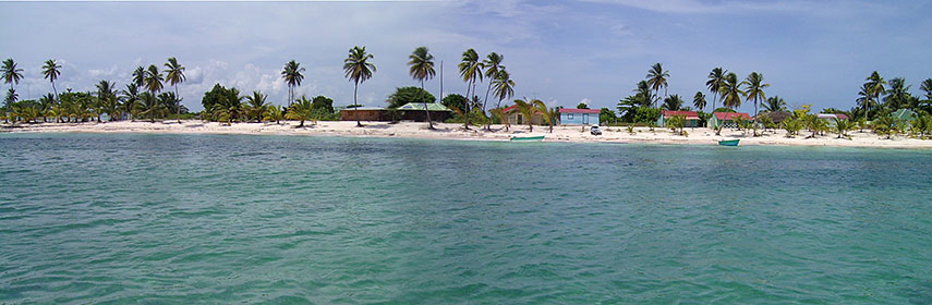 Panorama of the island of Saona, located south of the Dominican Republic. Image: Friviere |
About Dominican Republic Satellite view is showing the the Dominican Republic on the island of Hispaniola, bordering the Atlantic Ocean to the north and the Caribbean Sea in south. Hispaniola island is home to the independent nations of Haiti in west and the Dominican Republic, which occupies the eastern part. It is a famous tourist destination known for its pristine beaches, all-inclusive resorts and golfing, but also for its rude approach on migrant workers from neighboring Haiti, the Dominican government had just stripped Dominican-born citizens of Haitian ancestry of their citizenship, rendering hundreds of thousands stateless. Satellite view is showing the the Dominican Republic on the island of Hispaniola, bordering the Atlantic Ocean to the north and the Caribbean Sea in south. Hispaniola island is home to the independent nations of Haiti in west and the Dominican Republic, which occupies the eastern part. It is a famous tourist destination known for its pristine beaches, all-inclusive resorts and golfing, but also for its rude approach on migrant workers from neighboring Haiti, the Dominican government had just stripped Dominican-born citizens of Haitian ancestry of their citizenship, rendering hundreds of thousands stateless.With an area of 48,310 km² the Dominican Republic is slightly smaller than Slovakia or about the size of the U.S. states of Vermont and New Hampshire combined. The country has a population of 9.9 million people (in 2015). Capital and largest city is Santo Domingo. Official language is Spanish. Nearby to Hispaniola island are the Caribbean Turks and Caicos Islands to the north, Puerto Rico to the east, Cuba and Jamaica in the west. Zoom out to see the location of the Dominican Republic within the Caribbean. The map shows Hispaniola and the Dominican Republic with cities, towns, expressways, main roads and streets, and the location of Santo Domingo International Airport (IATA code: SDQ) and of Punta Cana International Airport (IATA code: PUJ). To find a location use the form below. To view just the map, click on the "Map" button. |
||
| To find a location type: street or place, city, optional: state, country. | Local Time Dominican Republic:
Thursday-April-25 01:41
UTC/GMT -4 hours |
|
|
φ Latitude, λ Longitude (of Map center; move the map to see coordinates): , |
||||||
| Google Maps: Searchable Map of the Dominican Republic (Republica Dominicana). |
Bookmark/share this page |
|||||
| More about the Dominican Republic: Cities: Country: Political Map of the Dominican Republic. Continent: External Links: Santo Domingo Website of the national district government (in Spanish) Wikipedia: Santo Domingo Wikipedia entry Santo Domingo | Weather Conditions Santo Domingo: Weather station at Las Américas International Airport
| Related Consumer Information:
|
||||
Searchable Maps of Greater Antilles: Cuba, Haiti, Dominican Republic, Jamaica, Puerto Rico Searchable Maps of Lesser Antilles: Anguilla (UK), Antigua and Barbuda, Aruba (NL), Bahamas, Barbados, Bermuda, Curaçao (NL), Dominica, Grenada, Guadeloupe (FR) Martinique (FR), Montserrat (UK), Netherlands Antilles, Saint Kitts and Nevis, Saint Lucia, Saint Martin (Sint Maarten), Saint Vincent and the Grenadines, Trinidad and Tobago, Virgin Islands Maps of Caribbean Islands (Greater Antilles) Cuba Map, Dominican Republic Map, Haiti Map, Jamaica Map, Puerto Rico Map Countries and Territories of the Americas |
||||||
Map Help [ show ] |
||||||
One World - Nations Online .:. let's care for this planet Promote that every nation assumes responsibility for our world. Nations Online Project is made to improve cross-cultural understanding and global awareness. More signal - less NOISE |
| Site Map
| Information Sources | Disclaimer | Copyright © 1998-2023 :: nationsonline.org |

