Nations Online
All Countries in the World
Nations Online All Countries in the World | |
Home  |
___ Satellite View and Map of Netherlands Antilles (Southern group, ABC islands) |
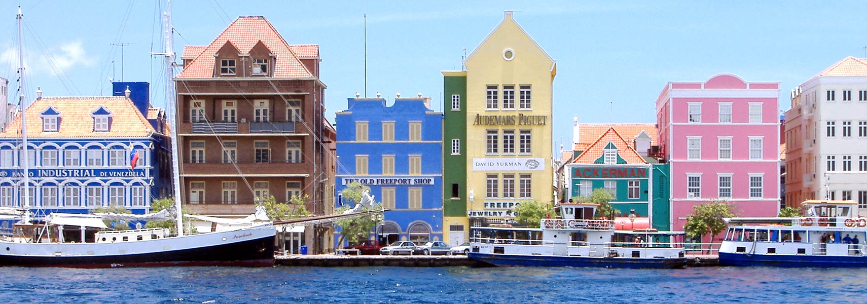 Dutch-Caribbean architecture along Willemstad's harbour. Image: Mtmelendez |
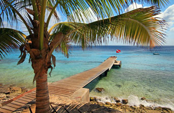
About Netherlands Antilles On 10 October 2010, the Netherlands Antilles, an autonomous Caribbean country within the Kingdom of the Netherlands, was dissolved. On 10 October 2010, the Netherlands Antilles, an autonomous Caribbean country within the Kingdom of the Netherlands, was dissolved."Since 10 October 2010, the Kingdom of the Netherlands consists of four countries: the Netherlands, Aruba, Curacao and Saint Maarten. The Netherlands Antilles have then ceased to exist, because all islands have acquired a new status." With the dissolution of the Netherlands Antilles Curaçao and Sint Maarten (on the island of Saint Martin) became constituent countries within the Kingdom of the Netherlands, like Aruba, which had separated from the Netherlands Antilles in 1986. The Netherlands Antilles consisted of two widely separated groups of Dutch islands in the Caribbean Sea, they were (and still are) part of the Kingdom of the Netherlands. Capital city of Netherlands Antilles was Willemstad (on Curaçao). Spoken languages are Dutch, English, and Papiamento (a Spanish Creole language with admixtures of Portuguese and Dutch) Satellite view is showing the two islands of Bonaire and Curaçao, situated just north of Venezuela and east of Aruba, which is also a constituent country of the Netherlands. (The island group is also known as the ABC islands) Curaçao has a population of 150,000 and Bonaire a population of 15,700 (in 2012). Curaçao is in Frommer's list of Top Destinations 2012. The island is described as: "Curacao is not your quintessential Caribbean island. Sure, it has curvaceous white beaches, cerulean seas, and a coral reef brimming with exotically hued marine life. But Curacao offers even more, with one of the region's most cosmopolitan cultures and a standout capital in Willemstad, a child's paintbox of giddy Caribbean colors and gabled colonial architecture." The Map shows the southern island group of the Netherlands Antilles with cities, towns, main roads and streets, and the location of Curaçao International Airport (IATA code: CUR) and Bonaire Flamingo Airport (IATA code: BON) at Kralendijk, Bonaire. Zoom out to see the location of Curaçao within the Caribbean. The To find a location use the form below. |
|
| To find a location type: street or place, city, optional: state, country. |
Local Time Curaçao:
Sunday-April-28 03:27
UTC/GMT -4 hours |
|
φ Latitude, λ Longitude (of Map center; move the map to see coordinates): , |
||||||
| Google Earth: Searchable map/satellite view of Curaçao (left) and Bonaire (right), Netherlands Antilles. |
Bookmark/share this page |
|||||
| More about Netherlands Antilles: Cities: Country: Continent: | Weather Conditions Curaçao:
| Related Consumer Information:
|
||||
Searchable Maps of Greater Antilles: Cuba, Haiti, Dominican Republic, Jamaica, Puerto Rico Searchable Maps of Lesser Antilles: Anguilla (UK), Antigua and Barbuda, Aruba (NL), Bahamas, Barbados, Bermuda, Dominica, Grenada, Guadeloupe (FR) Martinique (FR), Montserrat (UK), Saint Kitts and Nevis, Saint Lucia, Saint Martin (Sint Maarten), Saint Vincent and the Grenadines, Trinidad and Tobago, Virgin Islands Maps of Caribbean Islands (Greater Antilles) Cuba Map, Dominican Republic Map, Haiti Map, Jamaica Map, Puerto Rico Map Countries and Territories of the Americas |
||||||
Map Help [ show ] |
||||||
One World - Nations Online .:. let's care for this planet Promote that every nation assumes responsibility for our world. Nations Online Project is made to improve cross-cultural understanding and global awareness. More signal - less NOISE |
| Site Map
| Information Sources | Disclaimer | Copyright © 1998-2023 :: nationsonline.org |