Nations Online
All Countries in the World
Nations Online All Countries in the World | |
Home  |
___ Satellite View and Map of Bermuda |
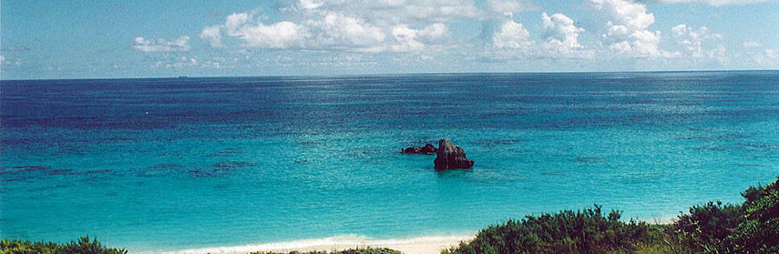 South shore beach, Bermuda. Image: © James G. Howes |
About Bermuda Map is showing the British crown colony or political more correct, a British Overseas Territory in the Caribbean in the North Atlantic Ocean. Map is showing the British crown colony or political more correct, a British Overseas Territory in the Caribbean in the North Atlantic Ocean.Bermuda is a kind of lonely archipelago of volcanic origin, made up of about 180 small islands, about 1,040 km (650 mi) east of North Carolina's (USA) coast. The islands are actually the visible peaks of a seamount rising from the seafloor of the Atlantic Ocean, formed millions of years ago by volcanism. The islands have a humid subtropical to tropical climate. About 70,000 people live on Bermuda, capital is Hamilton. The map shows Bermuda with cities, towns, main roads and streets, and the location of L.F. Wade International Airport (IATA code: BDA) is located 17.5 km (10 mi) by road, (via Middle Road 10), north east of the city of Hamilton. Zoom out to see the location of Bermuda within the Caribbean. To find a location use the form below. To view just the map, click on the "Map" button. |
|
| To find a location type: street or place, city, optional: state, country. |
Local Time Bermuda:
Sunday-April-28 10:05
UTC/GMT -4 hoursDaylight Saving Time from March - Nov (Time zone: Atlantic Daylight Time (ADT) UTC/GMT -3 hours) |
|
φ Latitude, λ Longitude (of Map center; move the map to see coordinates): , |
||||||
| Google Maps:Searchable Map of Bermuda. |
Bookmark/share this page |
|||||
| More about Bermuda: |
Current Weather Conditions Bermuda:
|
Related Consumer Information:
|
||||
Searchable Maps of Greater Antilles: Cuba, Haiti, Dominican Republic, Jamaica, Puerto Rico Searchable Maps of Lesser Antilles: Anguilla (UK), Antigua and Barbuda, Aruba (NL), Bahamas, Barbados, Bermuda, Curaçao (NL), Dominica, Grenada, Guadeloupe (FR) Martinique (FR), Montserrat (UK), Netherlands Antilles, Saint Kitts and Nevis, Saint Lucia, Saint Martin (Sint Maarten), Saint Vincent and the Grenadines, Trinidad and Tobago, Virgin Islands Maps of Caribbean Islands (Greater Antilles) Cuba Map, Dominican Republic Map, Haiti Map, Jamaica Map, Puerto Rico Map Countries and Territories of the Americas |
||||||
Map Help [ show ] |
||||||
One World - Nations Online .:. let's care for this planet Promote that every nation assumes responsibility for our world. Nations Online Project is made to improve cross-cultural understanding and global awareness. More signal - less NOISE |
| Site Map
| Information Sources | Disclaimer | Copyright © 1998-2023 :: nationsonline.org |

