Nations Online
All Countries in the World
Nations Online All Countries in the World | |
Home  |
___ Satellite View and Map of Barbados |
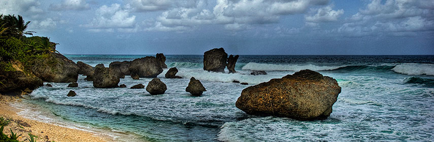 A beach on Barbados, the easternmost island in the Lesser Antilles. - Image: Berit Watkin |
About Barbados Satellite view is showing one of the Windward Islands in the eastern Caribbean in the North Atlantic Ocean,
northeast of Venezuela, to the east of Saint Lucia and Saint Vincent and the Grenadines. Satellite view is showing one of the Windward Islands in the eastern Caribbean in the North Atlantic Ocean,
northeast of Venezuela, to the east of Saint Lucia and Saint Vincent and the Grenadines. The independent island nation within the British Commonwealth has an area of 431 km² , making it somewhat smaller than Andorra, or 2.5 times the size of Washington, DC. Barbados' has a coastline of 97 km, its landscape is relatively flat, gently inclined to the central highland region in north east, its highest point, Mount Hillaby at 336 m. Barbados, has a population of of 250,000 people. Capital city is Bridgetown, official language is English. The map shows Barbados with cities, towns, expressways, main roads and streets, Grantley Adams International Airport (IATA code: BGI) is located in Seawell, about 15 km (9.5 mi) east of Bridgetown. Zoom out to see the location of Barbados within the Caribbean Sea. To find a location use the form below. To view just the map, click on the "Map" button. |
|
| To find a location type: street or place, city, optional: state, country. |
Local Time Barbados:
Sunday-April-28 15:57
UTC/GMT -4 hours |
|
φ Latitude, λ Longitude (of Map center; move the map to see coordinates): , |
||||||
| Google Maps: Searchable Map/Satellite View of Barbados. |
Bookmark/share this page |
|||||
| More about the Barbados: Reference Map of Central America and the Caribbean. |
Weather Conditions Barbados:
|
Related Consumer Information:
|
||||
Searchable Maps of Greater Antilles: Cuba, Haiti, Dominican Republic, Jamaica, Puerto Rico Searchable Maps of Lesser Antilles: Anguilla (UK), Antigua and Barbuda, Aruba (NL), Bahamas, Bermuda, Curaçao (NL), Dominica, Grenada, Guadeloupe (FR) Martinique (FR), Montserrat (UK), Netherlands Antilles, Saint Kitts and Nevis, Saint Lucia, Saint Martin (Sint Maarten), Saint Vincent and the Grenadines, Trinidad and Tobago, Virgin Islands Maps of Caribbean Islands (Greater Antilles) Cuba Map, Dominican Republic Map, Haiti Map, Jamaica Map, Puerto Rico Map Countries and Territories of the Americas |
||||||
Map Help [ show ] |
||||||
One World - Nations Online .:. let's care for this planet Promote that every nation assumes responsibility for our world. Nations Online Project is made to improve cross-cultural understanding and global awareness. More signal - less NOISE |
| Site Map
| Information Sources | Disclaimer | Copyright © 1998-2023 :: nationsonline.org |

