Nations Online
All Countries in the World
Nations Online All Countries in the World | |
Home  |
___ Satellite View and Map of Northern Ireland |
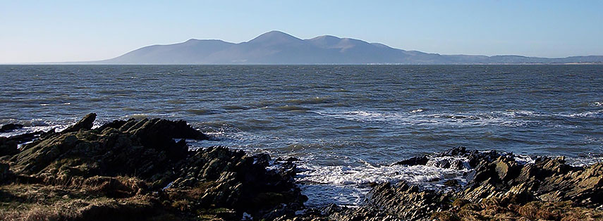 View of the Mourne Mountains from St John's Point, a granite mountain range in County Down. The Mournes are the highest mountains in Northern Ireland, Slieve Donard is the the highest peak with an elevation of 850 m. Image: Mark83 |
Satellite View of Northern Ireland using Google Earth DataMap showing the Northern Ireland, one of the four countries of the United Kingdom, occupying the north eastern part of the island of Ireland bordering the North Atlantic Ocean and the Irish Sea, it shares a border with the Republic of Ireland to the south and west.Northern Ireland has a population of 1,858,000 (in 2016), this is about 3% of the total population of the United Kingdom (64.6 million). Spoken languages are English (official), Irish, and Ulster Scots. Capital city of Northern Ireland is The Map shows Northern Ireland with cities, expressways, main roads and streets, Belfast International Airport (IATA code: BFS) is located 21 km (13 mi) northwest of Belfast City. To find a location use the form below. To view just the map, click on the "Map" button. |
|
| To find a location type: street or place, city, optional: state, country. |
Local Time UK:
Sunday-July-5 02:39
Standard time zone: No UTC/GMT offsetDaylight saving time (BST) in use from end of March until end of October, time zone offset: UTC/GMT +1 hours |
One World - Nations Online .:. let's care for this planet Promote that every nation assumes responsibility for our world. Nations Online Project is made to improve cross-cultural understanding and global awareness. More signal - less NOISE |
| Site Map
| Information Sources | Disclaimer | Copyright © 1998-2024:: nationsonline.org |

