Nations Online
All Countries in the World
Nations Online All Countries in the World | |
Home  |
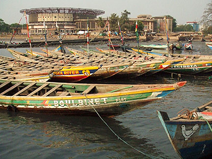
___ Satellite View and Map of the City of Conakry (Konakry) |
About ConakrySatellite view is showing Conakry, chief port and the national capital ofThe former fishing villages of Conakry and Boubinet became the capital of French Guinea in 1904 (a French colonial possession at that time). Guinea was ruled by France until 1958. Today Conakry has a city population of about 1 million inhabitants, and 1.5 to 2 million live in its metropolitan area, thats almost a quarter of Guinea's population. Spoken languages are French (official) and various native African languages predominantly Fula, Mandinka and Susu. The city is the administrative, and economic center of the nation. Conakry has a tropical monsoon climate with a wet season from June to October and a dry season from December to April. The map shows a city map of Conakry with expressways, and main roads, and the location of Conakry International Airport (IATA code: CKY) about 13 km by road (via N.1) northeast of the city center. To find a location use the form below. |
|
| To find a location type: street or place, city, optional: state, country. | Local Time Conakry:
Friday-July-31 01:59
UTC/GMT +2 hours |
One World - Nations Online .:. let's care for this planet Promote that every nation assumes responsibility for our world. Nations Online Project is made to improve cross-cultural understanding and global awareness. More signal - less NOISE |
| Site Map
| Information Sources | Disclaimer | Copyright © 1998-2024:: nationsonline.org |