One Planet
Nations Online

All Countries in the World


___ Satellite View and Map of Iceland

 
Jökulsá á Fjöllum river at Hafragilsfoss Waterfall, Iceland
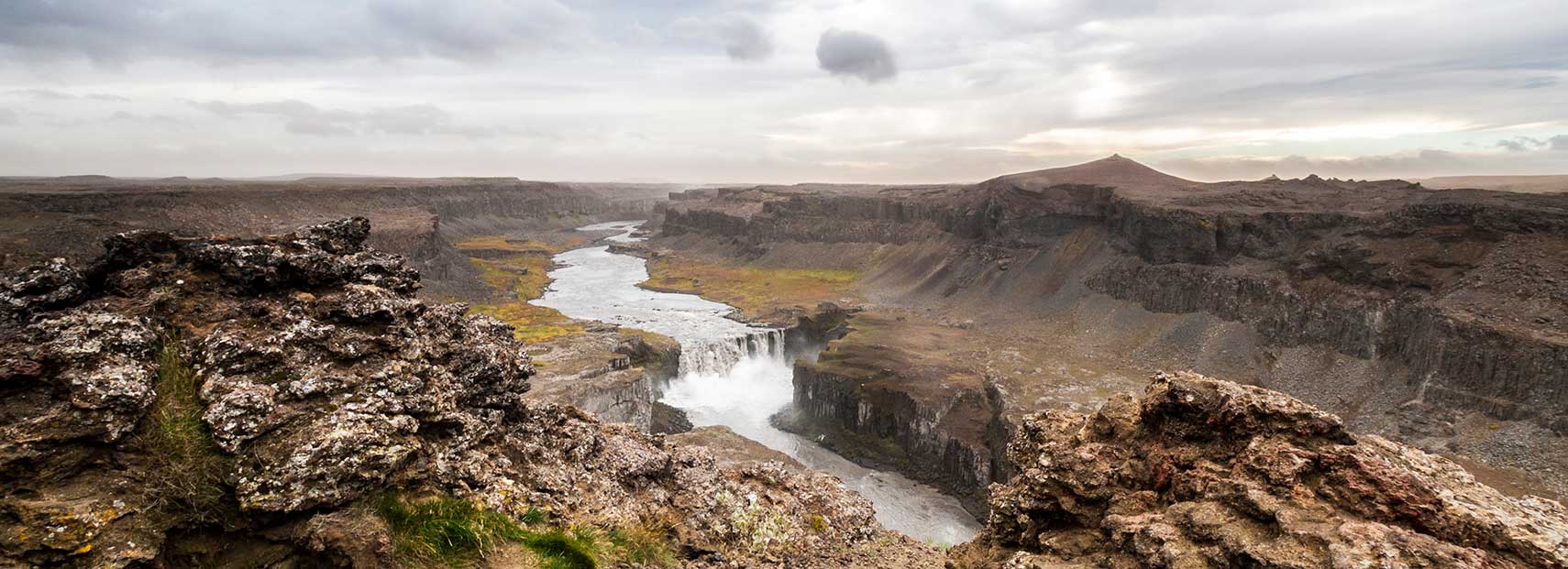
Hafragilsfoss Waterfall of Jökulsá á Fjöllum river, the second longest river in Iceland. The waterfall is located in the north eastern part of the island.
Image: Javier Rodríguez
 

About Iceland


Satellite view is showing the volcanic island in the North Atlantic Ocean east of Greenland and immediately south of the Arctic Circle.


City View of Reykjavik view from Hallgrímskirkja
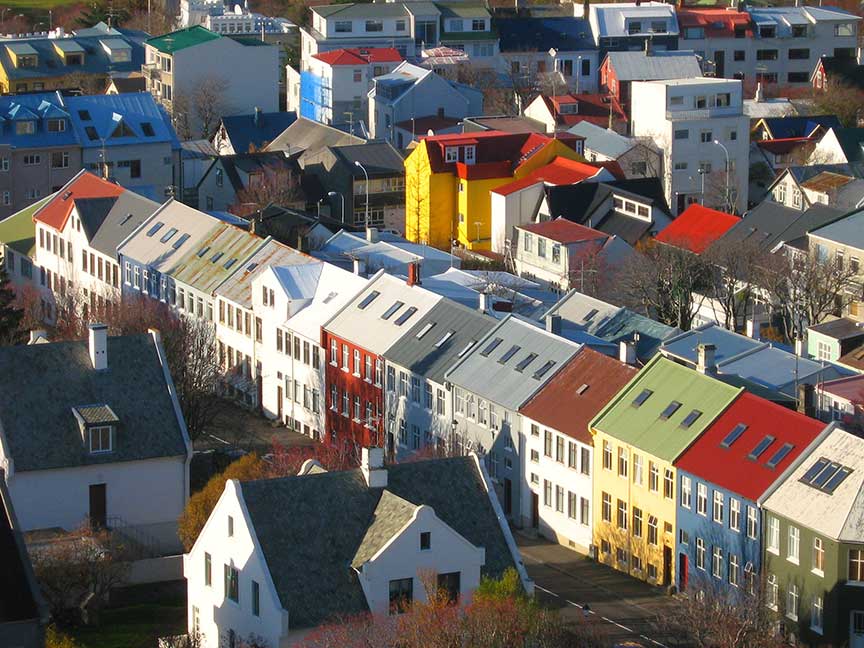
They do like colors on the island. View of Reykjavik from Hallgrímskirkja (Icelandic for: church of Hallgrímur)
Image: Bjørn Giesenbauer

 
Iceland's Middle-earth like landscape offers active volcanoes, geysers, hot springs, waterfalls, glaciers, black-sandy beaches, and - elfins. Only about 20% percent of the country is inhabited, enough room to move freely.

With an area of 103,000 km² Iceland is more than twice the size of Denmark, or slightly smaller than the US state of Pennsylvania.

Capital and largest city is Reykjavik, situated in the southwest of the island. In the capital and the surrounding areas live more than two-thirds of the Iceland's population of 332,529 people (Jan 2016).

The map shows Iceland with cities, towns, expressways, main roads and streets.

To find a location use the form below.
 
To find a location type: street or place, city, optional: state, country.

Local Time Iceland:
Monday-March-18  15:47  
UTC/GMT
φ Latitude, λ Longitude (of Map center; move the map to see coordinates):
,
 
Google Maps: Searchable Map of the Republic of Iceland.
 
Bookmark/share this page
Instagram


More about Iceland:

Landmarks:
Searchable map/satellite view of Eyjafjallajökull glacier and volcano

Cities:
Searchable map/satellite view of Reykjavik

Country:
Reference Map of Iceland

Iceland Country Profile

Continent:
Political Map of Europe

Weather Conditions Reykjavik:


Related Consumer Information:


Major Cities in Northern Europe
Belfast | Birmingham | Cardiff | Copenhagen | Dublin | Edinburgh | Glasgow | Helsinki | Liverpool | London | Malmö
Manchester | Nuuk | Oslo | Reykjavik | Riga | Saint Petersburg | Stockholm | Tallinn | Vilnius

Maps of other Countries in Northern Europe
Denmark Map, Estonia Map, Faroe Islands Map, Greenland Map, Iceland Map, Ireland Map,
Latvia Map, Lithuania Map, Sweden Map, United Kingdom Map

Interactive Maps of other countries and regions in Northern Europe:
Denmark Interactive Map, Faroe Islands Interactive Map, Greenland Interactive Map, Iceland Interactive Map,
Ireland Interactive Map, Latvia Interactive Map, Lithuania Interactive Map, Norway Interactive Map,
Scotland Interactive Map, Sweden Interactive Map, United Kingdom Interactive Map


Map Help [ show ]