Nations Online
All Countries in the World
Nations Online All Countries in the World | |
Home  |
___ Satellite View and Map of Denmark (Danish: Danmark) |
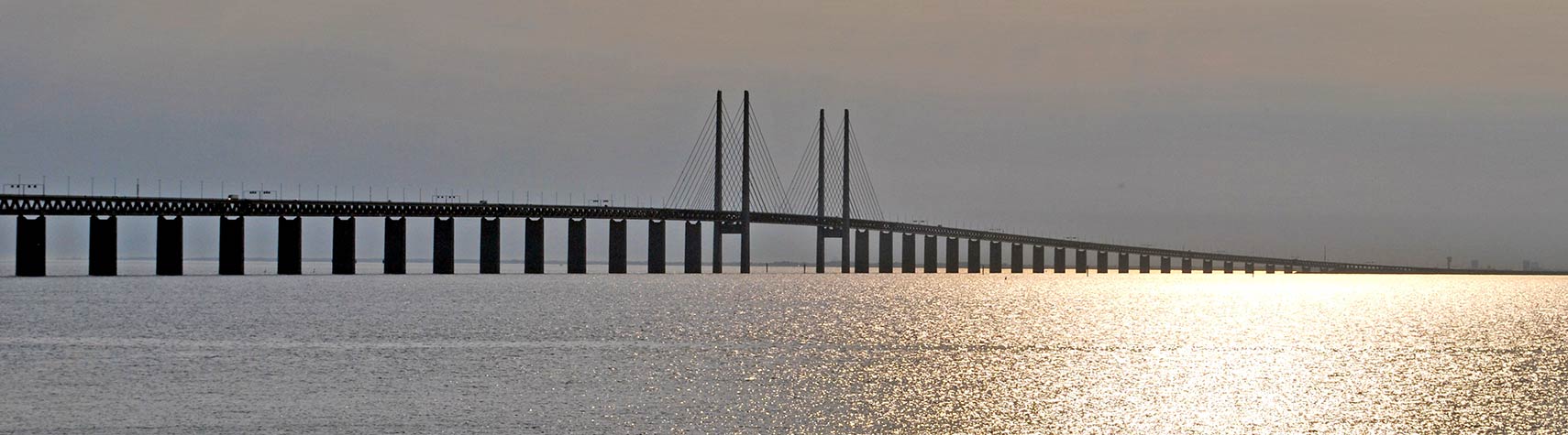 The Øresund Bridge is a combined railway and motorway bridge across the Øresund, a strait between Sweden and Denmark. Image: Soerfm |
|
About Denmark Satellite view is showing Denmark, a country in northwestern Europe
between the North and the Baltic seas. The Kingdom is located on the Jutland peninsula
and several islands, north of Germany. Satellite view is showing Denmark, a country in northwestern Europe
between the North and the Baltic seas. The Kingdom is located on the Jutland peninsula
and several islands, north of Germany. Denmark comprises of the state of Denmark, plus the Faroe Islands and Greenland, both self-governing countries under the sovereignty of the Kingdom of Denmark. The national capital is Denmark's only land border is with Germany, it shares maritime borders with Norway, Poland, Sweden, and the United Kingdom. The map shows Denmark with cities, towns, expressways, main roads and streets. To find a location use the form below. To view just the map, click on the "Map" button. |
|
| To find a location type: street or place, city, optional: state, country. |
Local Time Denmark:
Friday-April-26 17:23
Standard Time Zone (CET): UTC/GMT +1 hourCEST (Daylight Saving Time) in use from end of March until end of October. Time zone offset: UTC/GMT +2 hours |
One World - Nations Online .:. let's care for this planet Promote that every nation assumes responsibility for our world. Nations Online Project is made to improve cross-cultural understanding and global awareness. More signal - less NOISE |
| Site Map
| Information Sources | Disclaimer | Copyright © 1998-2023 :: nationsonline.org |


