Advertising

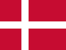
Denmark Flag detail
Home Earth Continents Europe Denmark Country Profile Map of Denmark

Maps Index

Map of Denmark (Danmark), Europe


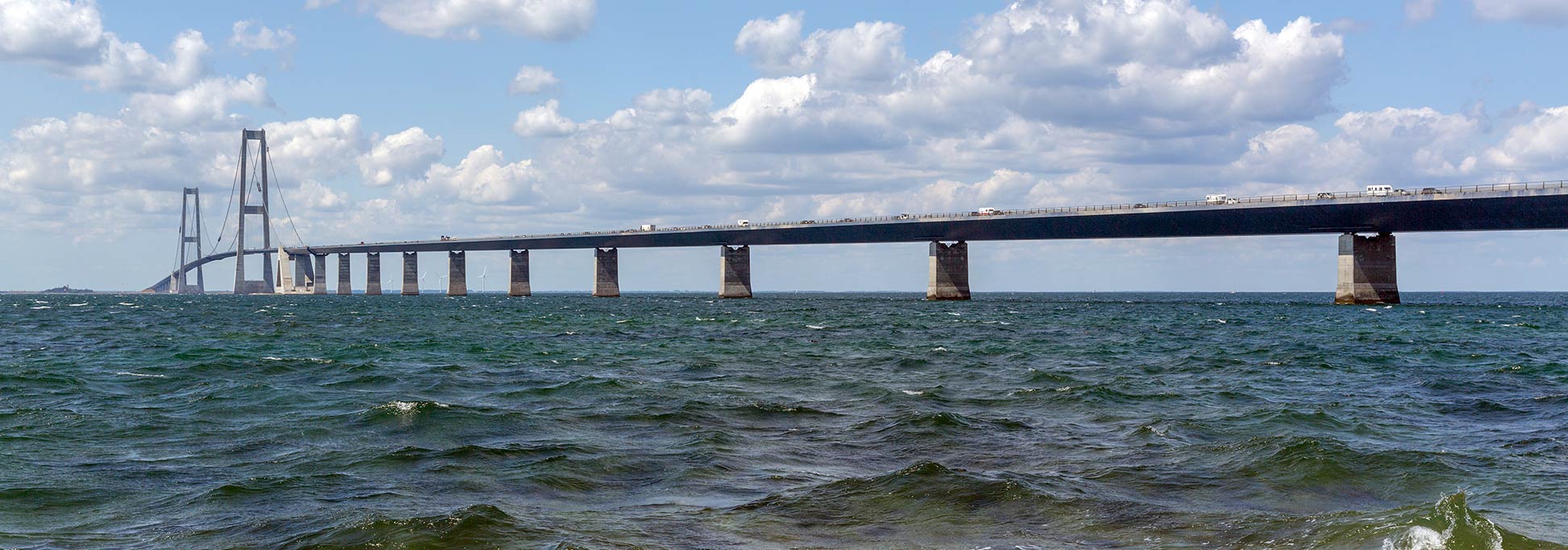
Great Belt Bridge crossing the Great Belt strait
The Great Belt Bridge crossing the Great Belt strait between the Danish islands of Zealand and Funen.
Image: Villy Fink Isaksen

About Denmark


Denmark Flag
The map shows Denmark, officially the Kingdom of Denmark, a country in northwestern Europe, situated on the Jutland peninsula and its main islands of Zealand and Funen.

The country is located between the North Sea and the Baltic Sea, north of Germany and west of Sweden, across the Kattegat the maritime link between the North– and the Baltic Sea.

With an area of 43,094 km² Denmark proper is the smallest of the Scandinavian countries, just somewhat bigger than Switzerland, or slightly less than twice the size of the U.S. state of Massachusetts.

Including the Faroe Islands and Greenland, which are self-governing countries under the sovereignty of the Kingdom of Denmark, the country shares maritime borders with Canada, Iceland, Norway, Poland, Sweden, and the United Kingdom.

Denmark has a population of 5.8 million people (in 2019); its capital, largest city, and chief port is Copenhagen. The official language is Danish; recognized regional languages are Faroese, Greenlandic, and German.

Denmark consists of the peninsula of Jutland, the main island of Zealand (Sjaelland), which includes the capital of Copenhagen and nearly half the population. Zealand is connected to the island of Funen by the Great Belt Bridge and with Sweden via Amager island by the Öresund (Øresund) Bridge. The kingdom has a land border with Germany on Jutland with the German Federal State of Schleswig-Holstein.

The island of Bornholm lies about 130 km (80 mi) to the east in the Baltic Sea, a relic of a time when Denmark’s kings completely controlled the Baltic region.
 
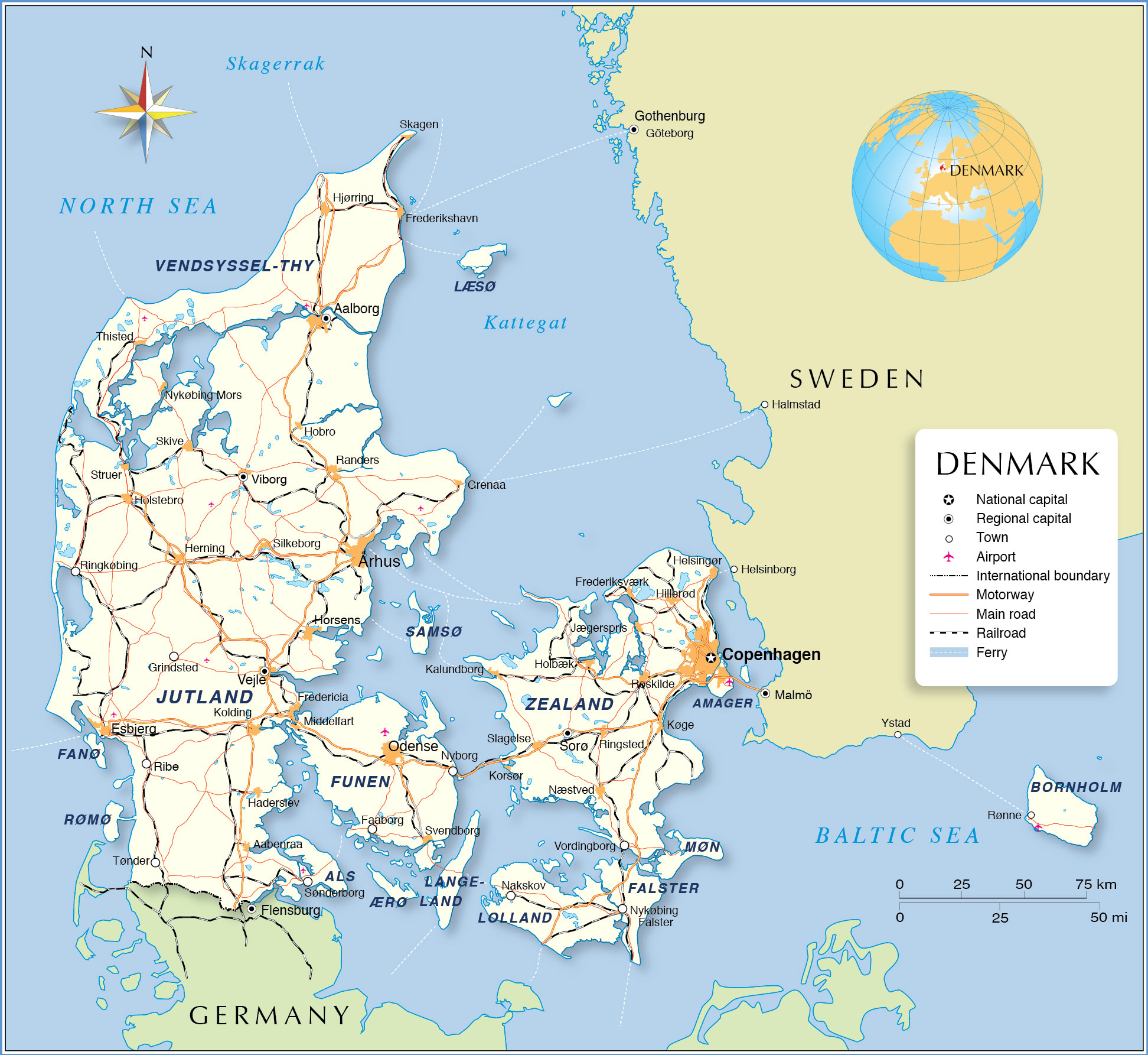
Map of Denmark

Political Map of Denmark

The map shows Denmark and surrounding countries with international borders, the national capital Copenhagen, governorate capitals, major cities, main roads, railroads, and major airports.

You are free to use above map for educational purposes, please refer to the Nations Online Project.

 
Cities and Towns in Denmark:

The map shows the location of following Danish cities:

Largest Cities (2011): Copenhagen (pop.: in the metropolitan area 1.6 million in 2018), Århus (250,000), and Odense (168,000).

Other cities and towns:
Aabenraa, Aalborg, Esbjerg, Faaborg, Fredericia, Frederikshavn, Frederiksværk, Grenaa, Grindsted, Haderslev, Helsingør, Herning, Hillerød, Hjørring, Hobro, Holbæk, Holstebro, Horsens, Jægerspris, Kalundborg, Kolding, Korsør, Køge, Middelfart, Nakskov, Næstved, Nyborg, Nykøbing Falster, Nykøbing Mors, Randers, Ribe, Ringkøbing, Ringsted, Roskilde, Rønne, Silkeborg, Skagen, Skive, Slagelse, Sorø, Sønderborg, Struer, Svendborg, Thisted, Tønder, Vejle, Viborg, and Vordingborg.
 

Bookmark/share this page
  Instagram button

Weather Conditions Copenhagen:

COPENHAGEN WEATHER


Advertisements:


Maps of other Countries in Northern Europe
European Russia Map, Estonia Map, Faroe Islands Map, Finland Map, Greenland Map, Iceland Map, Ireland Map, Latvia Map, Lithuania Map, Norway Map, Sweden Map, United Kingdom Map

Interactive Maps of countries and regions in Northern Europe:
Denmark Interactive Map, Estonia Interactive Map, Faroe Islands Interactive Map, Finland Interactive Map, Greenland Interactive Map, Iceland Interactive Map, Ireland Interactive Map, Latvia Interactive Map, Lithuania Interactive Map, Northern Ireland Interactive Map, Norway Interactive Map, Scotland Interactive Map, Sweden Interactive Map, United Kingdom Interactive Map, Wales Interactive Map

Major Cities in Northern Europe
Belfast | Cardiff | Copenhagen | Dublin | Edinburgh | Glasgow | Helsinki | London | Moscow | Nuuk | Oslo | Reykjavik | Riga | Saint Petersburg | Stockholm | Tallinn | Vilnius
 
up