Nations Online
All Countries in the World
Nations Online All Countries in the World | |
Home  |
___ Satellite View and Map of the City of Belfast, Northern Ireland |
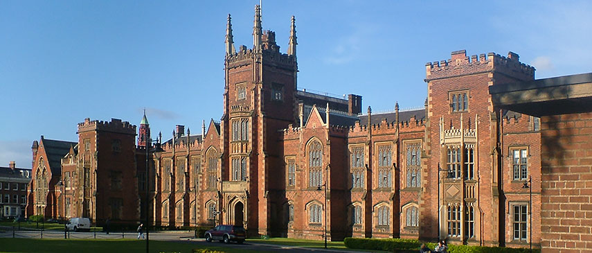 The Lanyon Building, opened in 1849, named after its architect Sir Charles Lanyon, is the centerpiece of the Queen's University in south Belfast. |
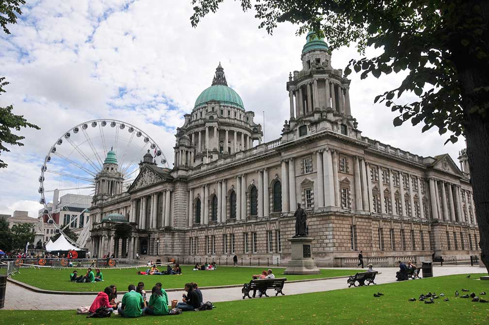
About Belfast Satellite view is showing Belfast, a major seaport, largest city, and the capital city of Satellite view is showing Belfast, a major seaport, largest city, and the capital city of Belfast, the second largest city (after Dublin) on the island of Ireland, is situated midway of Northern Ireland`s eastern coast, at the estuary mouth of the Lagan river. The IRA Ceasefire in 1994 and the signing of the Good Friday Agreement in 1998 have ended the period of disruption, conflict, and destruction called the Troubles (1969-1997). This has given investors increased confidence to invest in Belfast and led to a period of sustained economic growth and large-scale redevelopment of the city center. Belfast economy was historically based on maritime, linen and shipbuilding industries, today Belfast’s economy is dominated by the hi-tech service of telecoms and technology companies, financial services, creative industries and advanced manufacturing. The city has been the fastest-growing economy in the UK over the past decade. Belfast has a population of 339,800 inhabitants (in 2016 est.), about 700,000 people live in the urban area of Belfast, combining the Belfast, Lisburn, Newtownabbey, North Down, Castlereagh and Carrickfergus districts. Official languages are English (de facto), Irish and Ulster Scots. In the UK's EU referendum on 23rd June 2016, Belfast voted 61% to remain, only Belfast East voted with 51.4% for leave. Northern Ireland has voted to remain in the EU Referendum by a majority of 56% to 44%. Belfast is home to the Queen's University Belfast (QUB), the songwriter and musician Van Morrison, blues guitarist Gary Moore (died in 2011), physicist John Stewart Bell (died in 1990), and C. S. Lewis (died in 1963), author of 'The Chronicles of Narnia'. Some of the city's highlights are: Belfast Castle, the Lyric Theatre, the Ulster Museum located in the Botanic Gardens, the Golden Mile with the Crown Liquor Saloon and the Grand Opera House, Cavehill and Belfast Zoo. Just zoom in (+) to see Belfast City Hall. The Map shows a city map of Belfast with expressways, main roads and streets, zoom out to find the location of Belfast International Airport To find a location use the form below. To view just the map, click on the "Map" button. |
|
| To find a location type: street or place, city, optional: state, country. |
Local Time United Kingdom:
Thursday-April-18 17:38
Standard time zone GMT: No UTC/GMT offsetDaylight saving time (BST) in use from end of March until end of October, time zone offset: UTC/GMT +1 hour |
One World - Nations Online .:. let's care for this planet Promote that every nation assumes responsibility for our world. Nations Online Project is made to improve cross-cultural understanding and global awareness. More signal - less NOISE |
| Site Map
| Information Sources | Disclaimer | Copyright © 1998-2023 :: nationsonline.org |