About Iceland
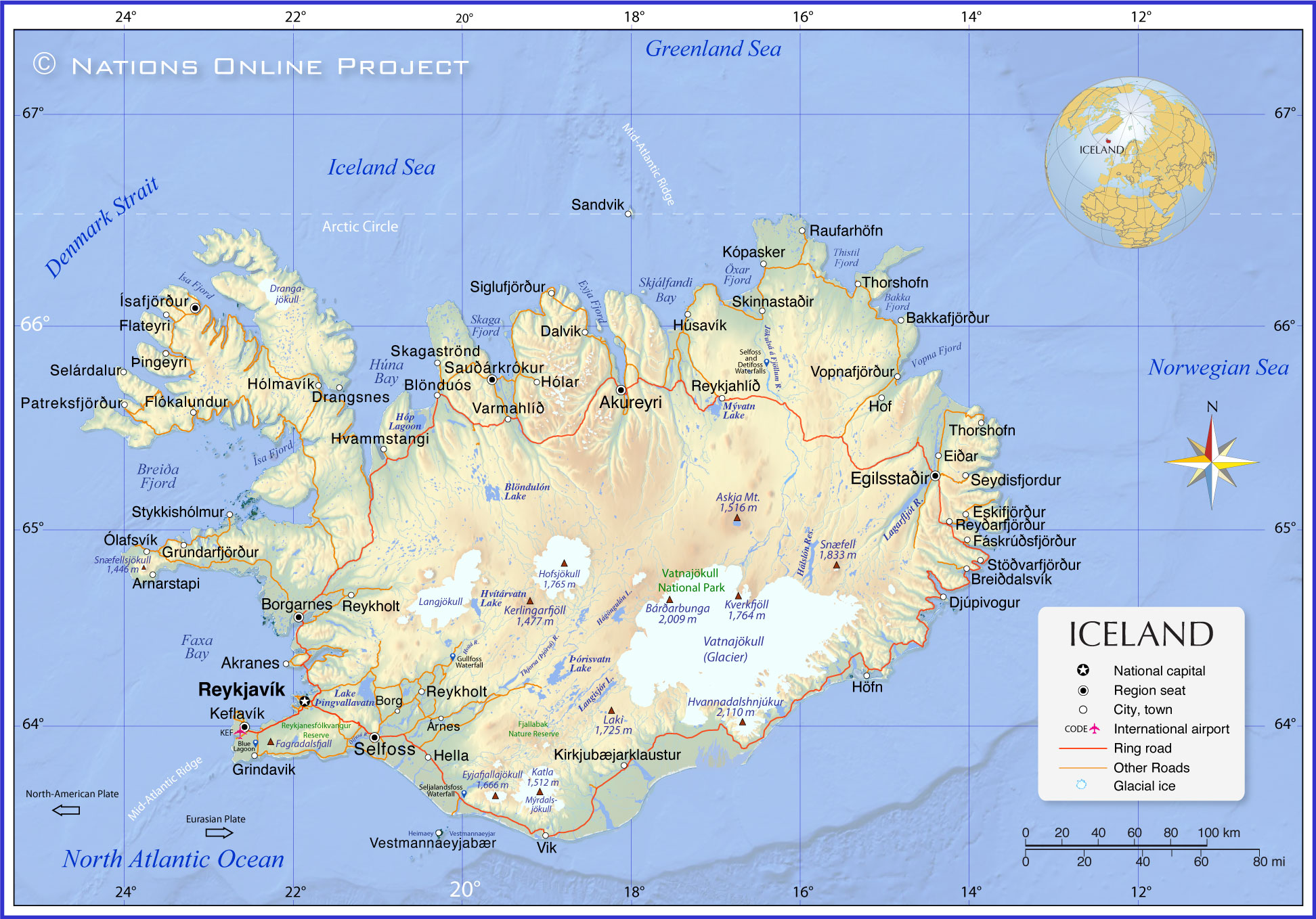
The map shows Iceland, a sparsely populated island country in the far northwest of Europe. The island is in the North Atlantic Ocean, southeast of southern
Greenland and just south of the Arctic Circle at the northern end of the Mid-Atlantic Ridge.
The closest bodies of land are Greenland in the west (290 km (180 mi) from coast to coast) and the
Faroe Islands in the southeast (430 km (270 mi)), an autonomous part of the
Kingdom of Denmark.
With an
area of 103,000 km², the island nation is slightly larger than
Portugal or about the same size as the US state of
Kentucky.
Iceland has a
population of 387,758 (Nov 2023), making it one of Europe's least densely populated countries. Only about 20-25 percent of Iceland is habitable
[NASA]; all urban settlements and towns are on or near the coast. The capital and largest city is
Reykjavik. Spoken
language is Icelandic, one of the North Germanic languages.
[EB]
The country's main religion is the Church of Iceland (Lutheran (58%)), some Germanic folk religion (Ásatrú).
Administrative Divisions of Iceland
Iceland is divided into eight regions, six constituencies, 23 counties, and 64 municipalities. The eight regions are primarily used for statistical purposes. Iceland has only two levels of administration: the national government and the 64 municipalities.
[WP]
More about Iceland
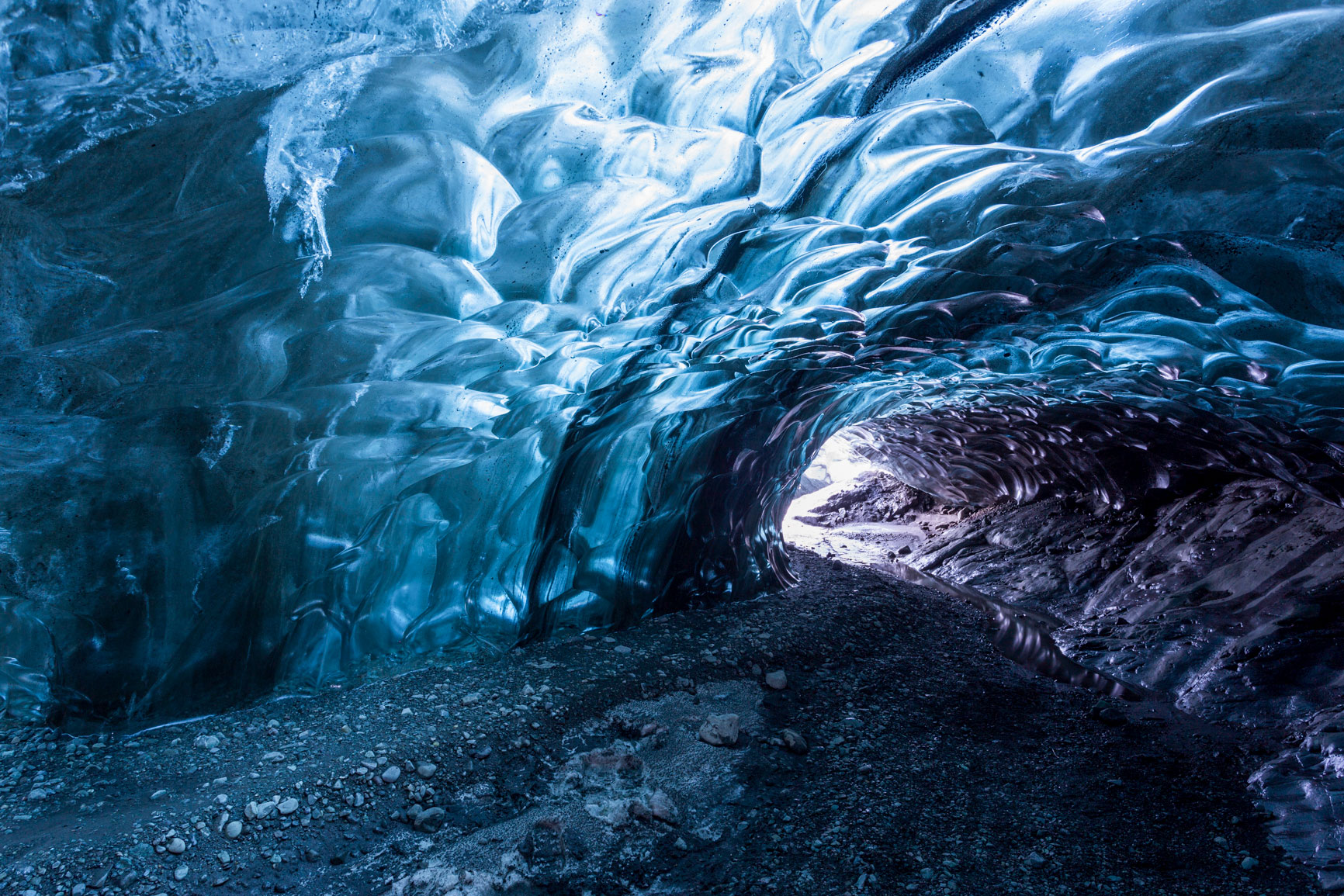 An ice cave under Vatnajökull, an 8,100 km² large ice cap in southern Iceland, and one of the largest glaciers in the world.
Photo: David Phan
The island nation is situated in the North Atlantic Ocean just south of the Arctic Circle, about 290 km (180 mi) southeast of southern Greenland and 820 km (510 mi) northwest of
Scotland,
UK. Iceland is known for its striking and unique landscape.
According to the Íslendingabók (The Book of Icelanders), Norse people discovered and settled the island in the Viking Age, around 870-930 CE.
[EB]
Geography of Iceland
The Icelandic landscape is quite varied, with numerous volcanoes and geothermal areas with rift valleys, tundras, geysers, hot springs, lava fields, fjords, and ice caps.
Glaciers
Despite its relatively mild climate due to the
Gulf Stream, Iceland has large glaciers and ice fields. These glaciers shape the country's landscape and are a source of various glacial rivers.
Vatnajökull is an 8.000 km² (3,000 sq mi) large ice cap; it is one of the largest glaciers in the world; it is the most voluminous ice cap in Iceland and the second largest in Europe after the Severny Island ice cap in
Russia. As with many Icelandic glaciers, there are also several volcanoes under the ice cap of Vatnajökull.
Volcanism
One of Iceland's most defining characteristics is its active volcanism. Iceland has around 130 volcanoes, most of which are active. The country's volcanism is a result of its location on the Mid-Atlantic Ridge at the boundary between the
North American and Eurasian tectonic plates. The two tectonic plates are moving away from each other at a rate of around 2-3 centimeters per year. The western part of Iceland sits on the North American Plate, which moves west, and the eastern portion sits on the Eurasian Plate, which moves east. The divergent tectonic activity of both plates causes the seabed to "rip open" (the process is known as seafloor spreading). As the plates move apart, rising magma solidifies, forming a new oceanic crust along the rift. This process, over time, creates a submarine mountain range.
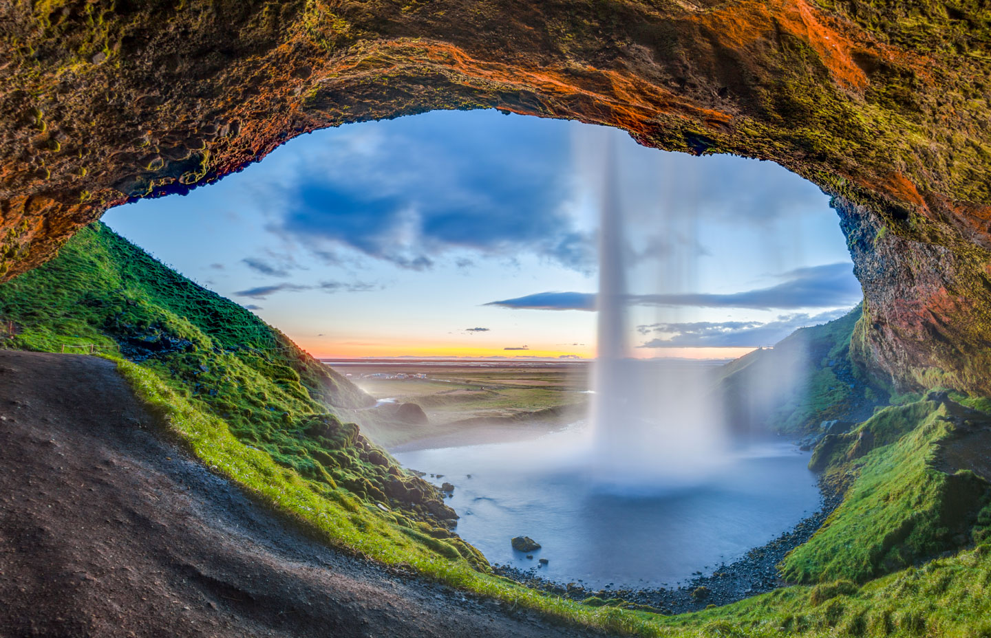 Sunset view from the back of the Seljalandsfoss waterfall in Suðurland of Iceland. The waterfall of the river Seljalandsá drops 65 meters (210 ft) over the cliffs of the former coastline.
Photo: Diego Delso
, a subglacial volcano in the south, has erupted relatively frequently since the
Last Glacial Period. But in 2010, a relatively small outbreak caused enormous disruption to air traffic in northern and western Europe for a week. The wild reaction of lava with ice and meltwater made that eruption so explosive and dangerous for aviation.
[USGS]
Fjords
Iceland's coastline is rugged and indented with fjords, particularly in the west and northwest. Retreating glaciers carved these fjords during the
last ice age and are now a defining feature of the Icelandic landscape.
Rivers and Lakes
Iceland has numerous rivers, most of which are glacial in origin and are known for their clear and clean waters. The country also has many lakes;
Þingvallavatn, in the southwest of the island, is the country's largest natural lake. Iceland's largest artificial lake is
Þórisvatn, a hydroelectric reservoir in central south.
Waterfalls
The country is known for its spectacular waterfalls, such as Gullfoss, Skógafoss, and Dettifoss. The falls are a result of melting ice from the glaciers flowing down the steep volcanic rocks.
Highlands
The Central Highlands of Iceland is an area that comprises much of the interior land and is mainly an uninhabitable volcanic desert, presenting a stark contrast to the coastal areas. The region is characterized by harsh terrain, limited vegetation, and rough beauty.
Flora and Fauna
The vegetation is primarily tundra, with limited forest cover. Fauna includes species adapted to the Arctic environment, and the surrounding seas are rich in marine life.
Climate
Despite its name and northerly location, Iceland has a relatively mild climate due to the Gulf Stream, which brings warmer ocean water from the south. The island features relatively mild winters and cool summers; however, the weather can be unpredictable and varies significantly between different regions.
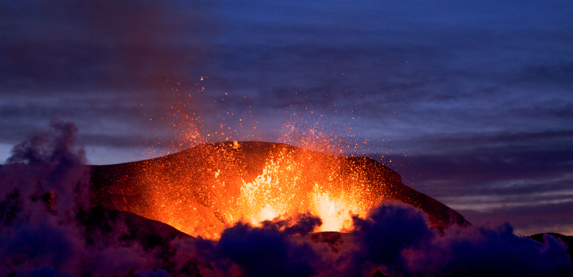
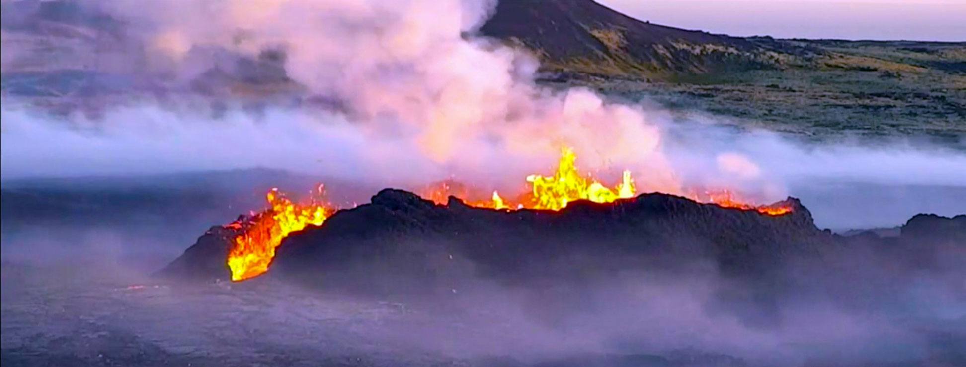 Since November 2023, increasing seismic activity on the Reykjanes Peninsula indicated an imminent volcanic eruption near Grindavík. The volcano erupted spectacularly on 18 December. Thanks to widespread media coverage, the whole world witnessed it. [Visit Iceland]
The map shows the location of the following Icelandic cities and towns:
Akranes, Akureyri, Arnarstapi, Árnes, Bakkafjörður, Blönduós, Borg, Borgarnes, Breiðdalsvík, Dalvik, Djúpivogur, Drangsnes, Egilsstaðir, Eiðar, Fáskrúðsfjörður, Flateyri, Flókalundur, Grindavik, Grundarfjörður, Hella, Höfn, Hólar, Hólmavík, Húsavík, Hvammstangi, Ísafjörður, Keflavík, Kirkjubæjarklaustur, Kópasker, Ólafsvík, Patreksfjörður, Raufarhöfn, Reyðarfjörður, Reykholt (Southern Iceland), Reykholt (Western Iceland), Reykjahlíð, Reykjavík, Sandvik, Sauðárkrókur, Selárdalur, Selfoss (Árborg), Seydisfjordur, Siglufjörður, Skagaströnd, Skinnastaðir, Stöðvarfjörður, Stykkishólmur, Thorshofn, Thorshofn, Vallanes, Varmahlíð, Vestmannaeyjabær, Vik, Vopnafjörður Hof and Þingeyri.
Advertisements:

