Nations Online
All Countries in the World
Nations Online All Countries in the World | |
Home  |
___ Satellite View and Map of the City of Cardiff (Welsh: Caerdydd), Wales, UK (45-degree view available) |
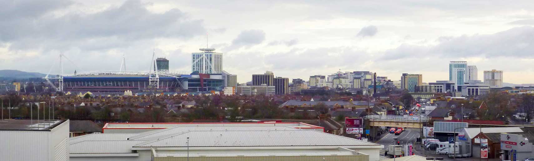 View of Cardiff city center with the Millennium Stadium (left; named Principality Stadium) and Cardiff Stadium House. Image: Kizpho11 |
 About CardiffSatellite view is showing Cardiff, largest city, chief commercial center and the capital of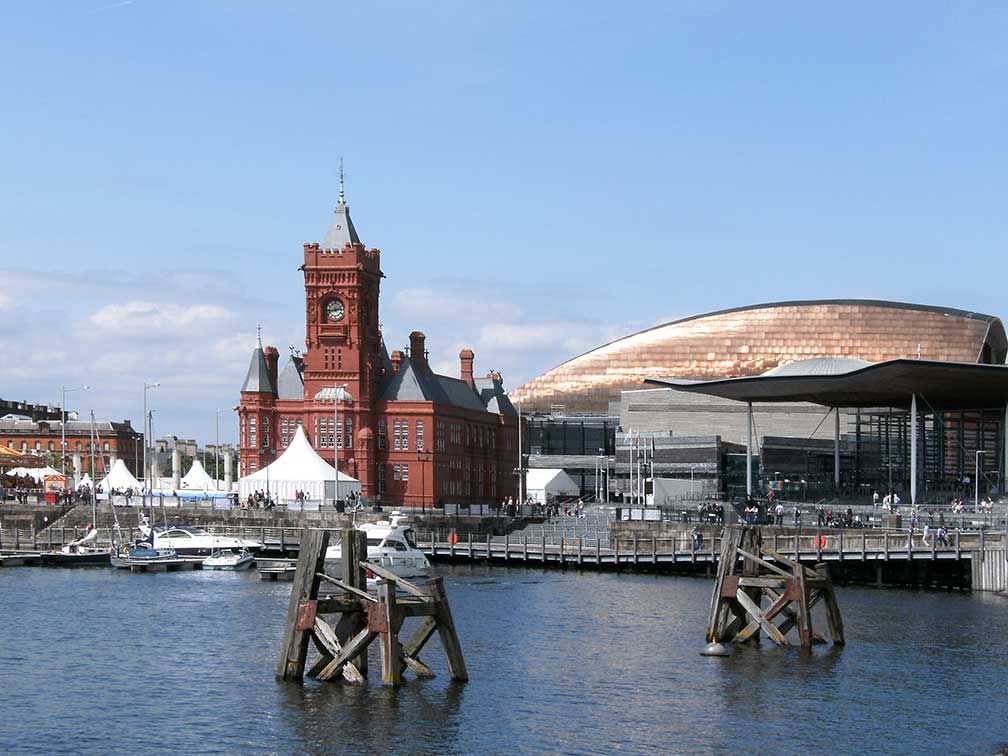 Cardiff Bay, the former dockland area south of the city center with the red Pierhead Building, Wales Millennium Centre (bronze colored dome) and the Senedd (far right), the National Assembly building. Image: givingnot [at] rocketmail.com Today the city has a population of almost 350,000 inhabitants (in 2015). Spoken languages are Welsh and English. In the UK's EU referendum on 23rd June 2016, Cardiff voted 60% to remain. Some points of interest: Cardiff Bay (dockland area and bay created by the Cardiff Barrage); Wales Millennium Centre (theater, national orchestra and opera); National Museum Cardiff (art, natural history and geology); Chapter Arts Centre (multi-artform cultural space); Techniquest (a Welsh science and discovery center); Cardiff Castle (a medieval castle); Cathays Park (the administrative heart of Cardiff); St John the Baptist Church (the only church dating to pre-Medieval times in Cardiff); and Tinkinswood (megalithic burial chamber). Just zoom in to see Cardiff City Hall, the National Museum Cardiff and Cardiff Crown Court at Alexandra Gardens (Cathays Park). The Map shows a city map of Cardiff with expressways, main roads and streets, zoom out to find the location of Cardiff International Airport To find a location use the form below. |
|
| To find a location type: street or place, city, optional: state, country. |
Local Time Cardiff:
Thursday-April-25 16:06
Standard time zone: No UTC/GMT offsetDaylight saving time (BST) in use from end of March until end of October, time zone offset: UTC/GMT +1 hour |
One World - Nations Online .:. let's care for this planet Promote that every nation assumes responsibility for our world. Nations Online Project is made to improve cross-cultural understanding and global awareness. More signal - less NOISE |
| Site Map
| Information Sources | Disclaimer | Copyright © 1998-2023 :: nationsonline.org |

