Advertising

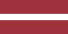
Latvia Flag detail
Home Earth Continents Europe Latvia Country Profile Map of Latvia

Maps Index

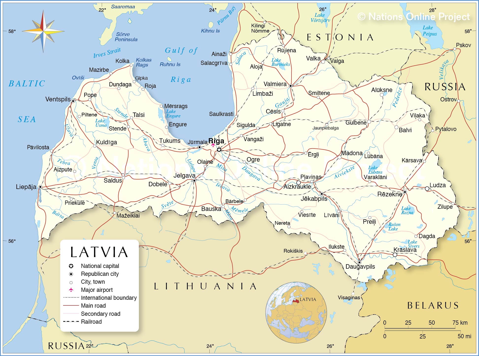
Map of Latvia, Baltic States, Europe


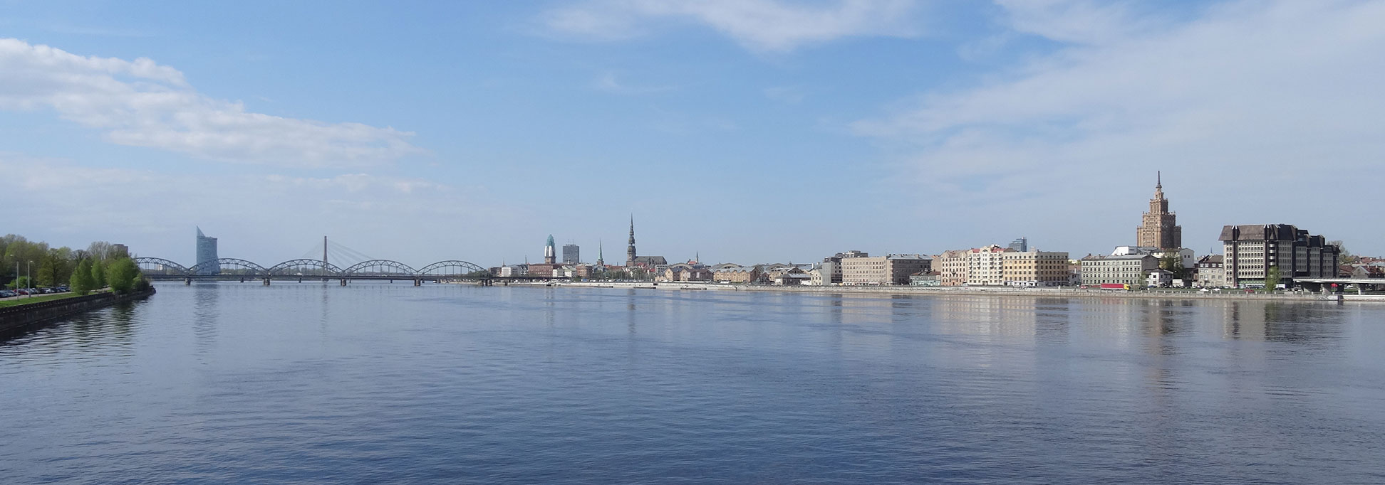
Panoramic view of Riga, Latvia's capital city at the Daugava River
View of Riga, Latvia's capital city at the Daugava River. Riga is the largest city in the three Baltic states and home to one third of Latvia's entire population.
Image: Sjaak Kempe

About Latvia


Latvia Flag
The map shows Latvia, an independent republic and one of the three Baltic states. The country is situated on the eastern shore of the Baltic Sea, between Estonia and Lithuania. It borders Belarus, Estonia, Lithuania, and Russia, and it shares maritime borders with Sweden.


Latvia is a flat country situated in the East European Plain, the vast mountain-free part of Europe's north-eastern landscape. It is bounded by the Gulf of Riga in the northwest and by the Baltic Sea in the west. Latvia is, for the most part, a wooded moraine hill country with numerous lakes and a broad, unindented coastal plain. The longest rivers in Latvia are the Düna and the Gauja. Latvia's largest lake is Lake Lubāns with 80 km².

With an area of 64,589 km², Latvia is somewhat larger than twice the size of Belgium, or slightly larger than the US state of West Virginia.

The country is sparsely populated, just 1.9 million people (in 2021) live in this Baltic state. Latvia's principal city, cultural center, and national capital is Riga. Spoken languages are Latvian (official) and Russian.


Map of Latvia

Political Map of Latvia

The map shows Latvia and surrounding countries with international borders, the national capital Riga, governorate capitals, major cities, main roads, railroads, and major airports.

You are free to use the above map for educational and similar purposes; if you publish it online or in print, you need to credit Nations Online Project as the source.

 
The map shows the location of following Latvian cities, towns:

Ainaži, Aizkraukle, Aizpute, Aloja, Alūksne, Balvi, Bauska, Bārbele, Cēsis, Dagda, Daugavpils, Dobele, Dundaga, Engure, Ērgļi, Ģipka, Gulbene, Ilukste, Jaunpiebalga, Jelgava, Jēkabpils, Jūrmala, Kolka, Krāslava, Kuldīga, Kārsava, Liepāja, Ligatne, Limbaži, Lubāna, Ludza, Līvāni, Madona, Mazirbe, Mērsrags, Nereta, Ogre, Olaine, Piltene, Pope, Preiļi, Priekule, Pāvilosta, Pļaviņas, Riga, Roja, Rēzekne, Rūjiena, Salacgrīva, Saldus, Saulkrasti, Sigulda, Smiltene, Stende, Talsi, Tukums, Valka, Valmiera, Vangaži , Varaklāni, Ventspils, Viesīte, Viļaka, and Zilupe


Advertisements:


Weather Conditions Riga:

RIGA WEATHER


Advertisements:


Maps of other Countries in Northern Europe
Denmark Map, European Russia Map, Estonia Map, Faroe Islands Map, Finland Map, Greenland Map, Iceland Map, Ireland Map, Latvia Map, Lithuania Map, Norway Map, Sweden Map, United Kingdom Map

Interactive Maps of other countries and regions in Northern Europe:
Denmark Interactive Map, Estonia Interactive Map, Faroe Islands Interactive Map, Finland Interactive Map, Greenland Interactive Map, Iceland Interactive Map, Ireland Interactive Map, Latvia Interactive Map, Lithuania Interactive Map, Northern Ireland Interactive Map, Norway Interactive Map, Scotland Interactive Map, Sweden Interactive Map, United Kingdom Interactive Map, Wales Interactive Map

Major Cities in Northern Europe
Belfast | Birmingham | Cardiff | Copenhagen | Dublin | Edinburgh | Glasgow | Helsinki | Liverpool | London | Malmö | Manchester | Moscow | Nuuk | Oslo | Reykjavik | Riga | Saint Petersburg | Stockholm | Tallinn | Vilnius
up