Nations Online
All Countries in the World
|
One Planet Nations Online All Countries in the World | |
Home  |
___ Satellite View and Map of the City of Oslo, Norway |
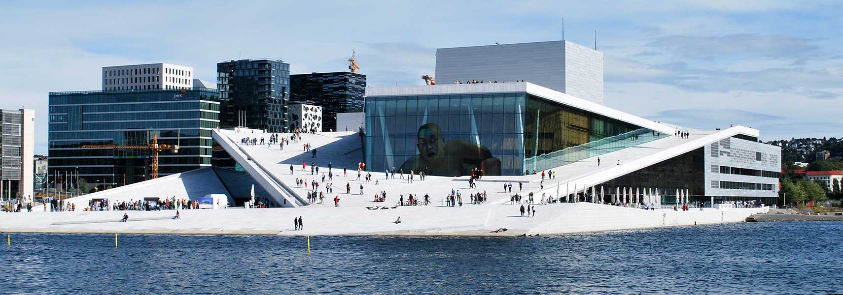
 View of the city's famous Oslo Opera House, home of the Norwegian National Opera and Ballet, and the national opera theater, thopera is located at Kirsten Flagstads Plass, at the head of the Oslofjord. Image: Helge Høifødt |
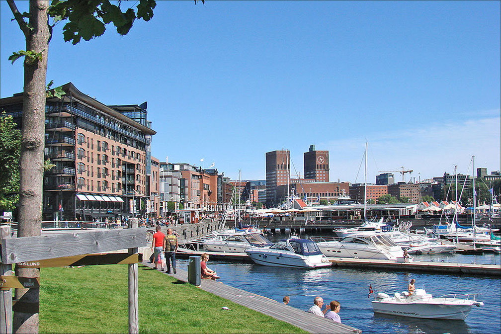
About Oslo Satellite view is showing Oslo, chief port, largest city, and the capital of Satellite view is showing Oslo, chief port, largest city, and the capital of  Aker Brygge, part of the Sentrum area and Oslo’s go-to place for shopping, dining, and entertainment, in background Oslo's twin-towered City Hall. Image: Jean-Pierre Dalbéra The city is the seat of the Norwegian government. Oslo is considered to be a global city, it is ranked a "Beta World City Plus". The city has a population of 700,000 inhabitants (in 2017), about 1 million people live in its urban area. Spoken language is Norwegian in various dialects. Major Points of Interest The city's top-sights are the Viking Ship Museum, art and culture of the real Vikings. The 19th century Royal Palace is open to the public during summer. The medieval castle of Akershus Fortress, a former royal residential palace and a prison. The Norwegian Museum of Cultural History is a large open-air museum with medieval building, it shows how people lived in Norway from 1500 to the present day. The Munch Museum is dedicated to the life and works of the Norwegian artist Edvard Munch (The Scream). The Fram Museum (Frammuseet) is telling the story of the polar explorations by Fridtjof Nansen, Roald Amundsen and other Norwegian explorers. Zoom straight in (+) to see Oslo’s Royal Palace (Det Kongelige Slott), the official residence of the Norwegian monarch. The map shows a city map of Oslo with expressways, main roads and streets, zoom out to find the location of Oslo International Airport, To find a location use the form below. |
|
| To find a location type: street or place, city, optional: state, country. |
Local Time Oslo:
Friday-April-19 10:20
Standard Time Zone (CET): UTC/GMT +1 hourCEST (Daylight Saving Time) in use from end of March until end of October. Time zone offset: UTC/GMT +2 hours |
|
φ Latitude, λ Longitude (of Map center; move the map to see coordinates): , |
||||||
| Google Maps: Searchable map/satellite view of the city of Oslo, Norway. City Coordinates: 59°57′N 10°45′E |
Bookmark/share this page
|
|||||
| More about Norway: Country: Continent: External Links: Oslo (official tourism web site) Wikipedia: Oslo Wikipedia entry for Oslo. |
Weather Conditions Oslo: |
Related Consumer Information:
|
||||
Major Cities in Northern Europe Belfast | Birmingham | Cardiff | Copenhagen | Dublin | Edinburgh | Glasgow | Helsinki | Liverpool | London | Malmö Manchester | Nuuk | Oslo | Reykjavik | Riga | Saint Petersburg | Stockholm | Tallinn | Vilnius Maps of other Countries in Northern Europe Denmark Map, Estonia Map, Faroe Islands Map, Finland Map, Greenland Map, Iceland Map, Ireland Map, Latvia Map, Lithuania Map, Sweden Map, United Kingdom Map Interactive Maps of other countries and regions in Northern Europe: Denmark Interactive Map, Faroe Islands Interactive Map, Greenland Interactive Map, Iceland Interactive Map, Ireland Interactive Map, Latvia Interactive Map, Lithuania Interactive Map, Norway Interactive Map, Scotland Interactive Map, Sweden Interactive Map, United Kingdom Interactive Map |
Map Help [ show ]  |
One World - Nations Online .:. let's care for this planet Promote that every nation assumes responsibility for our world. Nations Online Project is made to improve cross-cultural understanding and global awareness. More signal - less NOISE |
| Site Map
| Information Sources | Disclaimer | Copyright © 1998-2023 :: nationsonline.org |