Advertising

Estonia Flag detail
Home Earth Continents Europe Estonia Country Profile Map of Estonia

Maps Index

Map of Estonia (Eesti), Europe


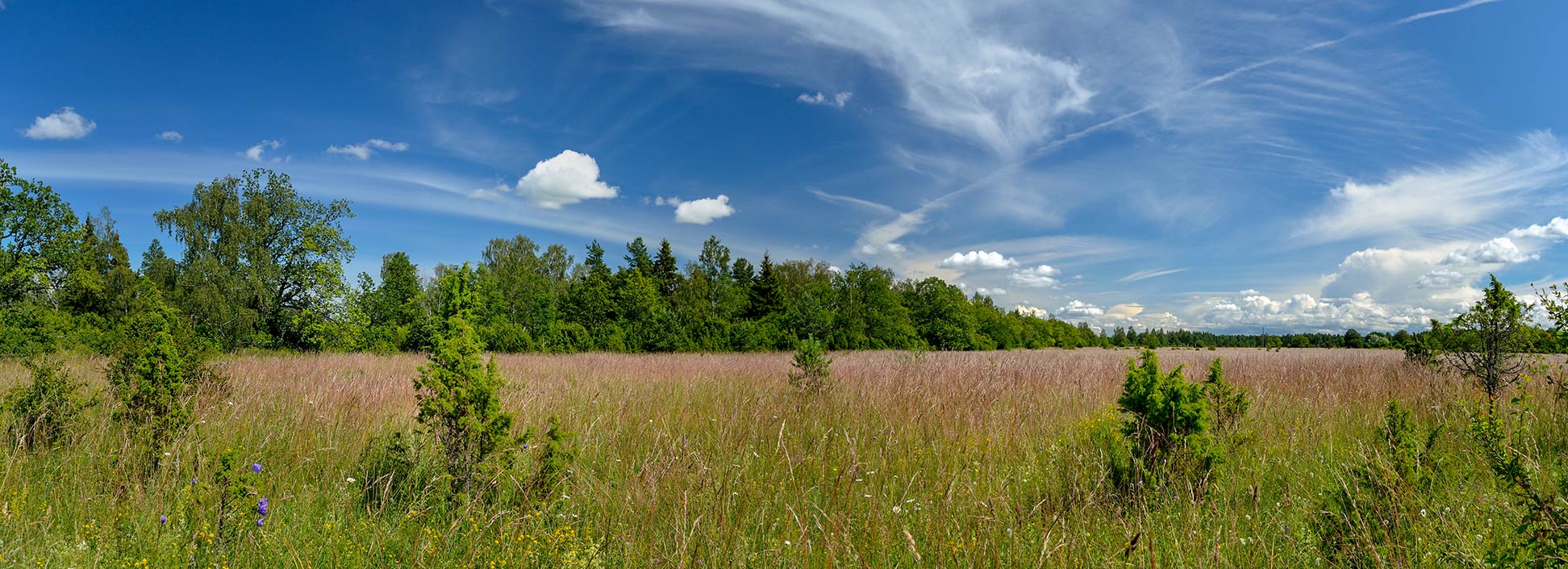
Alvar Landscape near Keila in Harju County of Estonia
Alvar Landscape near Keila in Harju County of Estonia.
Image: Ivar Leidus

About Estonia


Estonia Flag
The map shows Estonia, a country in Eastern Europe bounded by the Gulf of Finland in the north and the Baltic Sea in the west. It borders Latvia in the south and Russia in the east, and it shares maritime borders with Finland.

The country is one of the three Baltic states, the independent nations of Estonia, Latvia, and Lithuania.

With an area of 45,227 km², Estonia is about the size of Denmark, or slightly smaller than the U.S. states of New Hampshire and Vermont combined.

The country consists of a mainland plus 1,500 islands and islets in the Baltic Sea; the largest islands are Saaremaa and Hiiumaa.
The landscape of Estonia is flat in the north, and somewhat hilly in the south, its highest point is Suur Munamägi at 318 m. It has a maritime climate with wet, moderate winters, and cool summers.

Estonia has a population of 1.33 million people (in 2021); the capital, largest city, and the country’s cultural hub is Tallinn (pop. 450,000). Spoken language is Estonian.


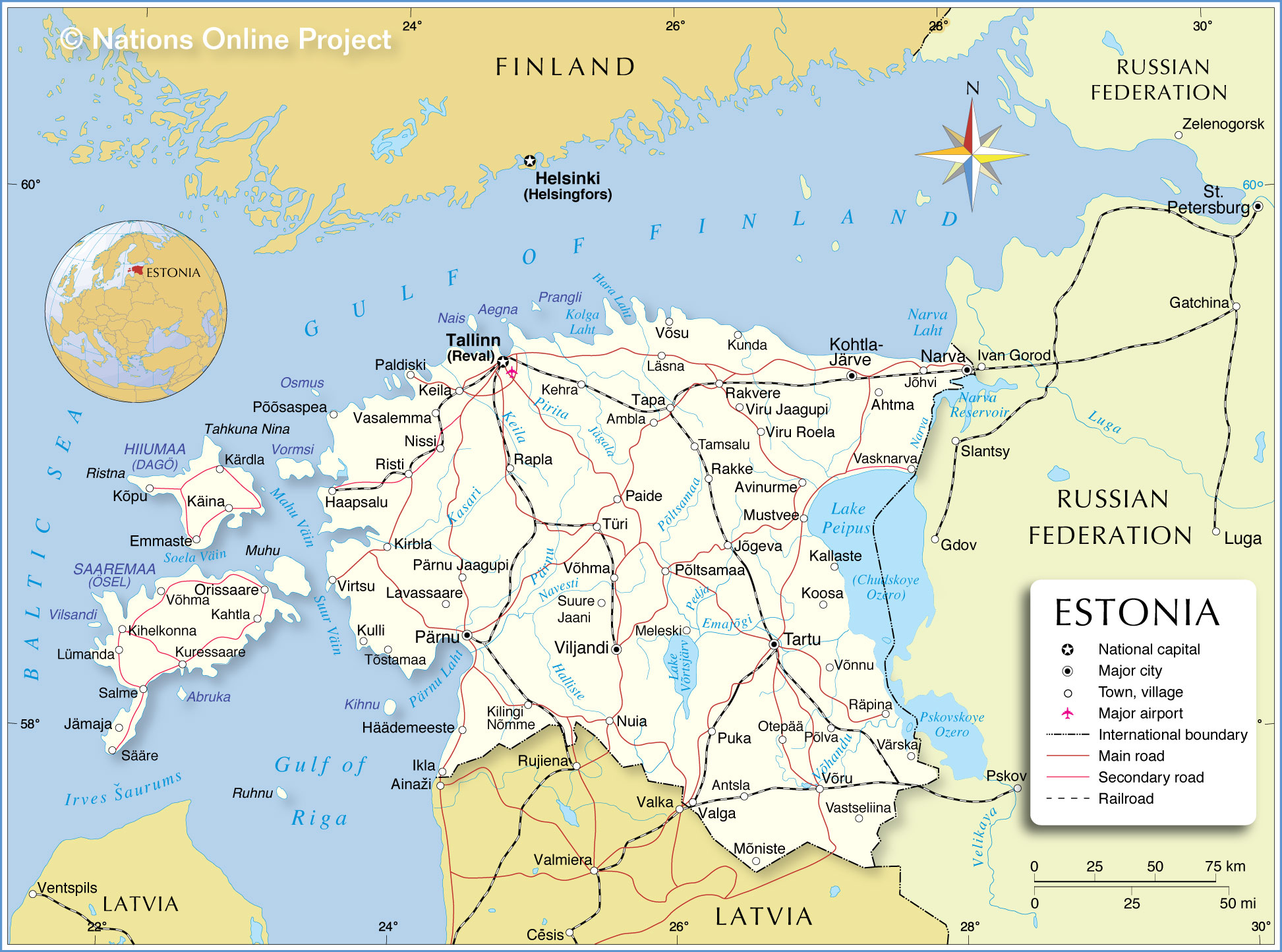
Map of Estonia
Political Map of Estonia

The map shows Estonia and surrounding countries with international borders, the national capital Tallinn, major cities, main roads, railroads, and major airports.

You are free to use the above map for educational and similar purposes; if you publish it online or in print, you need to credit Nations Online Project as the source.


More about Estonia


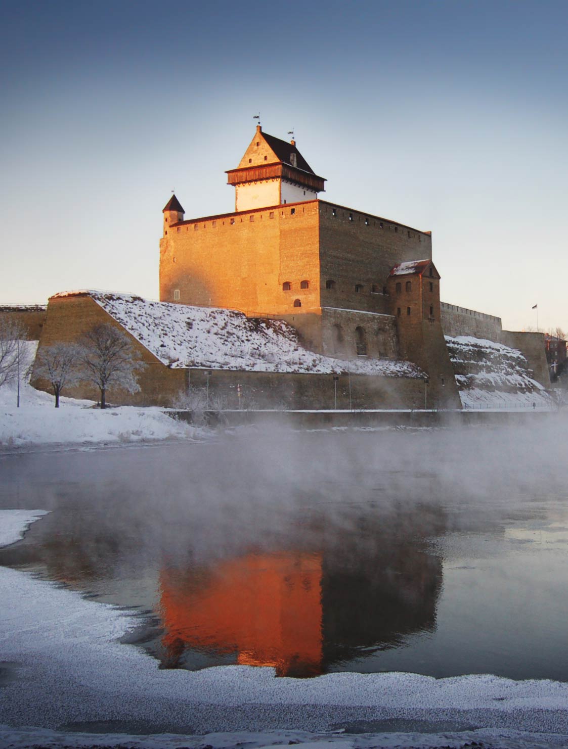
The Hermann Castle in Narva, Estonia
The Hermann Castle at the Narva River in Narva, Estonia.
Photo: Zentsik


Cities and towns of Estonia, listed by counties (maakond):

Tallinn is the national capital and the capital of Harju county; for centurys the city was known as Reval.

Other cities in Harju county: Kehra, Keila, Nissi, Paldiski, Vasalemma.

Ida-Viru; county capital: Jõhvi; other towns: Ahtma, Avinurme, Kohtla-Järve, Narva, Vasknarva.

Järva; county capital: Paide; other towns: Ambla, Türi

Jõgeva; county capital: Jõgeva; other towns: Mustvee, Põltsamaa

Lääne; county capital: Haapsalu; other towns: Kirbla, Põõsaspea, Risti, Virtsu

Lääne-Viru; county capital: Rakvere; other towns: Kunda, Läsna, Rakke, Tamsalu, Viru Jaagupi, Viru Roela, Võsu

Pärnu; county capital: Pärnu; other towns: Häädemeeste, Ikla, Kilingi Nõmme, Kulli, Lavassaare, Pärnu Jaagupi, Tõstamaa

Põlva; county capital: Põlva; other towns: Otepää, Räpina, Värska

Rapla; county capital: Rapla

Tartu; county capital: Tartu; other towns: Kallaste, Koosa, Võnnu

Valga; county capital: Valga; other towns: Puka

Viljandi; county capital: Viljandi; other towns: Meleski, Nuia, Suure Jaani, Võhma

Võru; county capital: Võru; Antsla, Mõniste, and Vastseliina.


The map shows the location of following Estonian islands.

Islands
Hiiumaa (Dagö) island
Hiiu county; capital: Kärdla; other towns: Emmaste, Käina, Kõpu

Saaremaa (Ösel) island
Saare county; capital: Kuressaare; other towns: Jämaja, Kahtla, Kihelkonna, Kuressaare, Lümanda, Orissaare, Salme, Sääre, and Võhma.

Other islands:
Abruka, Aegna, Kihnu, Nais, Osmus, Prangli, Vilsandi, and Vormsi.


Advertisements:


Weather Conditions Tallinn:

TALLINN WEATHER


Advertisements:


Maps of other Countries in Northern Europe
Denmark Map, European Russia Map, Faroe Islands Map, Finland Map, Greenland Map, Iceland Map, Ireland Map, Latvia Map, Lithuania Map, Norway Map, Sweden Map, United Kingdom Map

Interactive Maps of countries and regions in Northern Europe:
Denmark Interactive Map, Estonia Interactive Map, Faroe Islands Interactive Map, Finland Interactive Map, Greenland Interactive Map, Iceland Interactive Map, Ireland Interactive Map, Latvia Interactive Map, Lithuania Interactive Map, Northern Ireland Interactive Map, Norway Interactive Map, Scotland Interactive Map, Sweden Interactive Map, United Kingdom Interactive Map, Wales Interactive Map

Major Cities in Northern Europe
Belfast | Birmingham | Cardiff | Copenhagen | Dublin | Edinburgh | Glasgow | Helsinki | Liverpool | London | Malmö | Manchester | Moscow | Nuuk | Oslo | Reykjavik | Riga | Saint Petersburg | Stockholm | Tallinn | Vilnius
up