Advertising

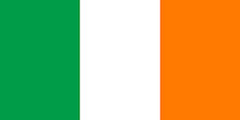
Republic of Ireland  Flag detail
Home Earth Continents Europe Republic of Ireland Country Profile Map of Ireland

Maps Index

Map of Ireland, Northern Europe


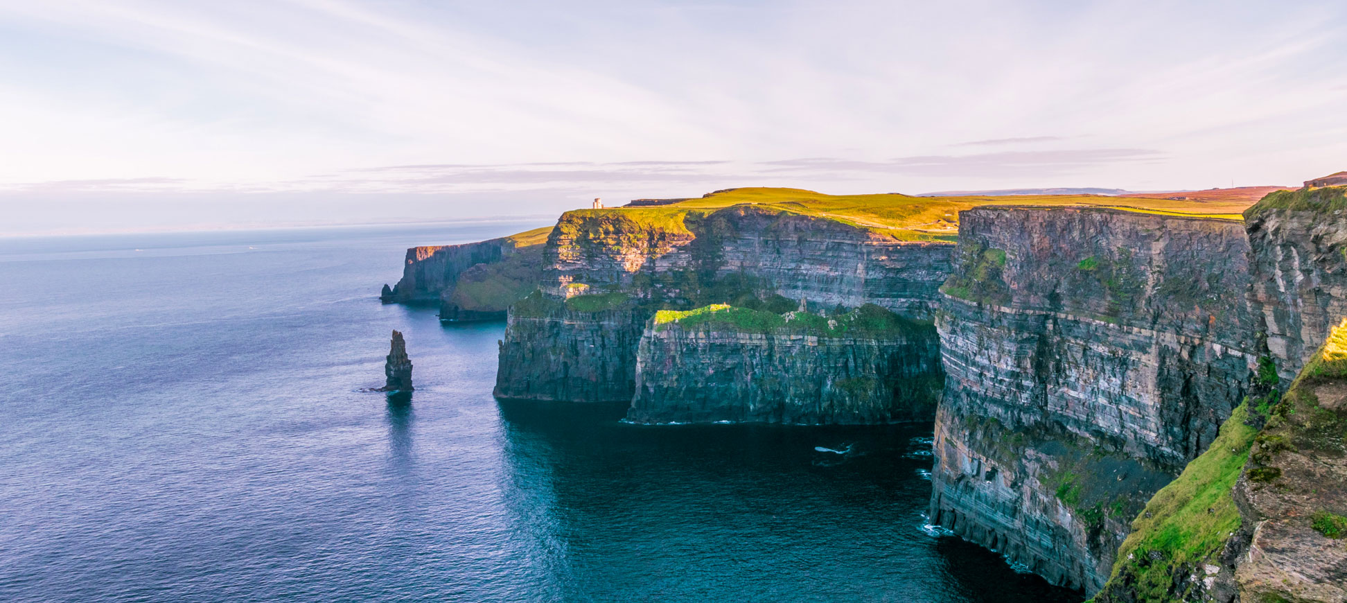
The famous Cliffs of Moher in County Clare, Ireland.
The Cliffs of Moher are a well-known steep coast in Ireland. The cliffs are on the west coast of the Irish island in County Clare (see the map).
Image: John Finkelstein


About Ireland


Ireland Flag
The map shows Ireland, the 'Emerald Isle' in the North Atlantic Ocean west of Great Britain. The island is home to the Republic of Ireland, a sovereign state (Éire) that covers slightly more than four-fifths of the island's area; the rest is occupied by Northern Ireland, a province of the United Kingdom.

Ireland is one of the British Isles. The Irish Sea and the North Channel separate the island from Great Britain; the body of water in the south between Ireland and the European mainland is known as the Celtic Sea.

The Irish Republic has one land border, the Republic of Ireland–United Kingdom border, sometimes referred to as the Irish border, which separates the Republic of Ireland from Northern Ireland.

Several mountain ranges surround Ireland's plains in the center. Carrauntoohil in the MacGillycuddy's Reeks mountain range in County Kerry is the highest mountain on the island at 1,038 m.
Ireland's largest river is the Shannon, with a length of about 386 km; it is also the longest river in Ireland and the British Isles. On its way to the sea, the river creates three large lakes: Lough Allen, Lough Ree, and the largest: Lough Derg.

With an area of 70,273 km², the Republic of Ireland is slightly larger than twice the size of Denmark or somewhat larger than the U.S. state of West Virginia.

The Republic of Ireland has a population of 5.12 million people (in 2022). The capital and largest city is Dublin. The national language is Irish; the spoken languages are Irish and English.
 

Map of Ireland

Political Map of the Republic of Ireland
Political Map of Ireland

The map shows the Irish island with the Republic of Ireland and the UK province of Northern Ireland within the British Isles. Depicted on the map are the Irish border, the national capital Dublin of the Republic of Ireland, county capitals, major cities, main roads, railroads, and major airports.

You are free to use the above map for educational and similar purposes; if you publish it online or in print, you need to credit the Nations Online Project as the source.

 
More about Ireland


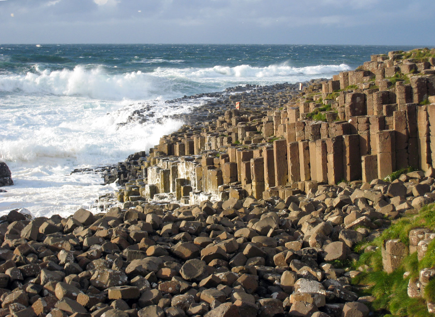
Giant's Causeway in Northern Ireland.
The famous Giant's Causeway is a geological formation of interlocking hexagonal basalt columns dating from the Tertiary period. Giant's Causeway and Causeway Coast is a UNESCO World Heritage Site located on the edge of the Antrim plateau in Northern Ireland.
Photo: Lena


Ireland is an island located in the North Atlantic Ocean to the west of the island of Great Britain. The island is shared by the Republic of Ireland, a sovereign state occupying the larger portion of the island, bordering Northern Ireland, one of the four countries of the United Kingdom.

The Emerald Isle is renowned for its natural beauty, with rolling green hills, rugged coastlines and many lakes.
Ireland has a rich history and culture that dates back thousands of years, with numerous ancient sites and monuments scattered throughout the country.

Ireland is divided into 32 counties, with 26 counties forming the Republic of Ireland and six counties forming Northern Ireland, a province of the United Kingdom.

Each county has its unique history, culture, and landscape.


Some of the famous counties in Ireland include:

  • County Dublin is home to the capital Dublin, a city that is famous for its literary heritage, lively pubs, Irish music and friendly locals.
  • County Cork is the largest county in Ireland, famous for its stunning coastline, rugged landscapes and charming towns and villages.
  • County Kerry is located in the southwest of Ireland and is known for its breathtaking natural beauty, including the scenic drive of the Ring of Kerry, a road along charming towns and villages.
  • County Galway on Ireland's western seaboard has nearly 700 kilometers of coastline and is famous for its stunning landscapes, including the Connemara National Park and the Aran Islands. Galway has a vibrant cultural scene and is known as the festival capital of Ireland. [GT]
  • County Donegal is a predominantly Irish-speaking region in northwest Ireland known for its rugged coastline, wild landscapes and traditional Irish culture. One of the county's two names is Dún na nGall, meaning the fort of the foreigners. [BBC]
Other notable counties in Ireland include County Mayo, County Wexford, County Waterford, County Limerick, and County Tipperary, each with its unique charm and character.


Ireland's natural and cultural-historical attractions


  • Cashel of the Kings and St. Patrick's Rock, County Tipperary, Ireland
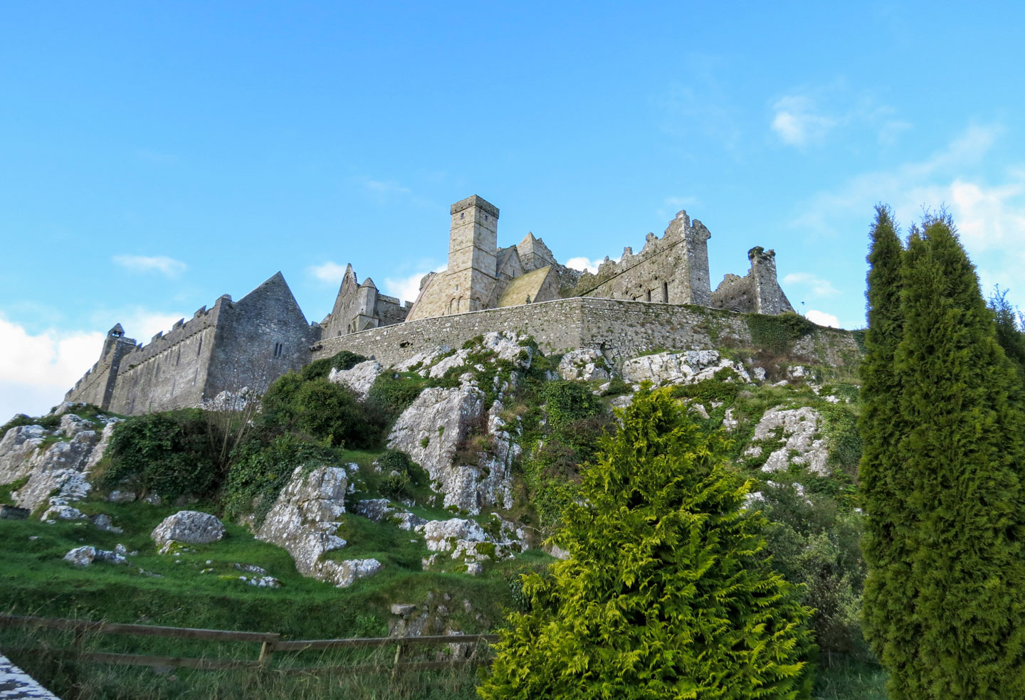
    The medieval fortress of Rock of Cashel, also known as Cashel of the Kings and St. Patrick's Rock, is a historic site in Cashel, County Tipperary.
    Photo: Malcolm Manners
    Among the island's famous natural attractions are the Cliffs of Moher, rising up to 214 m (702 feet) above the Atlantic Ocean, and the unique geological formation of the Giant's Causeway, consisting of about 40,000 interlocking hexagonal basalt columns.

  • The Burren, also located in County Clare, is a unique karst landscape. The name is derived from the Irish word "Boireann," which means "rocky place," which is an apt description. The limestone area is home to a variety of plant species and archaeological sites.

  • The Killarney National Park was the first national park in Ireland and is known for its beautiful lakes, mountains and forests. The park also includes Muckross House and Gardens, a well-preserved 19th-century mansion.

  • The medieval fortress of Rock of Cashel, located in County Tipperary, was once the seat of the kings of Munster and is now a popular tourist attraction.

  • The Blarney Stone, located in Blarney Castle in County Cork, is a famous landmark where legend has it that anyone who kisses the stone will be endowed with the gift of eloquence or "the gift of the gab."

     
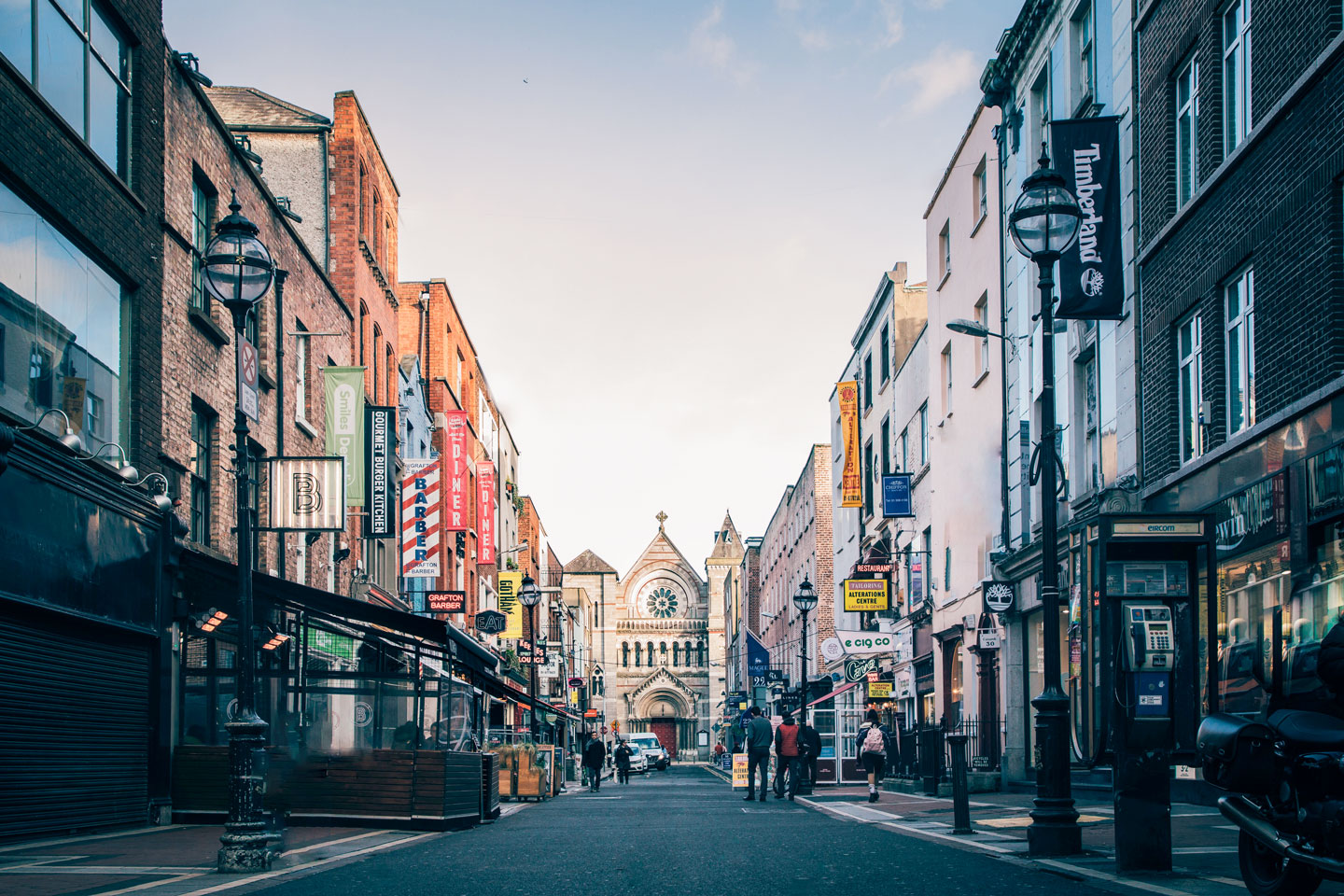
  • View of Anne Street with St. Ann's Church in Dublin, Ireland
    View of Anne Street with St. Ann's Church in the background in Dublin, the capital city of Ireland.
    Photo: Gregory DALLEAU
     
    Glendalough, or the "Glen of Two Lakes," is a glacial valley in County Wicklow in the east of the island. Glendalough is notable for its early medieval monastic settlement founded in the 6th century by Kevin of Glendalough (St. Kevin). Serene lakes, a waterfall and walking trails around the settlement make it a peaceful retreat.

  • Newgrange is a more than 5,000 years old tomb in County Meath. The prehistoric monument is a burial chamber covered in earth and stone and has a narrow access passage made of large stones. Newgrange is older than both Stonehenge and the Egyptian pyramids.

  • The Rock of Cashel, also known as St. Patrick's Rock, is a historical site in County Tipperary and features a collection of medieval ecclesiastical buildings; it is one of Ireland's most spectacular tourist attractions.

  • The Ring of Kerry is a scenic drive around the Iveragh Peninsula that takes visitors through some of the most picturesque landscapes in Ireland, including rugged coastlines, mountains, and lakes. The route passes through several charming towns and villages, making it a popular tourist destination.

  • The Iveragh Peninsula is home to the Carrauntoohil, Ireland's highest peak at 1,038 m (3,407 ft.); the mountain is located in MacGillycuddy's Reeks, a sandstone mountain range.

  • The Connemara National Park, located in the west of Ireland, is known for its expanse of bogland, heaths and grasslands dotted with a mosaic of lakes. The park is also home to a herd of purebred Connemara Ponies.

  • Skellig Michael is an island off the coast of County Kerry; it served as a monastic retreat in the Middle Ages. Its well-preserved structures and stunning ocean views make it worth a visit. The island was also a filming location for the Star Wars franchise.

  • The Slieve League Cliffs is a 600 m tall mountain on the Atlantic coast with spectacular towering sea cliffs.
Cities and towns in Ireland

The map shows the location of the following cities and towns of the Republic of Ireland (Irish names in brackets)

Largest cities: Dublin (capital), Cork (Corcaigh), Limerick (Luimneach)

Ardara, Ardee, Arklow, Athlone (Baile Átha Luain), Ballina, Ballyshannon, Bangor Erris, Bantry, Bray, Carlow (Ceatharlach), Carrick on Shannon (Cora Droma Rúisc), Castlebar (Caisleán an Bharraigh), Cavan, Clairemorris, Clifden, Clonmel (Cluain Meala), Creeslough, Dingle, Donegal, Drogheda (Droichead Átha), Dun Laoghaire, Dundalk (Dun Dealgan), Dungarvan, Durrow, Enistimon, Ennis (Inis), Enniscorthy, Fermoy, Galway, Gweedore, Kenmare, Kilkee, Kilkenny (Cill Chainnigh), Killarney, Kingscourt, Letterkenny, Lifford (Leifear), Loch Garman, Longford (An Longfort), Loughrea, Macroom, Mallow, Monaghan (Muineachán), Mullingar (An Muileann gCearr), Naas (Nás na Ríogh), Navan (An Uaimh), New Ross, Portlaoise, Portrush, Roscommon (Ros Comáin), Rosslare Harbour, Sligo (Sligeach), Swords, Tipperary (Tiobraid Árann), Tralee (Trá Lí), Trim (Baile Átha Troim), Tuam, Tullamore (Tulach Mhór), Waterford, Waterville, Westport, Wexford, Wicklow (Cill Mhantáin), and Youghal.
 

Advertisements:


Weather Conditions Dublin:

DUBLIN WEATHER


Advertisements:


Maps of other Countries in Northern Europe
Denmark Map, Estonia Map, European Russia Map, Faroe Islands Map, Finland Map, Greenland Map, Iceland Map, Latvia Map, Lithuania Map, Norway Map, Sweden Map, United Kingdom Map

Interactive Maps of other Countries and Regions in Northern Europe:
Denmark Interactive Map, Estonia Interactive Map, Faroe Islands Interactive Map, Finland Interactive Map, Greenland Interactive Map, Iceland Interactive Map, Latvia Interactive Map, Lithuania Interactive Map, Northern Ireland Interactive Map, Norway Interactive Map, Scotland Interactive Map, Sweden Interactive Map, United Kingdom Interactive Map, Wales Interactive Map

Major Cities in Northern Europe
Belfast | Birmingham | Cardiff | Copenhagen | Dublin | Edinburgh | Glasgow | Helsinki | Liverpool | London | Malmö | Manchester | Moscow | Nuuk | Oslo | Reykjavik | Riga | Saint Petersburg | Stockholm | Tallinn | Vilnius