Nations Online
All Countries in the World
|
One Planet Nations Online All Countries in the World | |
Home  |
___ Satellite View and Map of Dutch Antilles (The northern group) |
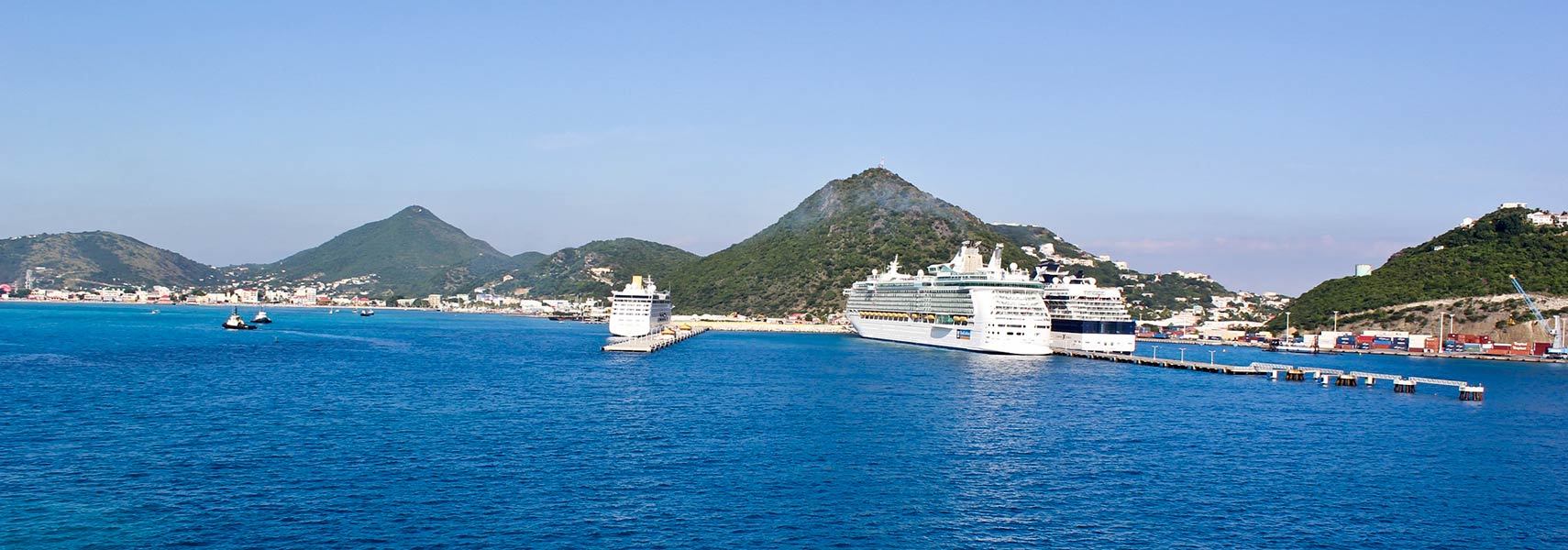
 The Dutch side of Sint Maarten with the Adonia, the Freedom of the Seas and the Celebrity Summit in the harbor of St Maarten. Image: Jonathan Palombo |
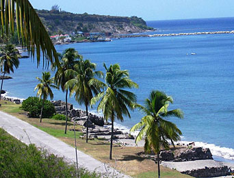
About the Dutch Antilles Ruins of 18th century warehouses on the beach of Lower Town, St. Eustatius. Photo: Walter Hellebrand The satellite view is showing the northern group of the (former) Netherlands Antilles, located south of the British overseas territory of Anguilla island and east of Puerto Rico. The northern group comprises the islands of St. Eustatius, St. Martin, and Saba. Saint Martin (Sint Maarten) island is divided into a French part, which is now an overseas collectivity of France (until Feb. 2007 it belonged to the French overseas department of Guadeloupe); and a Dutch part, formerly the Island Territory of Sint Maarten. Since 10 October 2010 Sint Maarten is a constituent country of the Kingdom of the Netherlands with a population of 41,000 people (in 2012). Main town and capital is Philipsburg. Princess Juliana International Airport (IATA code: SXM), a major airport in the Eastern Caribbean is located on the island, as well as the smaller French L'Espérance Airport (IATA code: SFG), . The island of Sint Eustatius (the Dutch name; pop.: 3,600) locally called Statia, is situated northwest of Saint Kitts and Nevis. Capital is Oranjestad with a population of 1,000 (not to be confused with the Oranjestad the capital of Aruba of the same name). In the 18th century St. Eustatius was an important Dutch trading center for sugar and weapons. St. Eustatius was the major supplier of arms and ammunition to the rebellious British Colonies in North America and in 1776 it was the first foreign nation to officially recognize the newly formed United States. Saba island (pop.: 1,800) is the smallest of the Dutch Caribbean islands, Mount Scenery, a volcano with an elevation of 877 m (2877 ft.) is actually the highest point in the Kingdom of the Netherlands. Saint Eustatius and Saba have the status of Dutch municipalities. Capital city of Netherlands Antilles was Willemstad (on Curaçao). To view just the map, click on the "Map" button. |
|
| Local Time Saint Martin:
Saturday-April-27 12:27
UTC/GMT -4 hours |
|
|
φ Latitude, λ Longitude (of Map center; move the map to see coordinates): , |
||||||
| Google Earth: Searchable map/satellite view of Saint Martin (Sint Maarten), St. Eustatius (Statia), and Saba islands of the northern Group of Netherlands Antilles. |
Bookmark/share this page
|
|||||
| More about the Dutch Antilles: Cities: Country: Related Islands: Continent: | Weather Conditions St. Martin: Weather station at Princess Juliana International Airport | Related Consumer Information:
|
||||
Searchable Maps of Greater Antilles: Cuba, Haiti, Dominican Republic, Jamaica, Puerto Rico Searchable Maps of other Islands of the Lesser Antilles: Anguilla (UK), Antigua and Barbuda, Aruba (NL), Barbados, Dominica, Grenada, Guadeloupe (FR), Martinique (FR), Montserrat (UK), Saint Kitts and Nevis, Saint Lucia, Saint Vincent and the Grenadines, Trinidad and Tobago, Virgin Islands (US and UK) Maps of Caribbean Islands (Greater Antilles) Cuba Map, Dominican Republic Map, Haiti Map, Jamaica Map, Puerto Rico Map Countries and Territories of the Americas |
||||||
Map Help [ show ]  |
||||||
One World - Nations Online .:. let's care for this planet Promote that every nation assumes responsibility for our world. Nations Online Project is made to improve cross-cultural understanding and global awareness. More signal - less NOISE |
| Site Map
| Information Sources | Disclaimer | Copyright © 1998-2023 :: nationsonline.org |