Advertising

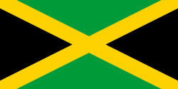
Jamaica Flag detail
Home Earth Continents The Americas Jamaica Country Profile Map of Jamaica

Maps Index

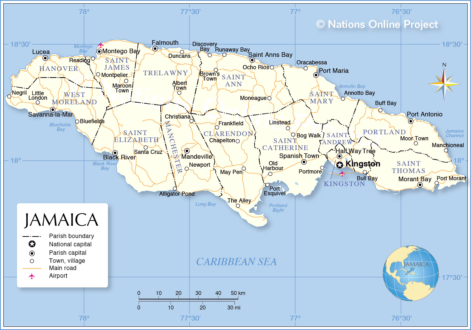
Map of Jamaica, Caribbean


Sunset Montego Bay Jamaica
Sundown Montego Bay Jamaica.
Image: Ian

About Jamaica


Jamaica Flag
Jamaica is an island nation in the Caribbean Sea, situated southeast of Cuba, southwest of the island of Hispaniola (Dominican Republic and Haiti).

With an area of 10,991 kmĀ², the island is somewhat larger than Cyprus, or slightly smaller than the U.S. state of Connecticut. The country's landscape is mostly mountainous, with narrow coastal plains. The nation's highest point is Blue Mountain Peak (2,256 m), home of Blue Mountain coffee.

The island has a population of 2.7 million (in 2019). Capital and largest city is Kingston. The official language is English, but spoken is Jamaican Patois, an English-based creole language with West African influences (Akan).

The map shows Jamaica with parish boundaries, the national capital Kingston, parish capitals, major cities, main roads, and major airports.


Map of Jamaica

Administrative Map of Jamaica
Map of Jamaica

The map shows Jamaica, the national capital Kingston, governorate capitals, major cities, main roads, and major airports.

You are free to use above map for educational purposes, please refer to the Nations Online Project.


More about Jamaica


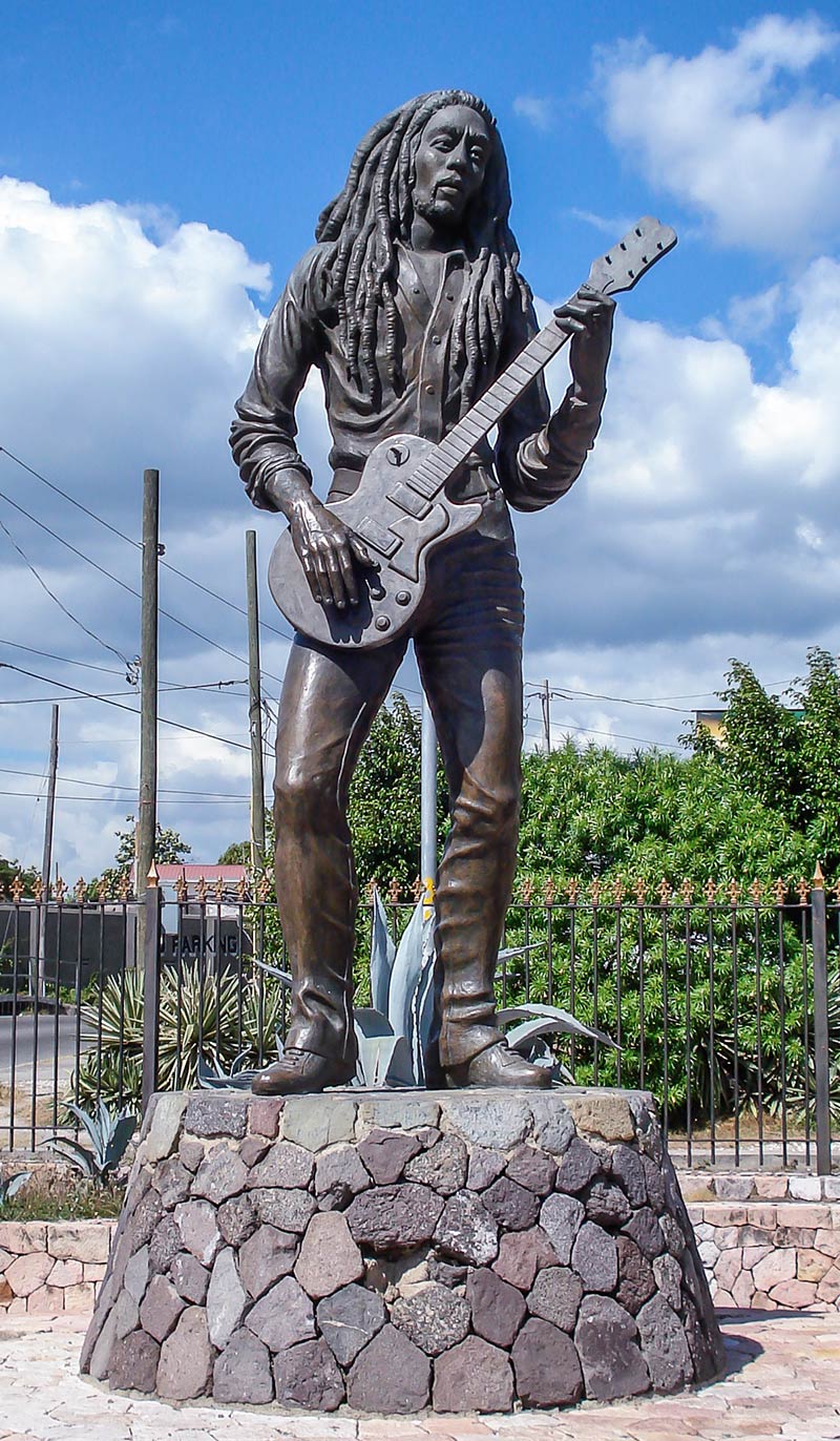
Statue of Bob Marley in Kingston, Jamaica
Statue of Bob Marley in Kingston, Jamaica.
Photo: Avda


Jamaica's Administrative Divisions
The map shows Jamaica's 14 parishes grouped into three historic counties which have no administrative relevance.


Cornwall County:
Hanover (Lucea)
Saint Elizabeth (Black River)
Saint James (Montego Bay)
Trelawny (Falmouth)
Westmoreland (Savanna-la-Mar)


Middlesex County:
Clarendon (May Pen)
Manchester (Mandeville)
Saint Ann (St. Ann's Bay)
Saint Catherine (Spanish Town)
Saint Mary (Port Maria)


Surrey County:
Kingston (Kingston)
Portland (Port Antonio)
Saint Andrew (Half Way Tree)
Saint Thomas (Morant Bay)


The map shows the location of following Jamaican cities and towns:

Largest Cities:
Kingston (capital; pop.: 938,000), Portmore (pop.: 167,000), Spanish Town (pop.: 162,000), Montego Bay (pop.: 100,000)

Albert Town, Alligator Pond, Annotto Bay, Black River, Bluefields, Bog Walk, Brown's Town, Buff Bay, Bull Bay,

Chapelton, Christiana, Discovery Bay, Duncans, Falmouth, Frankfield, Half Way Tree, Linstead, Little London, Lucea, Manchioneal, Mandeville, Maroon Town, May Pen, Moneague, Montpelier, Moor Town, Morant Bay,

Negril, Newport, Ocho Rios, Old Harbour, Oracabessa, Port Antonio, Port Esquivel, Port Maria, Port Morant, Reading, Runaway Bay, Saint Anns Bay, Santa Cruz, Savanna-la-Mar, and The Alley.


Advertisements:


Weather Conditions Kingston:

KINGSTON WEATHER


Advertisements:


Maps of Caribbean Islands:
Cuba Map, Dominican Republic, Haiti Map, Puerto Rico Map

Searchable Maps of Greater Antilles:
Cuba, Haiti, Dominican Republic, Jamaica, Puerto Rico

Searchable Maps of Lesser Antilles:
Anguilla, Antigua and Barbuda, Aruba, Bahamas, Barbados, Bermuda, Dominica, Grenada, Guadeloupe
Martinique, Montserrat, Netherlands Antilles, Saint Kitts and Nevis, Saint Lucia
Saint Vincent and the Grenadines, Trinidad and Tobago, Virgin Islands

Maps of other Countries in Central America:
Belize Map, Costa Rica Map, El Salvador Map, Guatemala Map, Honduras, Mexico Map, Nicaragua Map, Panama Map