Advertising

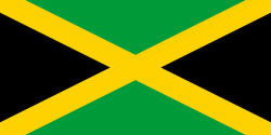
Jamaica Flag detail

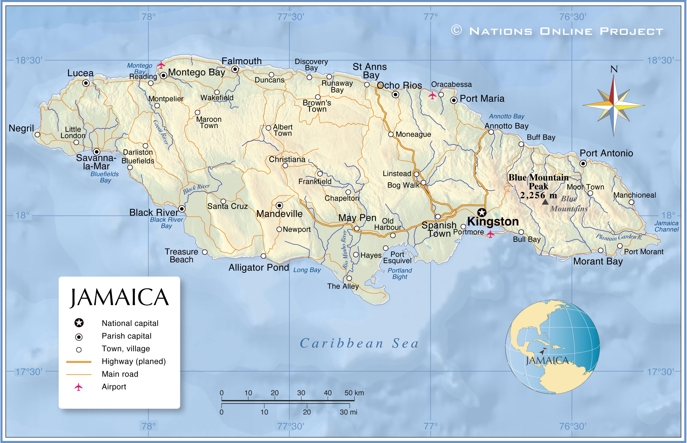
Map of Jamaica


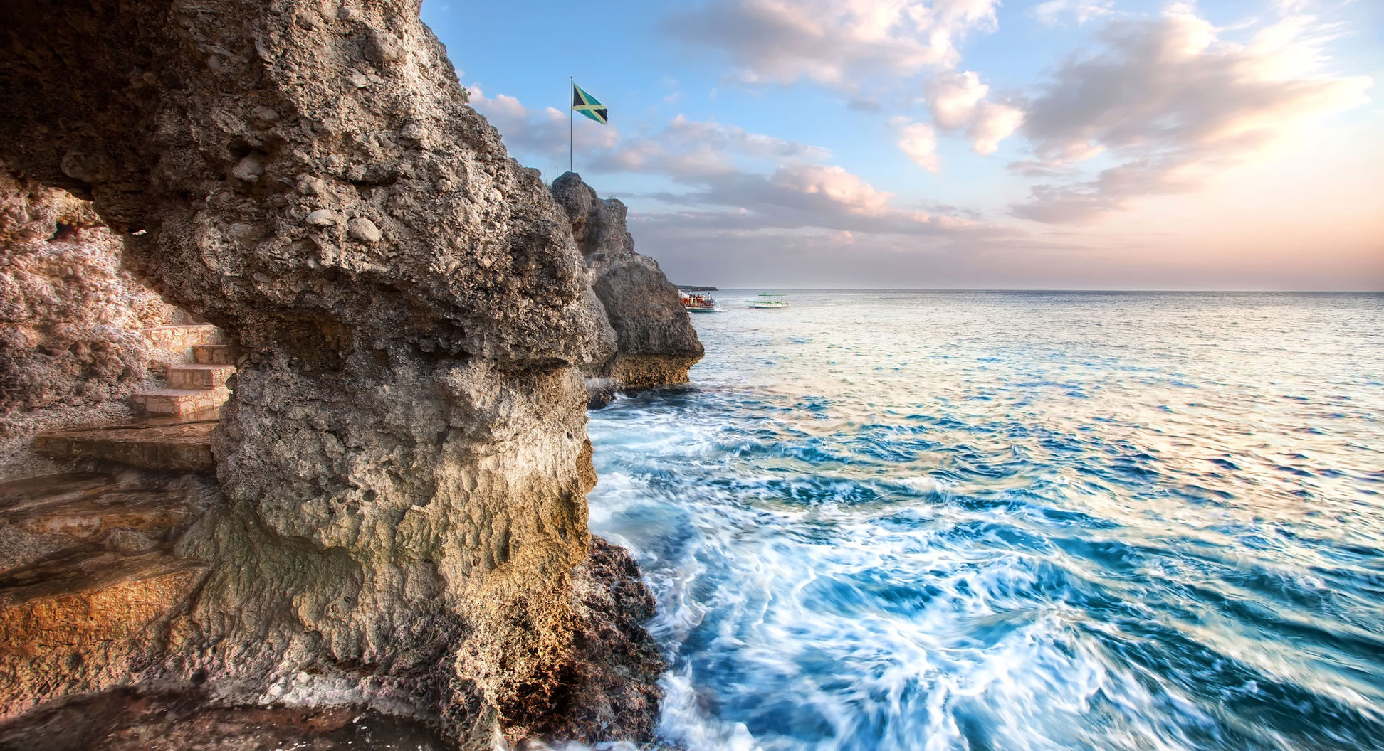
'Where the Ocean Meets the Sky', Jamaica, Negril, West Side Cliffs.
Image by Chris Ford
'Where the Ocean Meets the Sky' - West Side Cliffs, Negril, Jamaica.
Image: Chris Ford

About Jamaica


Jamaica Flag
The map shows Jamaica, an island country in the Caribbean Sea.

With an area of 10,991 km², it is the third-largest island of the Greater Antilles after Cuba and Hispaniola. Compared, Jamaica is somewhat larger than Cyprus or slightly smaller than half the size of the US state of New Jersey.

The island is known for its tropical beaches, blue mountains, and rich culture, a mix of African, indigenous Taino, and British influences.

Jamaica has 2.9 million inhabitants (in 2024), making it the fourth most-populous island nation in the Caribbean. Its capital and largest city is Kingston. The official language is English, the local dialect, Patois, is widely spoken. The most important religion is Christianity; most Jamaicans are Protestants.


Political Map of Jamaica


Jamaica Map
Political Map of Jamaica

The map shows Jamaica, an island in the Greater Antilles of the Caribbean Sea, the national capital Kingston, major cities, highways, and major airports.

You are free to use the above map for educational and similar purposes; if you publish it online or in print, you need to credit the Nations Online Project as the source.


More about Jamaica


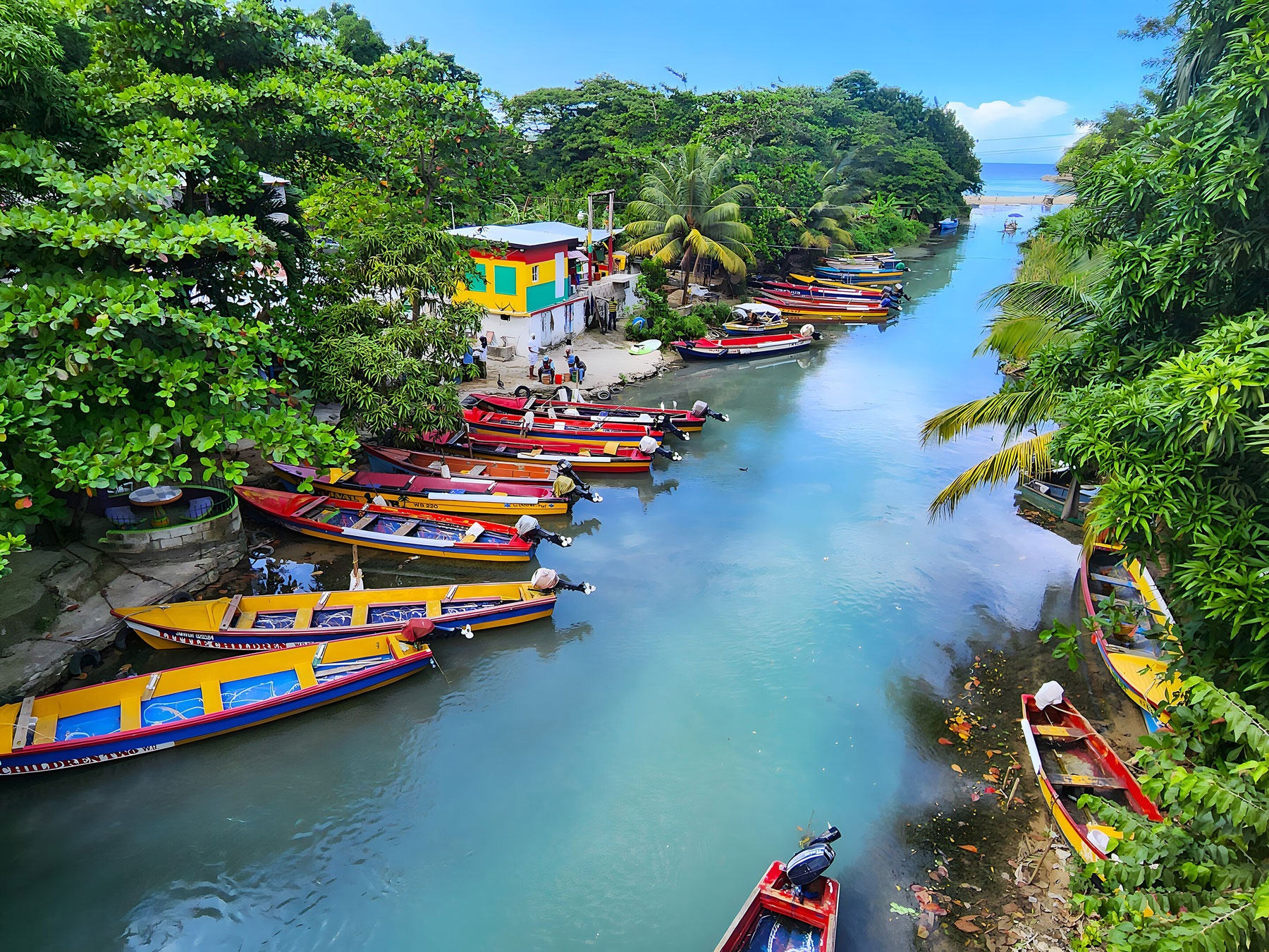
The White River Fishing Village is in Ocho Rios.
The White River Fishing Village is located just east of Ocho Rios on the mouth of the White River in St Ann Parish. The village blends traditional life with coastal charm.
Photo: CaptJayRuffins


Jamaica is an island country located in the Caribbean Sea. It is the third-largest island of the Greater Antilles and the fourth-largest island country in the Caribbean by population.

The island is known for its palm-fringed beaches, Rastas and reggae, the Blue Mountains and its rich culture, a mix of African, indigenous Taino, and British influences.

Jamaica is especially famous for its music, particularly reggae, which originated in the country in the late 1960s, evolving from genres like mento, ska and rocksteady, and was popularized globally by artists including Bob Marley, Peter Tosh, and Bunny Wailer.


Short History

The country has a diverse and vibrant culture heavily influenced by its colonial history.
The island was originally inhabited by indigenous Taino people; it was colonized by the Spanish in the early 16th century. In 1655, the British seized Jamaica from the Spanish.

African slaves were brought to Jamaica to work on the sugar plantations. By the 18th century, Jamaica had become one of the most valuable British colonies.


population symbol Population

Today, Jamaica has a population of about 2.9 million people; more than 75% are of African descent, but there is also a significant minority of people of European and East Indian descent.


Tourism symbol Tourism

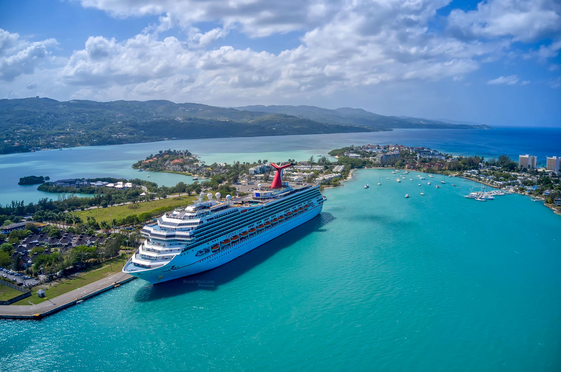
Carnival Glory in Montego Bay
The Carnival Glory, a Conquest-class cruise ship, is anchored in Montego Bay.
Photo: Brook Ward


Jamaica is a major tourist destination known for its tropical climate, beautiful beaches and turquoise waters. The island is home to many natural attractions, such as the Blue Mountains, which offer hiking and bird-watching opportunities, as well as some of the best coffee in the world. Jamaica also has a rich history, with many historic sites, including the former capital Spanish Town, the oldest continuously inhabited city in Jamaica.

Jamaica is also famous for its music, particularly reggae and ska, which originated in the country. Bob Marley, a Jamaican singer-songwriter and musician, is considered one of the most important figures in the history of reggae music and is still widely respected and celebrated today.


Economy symbol Economy

Jamaica is considered a developing country and has faced some economic challenges in recent years. Its economy is largely based on tourism and agriculture. The island is a major producer of sugar, bananas, and coffee. Jamaica is also known for its bauxite mining, the ore from which aluminum is made. It is an important source of foreign exchange for the country, but bauxite mining is considered one of the causes of deforestation on the island. Jamaican music attracts thousands of tourists to the island, generating earnings from their travel and spending, but the country profits only modestly from its music industry.


Climate Climate

Jamaica has a tropical climate moderated by the trade winds of the Caribbean Sea. Coastal areas are warm and humid year-round, while the interior highlands are cooler. The rainy seasons occur from May to June and September to November.
The island lies within the Atlantic hurricane belt, with storms most likely between June and November. Jamaica was hard hit by Category 5 Hurricane Melissa making landfall on the island on Tuesday, 28 October 2025. It was the strongest storm in the country's recorded history to make a direct hit.


Jamaica Photo Gallery


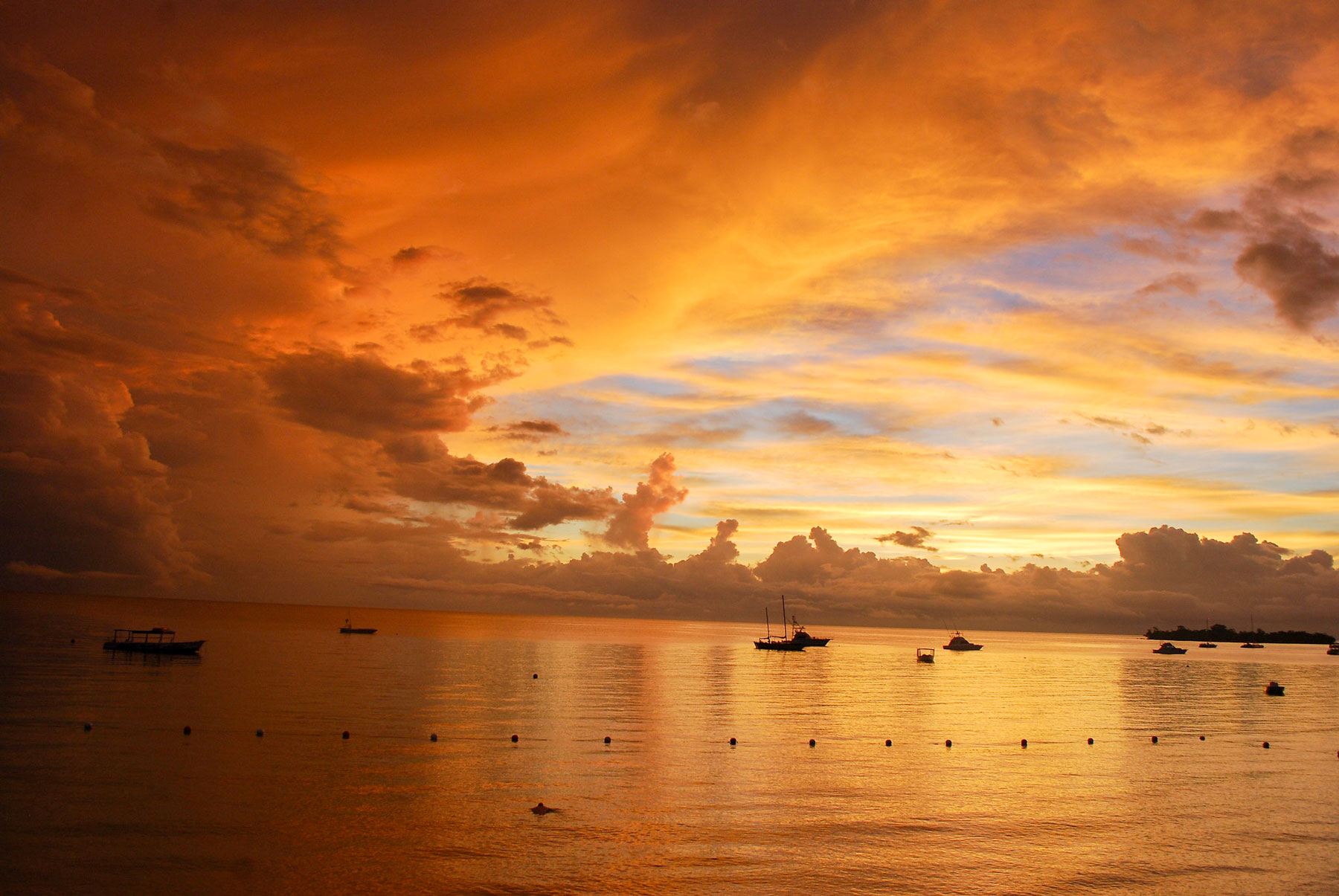
Caribbean sunset
Caribbean sunset

Nature's fantastic color show at Negril, Jamaica. Scheduled every day.
Negril is a small, sprawling seaside resort and town in the parishes of Westmoreland and Hanover in the far west of Jamaica.

Image: robert macdonald


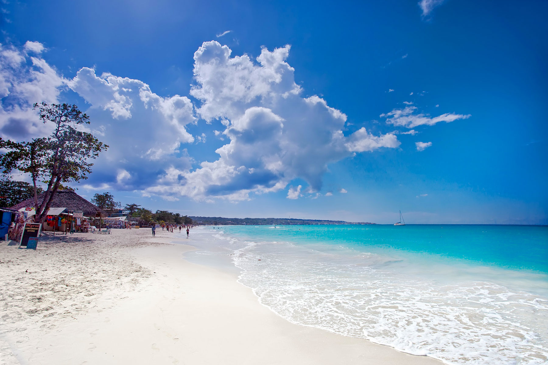
7-mile beach in Jamaica
7-mile beach

The beach in Negril on Jamaica's north coast is famous for its white sand, clear water, and vibrant nightlife.

Image: Chris Ford


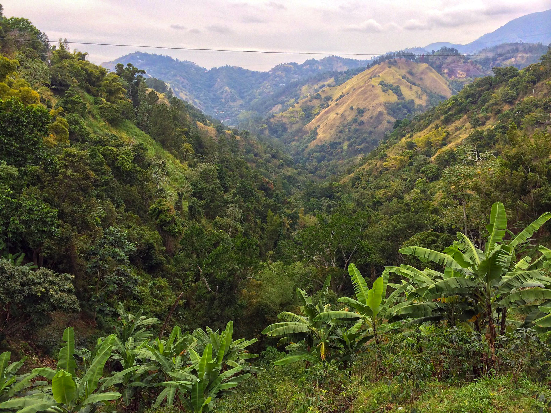
Blue Mountains Jamaica
Blue Mountains

The Blue Mountains are Jamaica's longest mountain range, known for their breathtaking scenery and world-famous coffee. The highest peak in the country is the Blue Mountain Peak at 2,256 m (7,402 ft).

Image: Nick Sherman


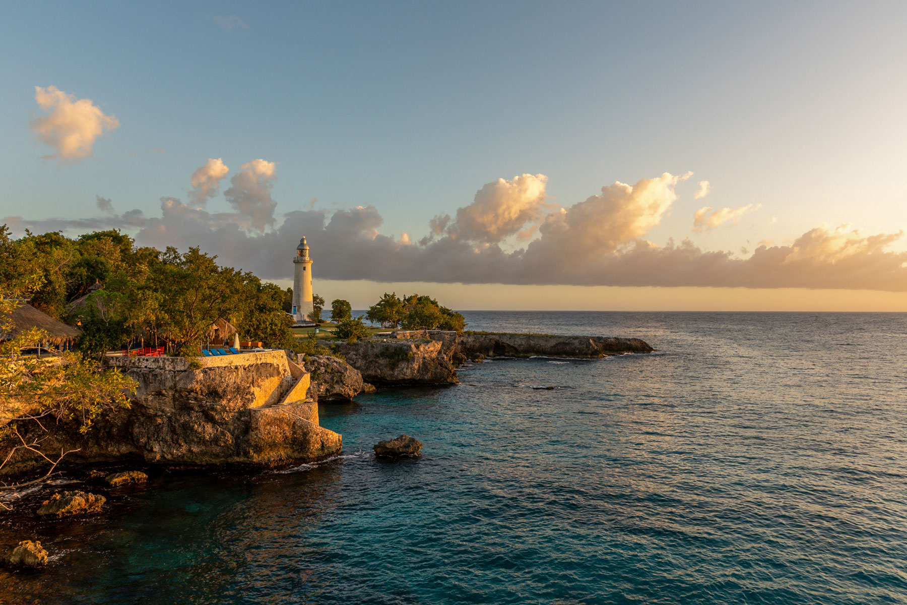
Negril Lighthouse, Jamaica
Negril Lighthouse

The Negril Lighthouse was built in 1894 on the western coast of the island of Jamaica

Image: Matthew Paulson


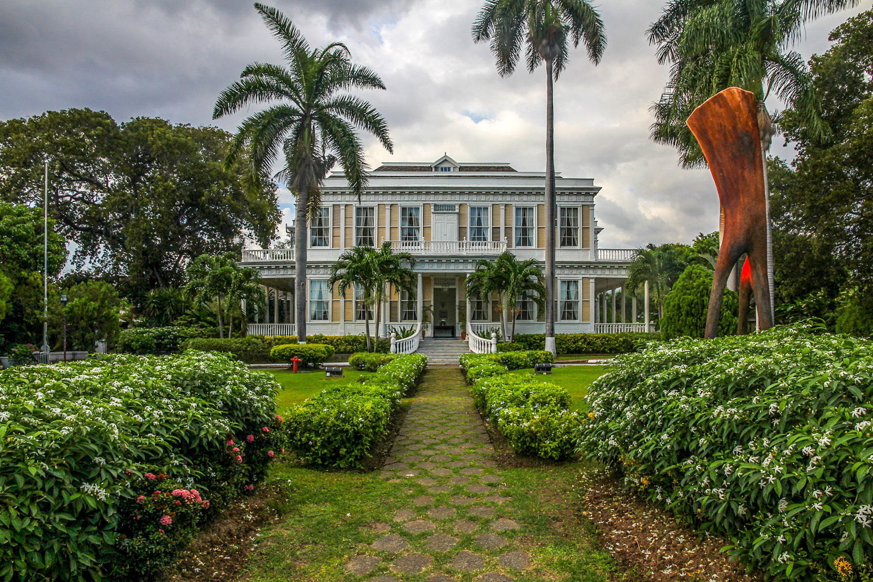
Devon House, Kingston
Devon House

The Devon House is a historic Jamaican heritage site in Kingston, built in 1881 by the country's first black millionaire, George Stiebel. The mansion features a blend of Georgian and Caribbean architecture.

Website: www.devonhouseja.com

Image: Stéphane DAMOUR
 

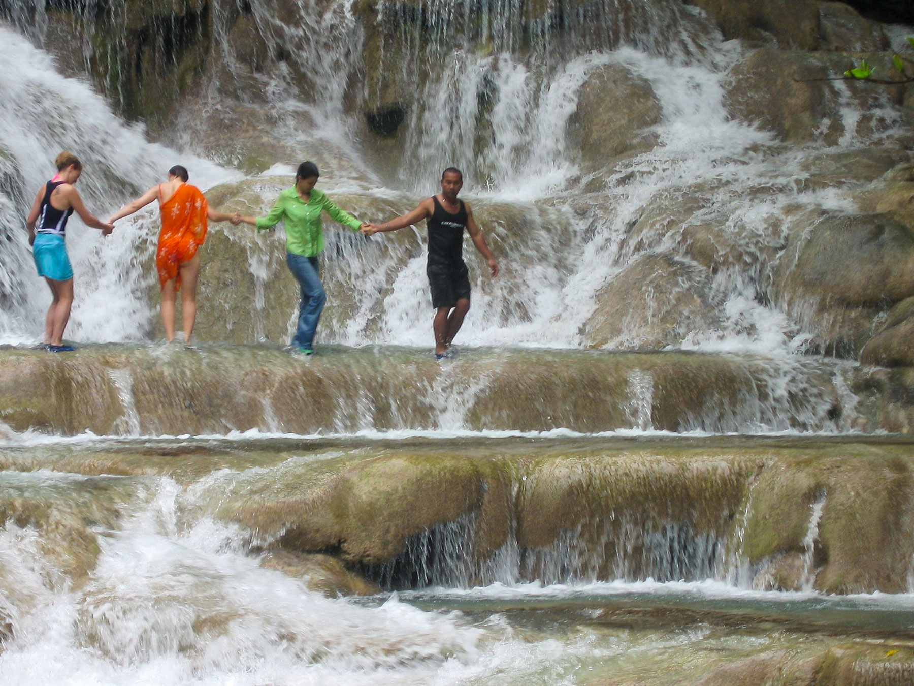
People on Dunn's River Falls
Dunn's River Falls

Dunn's River Falls in Ocho Rios is a popular tourist attraction, featuring a terraced waterfall that cascades into the Caribbean Sea.

Image: Marylyn Jeans


Blue Mountains Jamaica
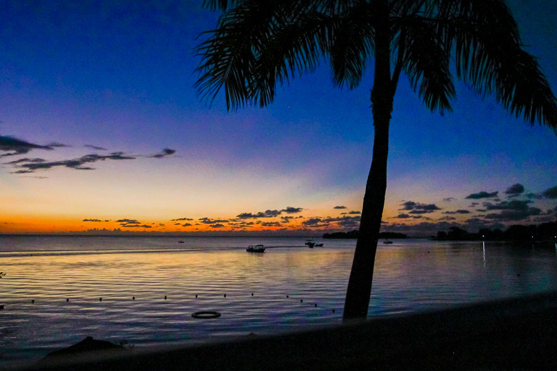
Negril Sunset

What can you do on a Caribbean island in the evening before dinner? Enjoy the sunset with a cool drink in your hand and listen to the sound of the Caribbean.

Image: Clair Dopson


Negril Lighthouse, Jamaica
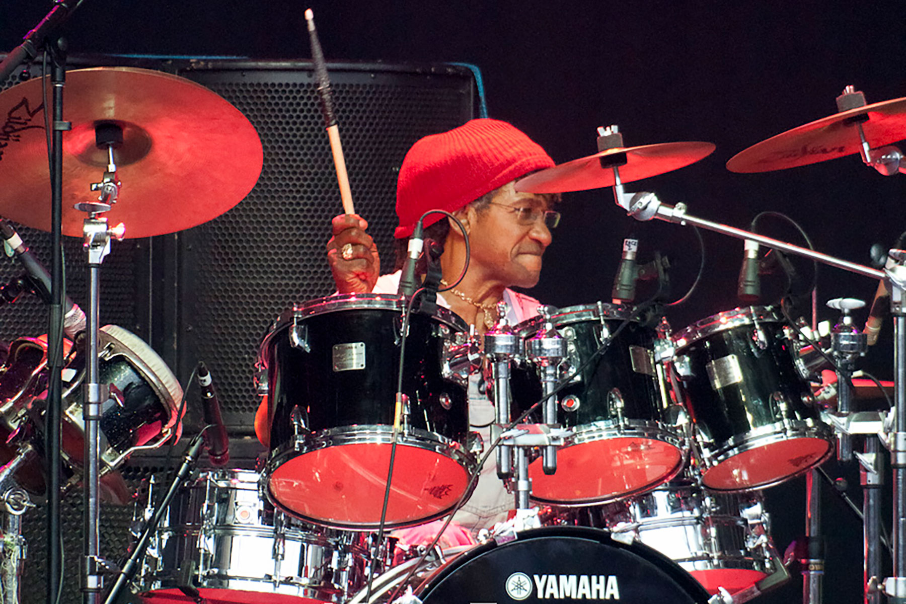
Sly & Robbie

Sly Dunbar on drums. Sly & Robbie was an influential Jamaican musician and producer duo consisting of drummer Sly Dunbar and bassist and keyboardist Robbie Shakespeare.

Image: PeterTea


Cities


The map shows the location of the following Jamaican cities and towns:

The largest cities are:
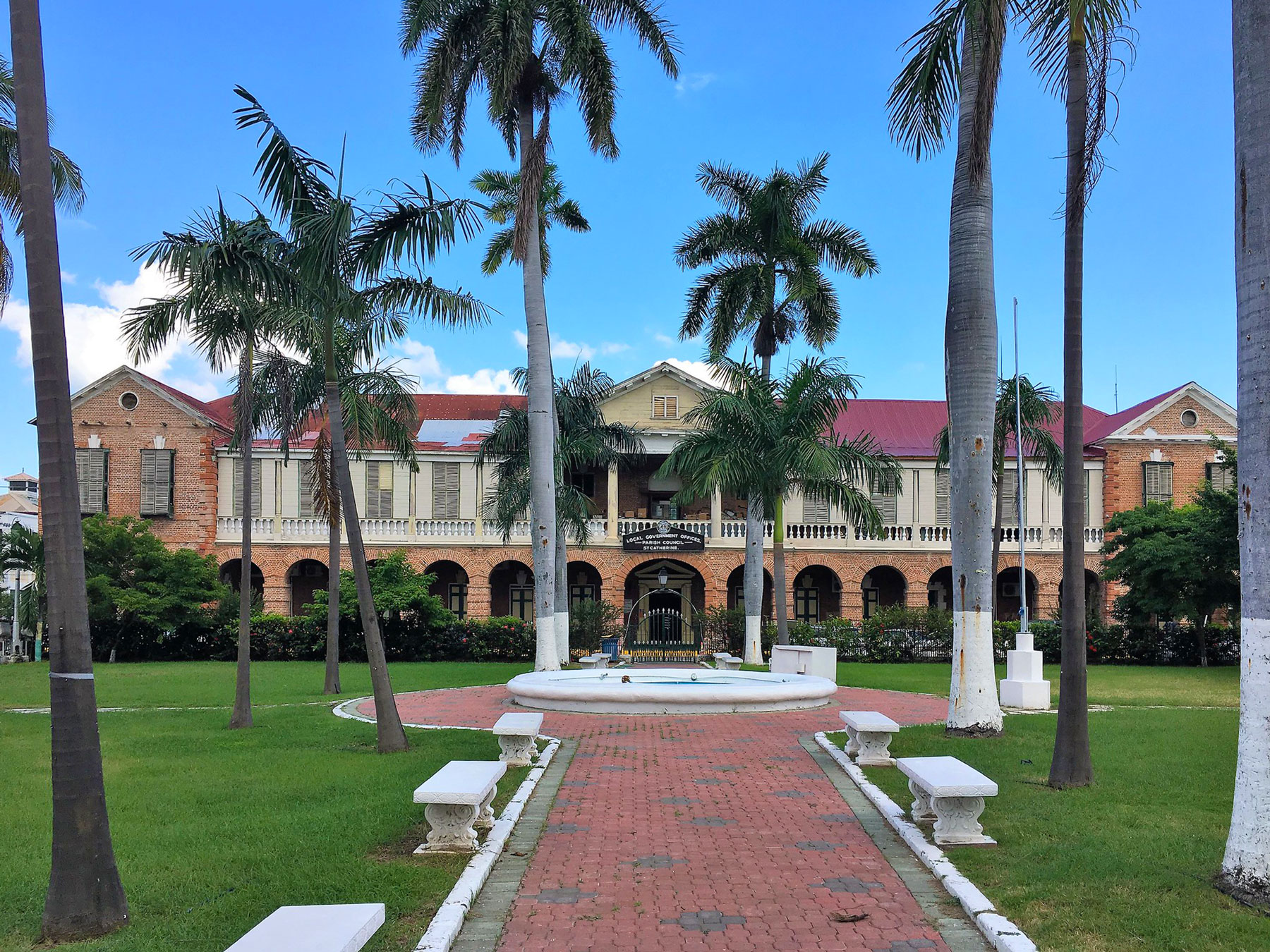
The Port of Falmouth in Jamaica. The town is known for its Jamaican Georgian architectural style and its cruise ship port opened in 2011
Old government building in Spanish Town, the former colonial capital of Jamaica.
Photo: Anthony International


Kingston
Jamaica's capital city is located on the southeastern coast, nestled between the Caribbean Sea and the Blue Mountains; its harbor is sheltered by the Palisadoes sand-spit. It is the country's largest city and economic, cultural and political hub. Kingston Metropolitan Area (KMA), which includes St. Andrew, has a population estimated to be 1.2 million people. (pop.: 604,000; Metro 1.2 million (est. in 2025)

Portmore
Portmore is a coastal city located in the south-east of Jamaica, in St. Catherine parish. Jamaica's second largest city is a major suburb of the capital Kingston and has experienced rapid residential growth. (pop.: 170,000; est. in 2025)

Spanish Town
Historic Spanish Town, the capital of St. Catherine parish, is located at the Rio Cobre, west of Kingston. The city was the capital of Spanish and British Jamaica from early 1500s until 1872. (pop.: 145,000; est. in 2021)

Montego Bay
The capital of St. James parish is the country's fourth-largest city and the center of Jamaica's tourism industry. The city is located on Jamaica's north‐western coast, and known as the island's "Second City." (pop.: 123,000; recent estimate)

Ocho Rios (Saint Ann Parish)
Ocho Rios is a resort town and major cruise port on Jamaica's north coast. Famous for Dunn's River Falls, Mystic Mountain, Dolphin Cove, and the lush Fern Gully. Once a small fishing village, it's now a hub for beaches, excursions, and shopping. Nearest airports are Ian Fleming International (OCJ) to the east and Sangster International (MBJ) in Montego Bay. (pop.: 16,000–17,000 (2024).

May Pen
May Pen is a major administrative and commercial hub in the central part of the island. It is the capital of Clarendon parish. (pop.: 77,500; recent estimate)

Black River
Black River is a small port city on Jamaica's southwestern coast. Once a prosperous 18th-century port, it is now known for its ecotourism and as the gateway to the Treasure Beach resort area. The town suffered severe damage from Category 5 Hurricane Melissa, which destroyed much of its infrastructure, including the hospital, police station, and the 300-year-old St. John's Parish Anglican Church.


Other towns are:
Albert Town, Alligator Pond, Annotto Bay, Black River, Bluefields, Bog Walk, Brown's Town, Buff Bay, Bull Bay,

Chapelton, Christiana, Discovery Bay, Duncans, Falmouth, Frankfield, Half Way Tree, Linstead, Little London, Lucea, Manchioneal, Mandeville, Maroon Town, May Pen, Moneague, Montpelier, Moor Town, Morant Bay,

Negril, Newport, Ocho Rios, Old Harbour, Oracabessa, Port Antonio, Port Esquivel, Port Maria, Port Morant, Reading, Runaway Bay, Saint Anns Bay, Santa Cruz, Savanna-la-Mar, and The Alley.


Plane Airport symbol Airports


Major airports in Jamaica are:
✈︎ Norman Manley International Airport (IATA code: KIN - nmia.aero)

✈︎ Sangster International Airport, Montego Bay (IATA code: MBJ - www.mbjairport.com)

✈︎ Ian Fleming International (IATA code: OCJ - ifia.aero)


Weather Conditions Kingston:

KINGSTON WEATHER


Advertisements:


Maps of Caribbean Islands:
Bahamas Map, Barbados Map, Bermuda Map, Cuba Map, Dominican Republic, Haiti Map, Hispaniola Map, Puerto Rico Map

Maps of other Countries in Central America:
Belize Map, Costa Rica Map, El Salvador Map, Guatemala Map, Honduras, Mexico Map, Nicaragua Map, Panama Map