Advertising

Cameroon Flag detail
Home Earth Continents The Americas Costa Rica Country Profile Map of Costa Rica

Maps Index

Map of Costa Rica


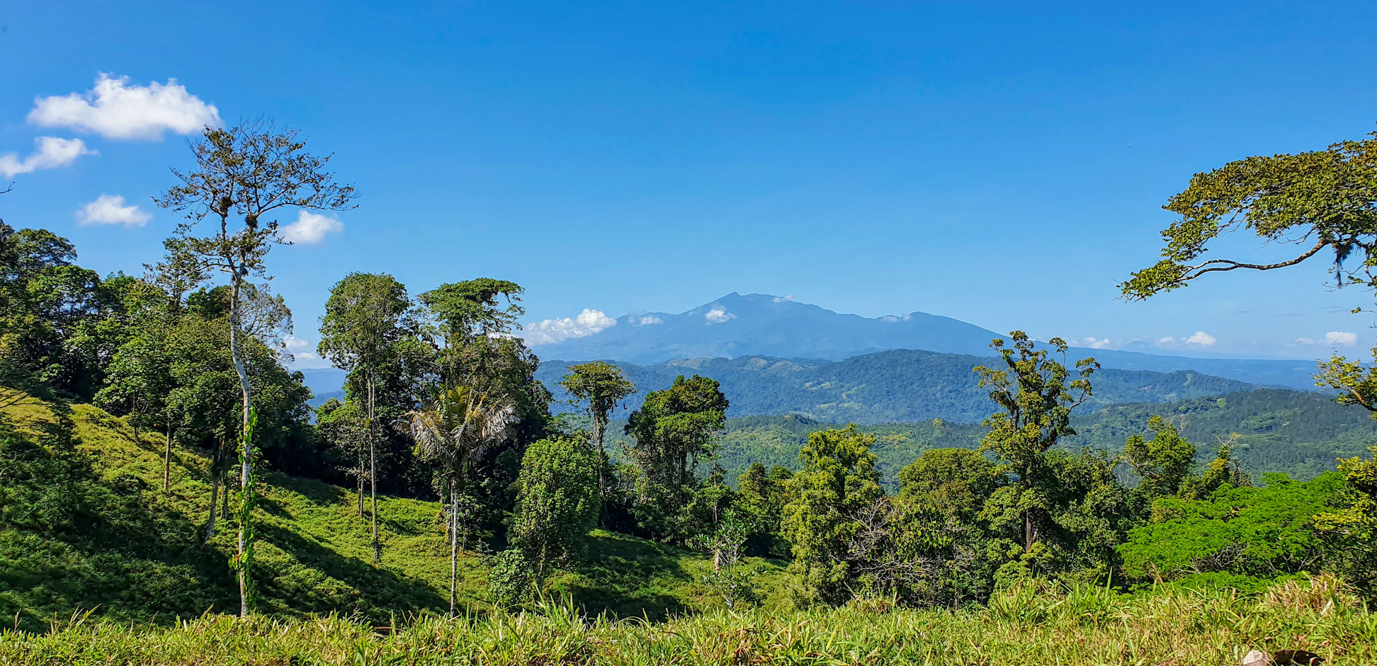
Turrialba stratovolcano seen from the Camino de Costa Rica, a trail in Costa Rica
A view from the Camino de Costa Rica with the Turrialba, an active volcano in the interior of Costa Rica, in the background. The Camino de Costa Rica (Costa Rica Trail) is a 280-kilometer (170 mi) long hiking trail across the country.
Image: Pigment-Ink

About Costa Rica


Costa Rica Flag
Flag of Costa Rica
Costa Rica is a republic in Central America on the Isthmus of Panama. The country with coasts on the Pacific Ocean to the west and the Caribbean Sea to the east borders Nicaragua in the north and Panama in the southeast.

With an area of 51,100 km², Costa Rica is about the size of Bosnia and Herzegovina or slightly smaller than the U.S. state of West Virginia.

Having a narrow Pacific coastal region, the country is covered by rugged mountains cutting the country from northwest to southeast, with peaks up to over 3,600 m (12,000 ft) high.

The mountain chain contains several major volcanoes, one volcano, Irazu, erupted destructively in the mid-1960s. With 3,821 m Mount Cerro Chirripo is the highest mountain in Costa Rica.

Costa Rica's heavily forested coastal plains are low and subject to flooding. The climate there is quite hot and humid.

Capital city is San José. The official language is Spanish. The currency of Costa Rica is the Costa Rican Colon (CRC)


Map of Costa Rica

Map of Costa Rica
Political Map of Costa Rica

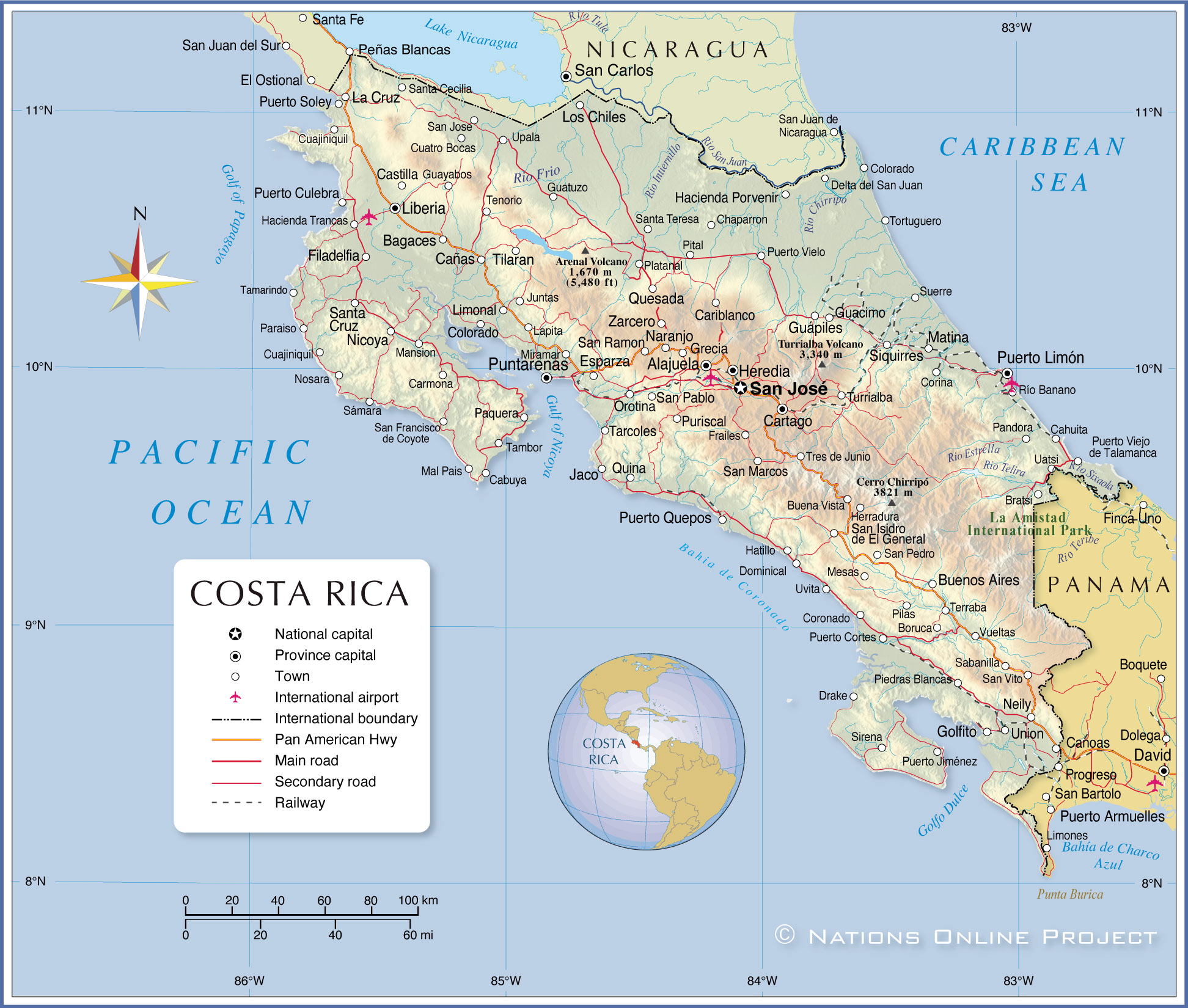
The map shows Costa Rica and neighboring countries with international borders, the national capital San José, province capitals, major cities and towns, main roads, railroads and major airports.

You are free to use the above map for educational and similar purposes; if you publish it online or in print, you need to credit the Nations Online Project as the source.


More about Costa Rica


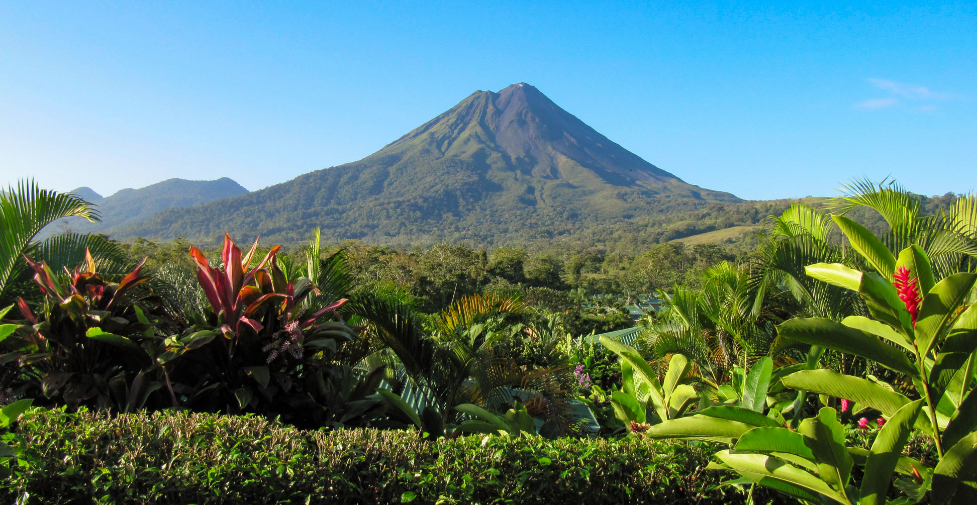
Arenal stratovolcano in Costa Rica
The 1,670 m high Arenal Volcano is an active stratovolcano in northwestern Costa Rica, about 90 km northwest of the capital San José.
Image: Leonora (Ellie) Enking


Costa Rica is known for its beaches, diverse and lush landscapes, volcanoes and many national parks, among them La Amistad National Park, a UNESCO World Heritage Site.

The country is home to various ecosystems, including rainforests, cloud forests, dry forests, mangroves, and wetlands.
The coastlines of Costa Rica offer picture-perfect beaches, mangrove swamps and estuaries.

The central highlands of Costa Rica contain several active volcanoes, including Arenal Volcano, one of the country's most active volcanoes. The landscape in the interior is dominated by several mountain ranges, including the Talamanca Mountains and the Cordillera de Tilarán, a UNESCO World Heritage site.

Additionally, Costa Rica is home to many rivers, including the Rio Pacuare, which is popular for white water rafting. The country's principal river is the San Juan River; the outlet of Lake Nicaragua forms a section of the border with Nicaragua.


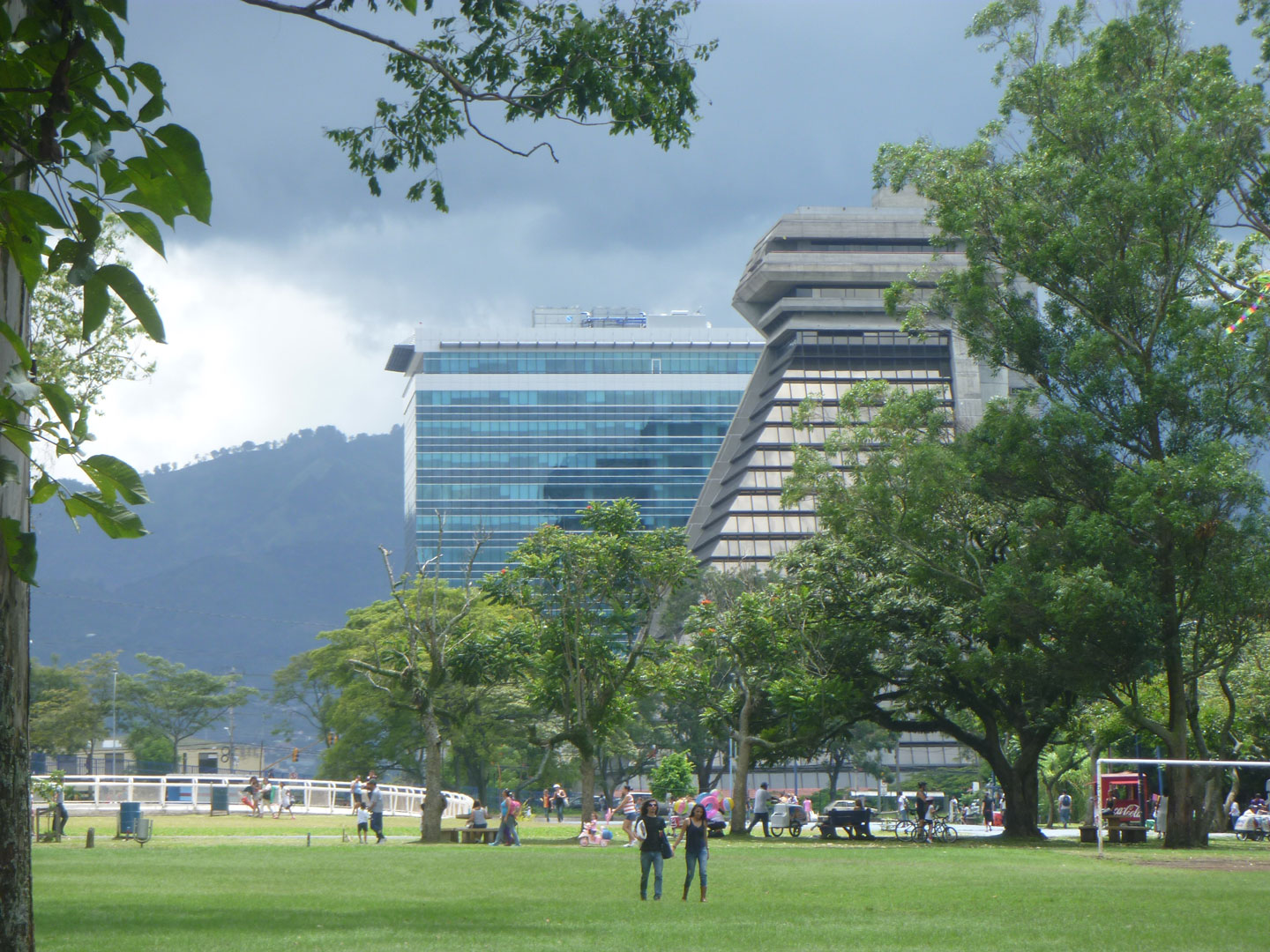
La Sabana Metropolitan Park is a large urban park in San José in Costa Rica
La Sabana Metropolitan Park is a large urban park in San José, Costa Rica.
Image: LACSACR

Costa Rica is part of the Pacific Ring of Fire, there are five active volcanoes in the country; its Turrialba Volcano, an active volcano in the interior, has erupted explosively in recent years, including in 2016 and 2017.

The country's capital city, San José, is located in the Central Valley (Spanish: Meseta Central), a plateau in the center of Costa Rica.
The Greater Costa Rica Area (GAM) includes San José, Alajuela, Cartago and Heredia, with a population of 3.1 million people (about 60% of the total population)


Costa Rica's largest cities

San José, Costa Rica's capital, has a population of 400,000; about 1,3 million people live in the metropolitan area.

Liberia, known as "la ciudad blanca" (the white city), is the largest city in the Guanacaste Province (pop.: 67,000).

Limón, Puerto Limón is the country's primary port; pop.: 60,000.

Alajuela is the head of the canton and the province of the same name, besides being part of the Greater Metropolitan Area. (pop.: 48,300).

Cartago is the capital and administrative center of the Canton of Cartago and part of the Greater Metropolitan Area (pop.: 22,700).

Heredia, part of the Greater Metropolitan Area (pop.: 19,000) and home to the National University of Costa Rica.


The map shows the location of Costa Rican cities and towns:

Largest cities in Costa Rica are: San José (capital; pop.: 310,000), Limón (Puerto Limón, second largest city and primary port; pop.: 56,000), Alajuela (pop.: 43,000), San Francisco (pop.: 41,000)

Other cities, towns, and places:
Bagaces, Bolivia, Bomba, Boruca, Bratsi, Buena Vista, Buenos Aires, Cabuya, Cahuita, Canas, Canoas, Caño Negro, Cariblanco, Carmona, Cartago, Castilla, Chaparron, Cocles, Colorado, Colorado, Corina, Coronado, Cuajiniquil, Cuajiniquil, Cuajiniquil, Cuatro Bocas, Delta del San Juan, Dominical, Drake, Esparza, Filadelphia, Frailes, Garza, Golfito, Grecia, Guacimo, Guapiles, Guatuzo, Guayabos, Hacienda Porvenir, Hacienda Trancas, Hatillo, Heredia, Herradura, Hojancha, Jaco, Juntas, La Cruz, Lapita, Liberia, Limonal, Los Chiles, Mal Pais, Matina, Mesas, Miramar, Naranjo, Neily, Nicoya, Orotina, Pandora, Paquera, Paraíso, Piedras Blancas, Pilas, Pital, Platanal, Portegolpe, Puerto Cortes, Puerto Culebra, Puerto Humo, Puerto Jimenez, Puerto Quepos, Puerto Soley, Puerto Vielo, Puntarenas, Puriscal, Quesada, Quina, Sabanilla, San Bartolo, San Isidro de El General, San Jose, San Marcos, San Pablo, San Pedro, San Ramon, San Vito, Santa Cecilia, Santa Cruz, Santa Teresa, Siquirres, Sirena, Suerre, Tambor, Tarcoles, Tenorio, Terraba, Tilaran, Tortuguero, Tres de Junio, Turrialba, Uatsi, Union, Upala, Uvita, Vueltas, and Zarcero.


Advertisements:


Weather Conditions San José, Costa Rica:

SAN JOSÉ PROVINCE WEATHER


Advertisements:


Maps of other Countries in Central America:
Belize Map, El Salvador Map, Guatemala Map, Honduras, Mexico Map, Nicaragua Map, Panama Map

Maps of Caribbean Islands
Cuba Map, Dominican Republic, Haiti Map, Jamaica Map, Puerto Rico Map