About Ukraine
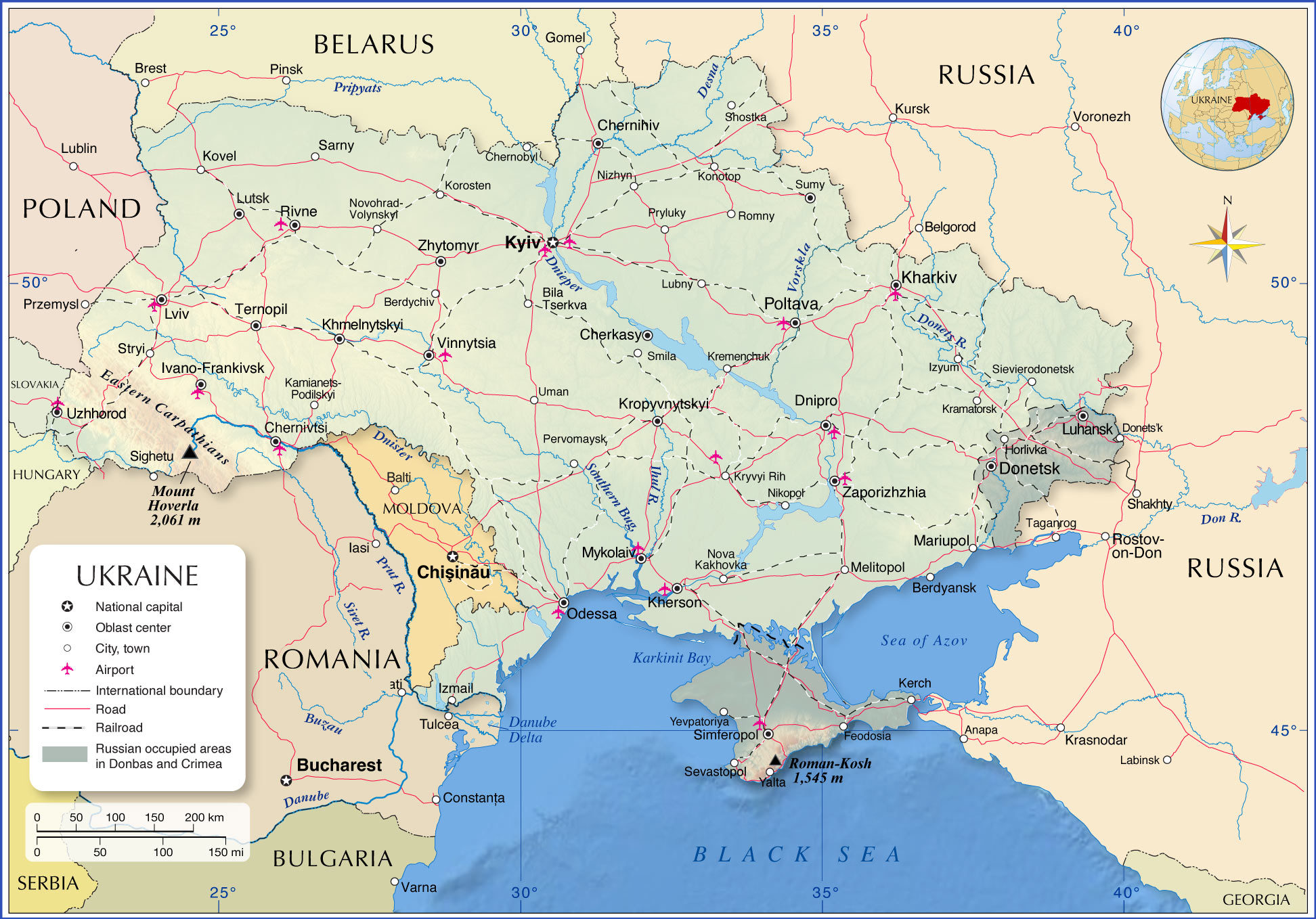
The map shows Ukraine, a country at the crossroads between Europe and Asia situated in eastern Europe, north of the
Black Sea and the Sea of Azov. Ukraine's fertile land was known as the breadbasket of the Soviet Union; now, it has become the breadbasket of Europe.
With an
area of 600,000 km², it is the second-largest country in Europe
after
European Russia, twice the size of
Italy or slightly smaller than the
US state of
Texas. Ukraine borders
Belarus,
Hungary,
Moldova,
Poland,
Romania,
Russia, and
Slovakia.
The landscape of Ukraine consists mainly of plains and plateaus, except the Carpathians in the west. Mount Hoverla (Hora Hoverla) is at 2.061 m (6.760 ft.), the highest peak in the country.
Ukraine's major rivers are the Dniester, the Southern Bug (Pivdennyi Buh), the Desna, the Donets, and the Dnieper (Dnipro), a vital waterway and the longest river in Ukraine with its large water reservoirs, the Kremenchuk Reservoir and the Kakhovka Reservoir.
Ukraine has a
population of
41.3 million people (in 2021); the capital and largest city is
Kiev (Kyiv) with a population of 2.9 million; the city is a major industrial, scientific, educational, and cultural center in Eastern Europe. Spoken
languages are Ukrainian (official), Russian is widely spoken, especially in eastern and southern parts of the country.
More about Ukraine
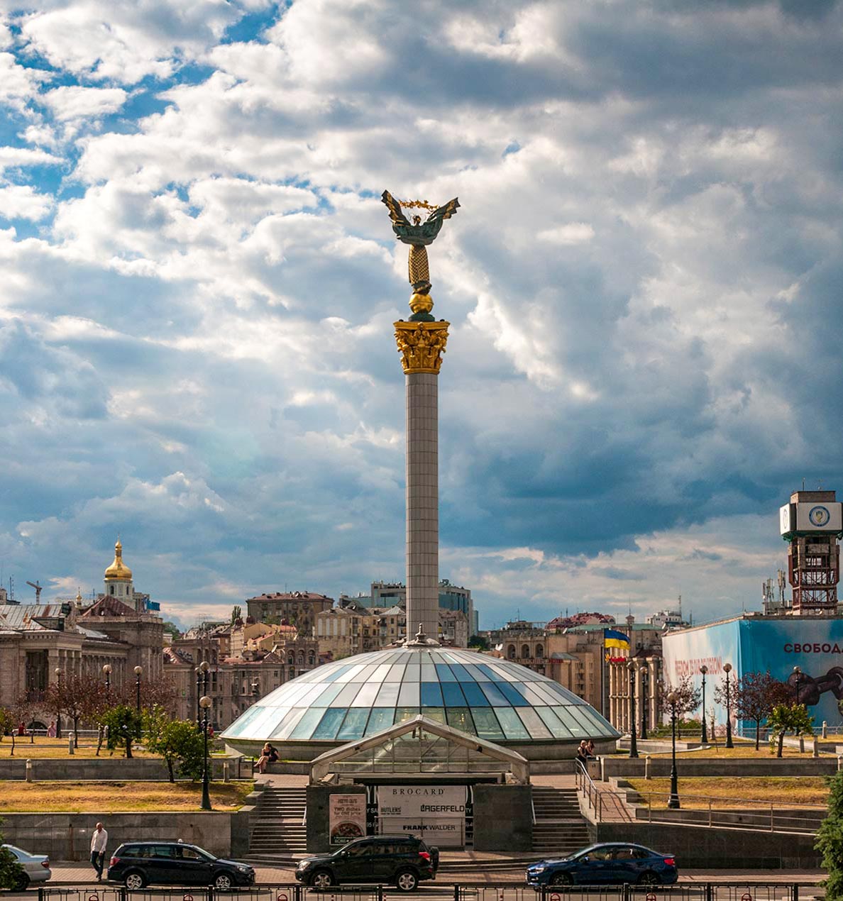 Monument of Independence on Maidan Nezalezhnosti, the central square of Kyiv.
Photo: © Ralf Roletschek
Ukraine is the largest country in Europe (including Crimea). About 95% of the country is flat, because it is located on the territory of the
East European Plain. There are only two regions in the country where there are mountains: in the western part of Ukraine are the
Eastern Carpathians, part of the Carpathian Mountains, a mountain range that spans Central and Eastern Europe. There is the highest mountain in Ukraine,
Mount Hoverla, at 2061 meters. In the southern part of the Crimean Peninsula are the
Crimean Mountains, which stretch along the southeast coast of the
Black Sea for a length of about 150 km.
Roman-Kosh is the highest elevation of the Crimean Mountains with 1545 m.
Rivers in Ukraine
Ukraine is a country rich in rivers. A large number of streams, rivers and creeks flow through Ukraine in whole or in part. Most rivers flow into the
Black Sea, a few into the
Baltic Sea. Among the most important rivers of Ukraine are the
Danube, the
Dnieper and the
Dniester. The Dniester creates a long section of Ukraine's border with Moldova. The Danube, Europe's second-longest river, and its
Chilia branch form the border between Ukraine and Romania. The Dnieper (Dnipro), the longest river in Ukraine, rises in Russia and flows in a southerly direction for about 2,200 km (1,370 mi) through Ukraine, emptying into the Black Sea at
Kherson.
Natural resources of Ukraine
The vast country is rich in natural resources in high concentrations, including iron ore, coal, manganese, natural gas, oil, petroleum, salt, sulfur, graphite. Other deposits are titanium ore, magnesium, bauxite, kaolin, nickel, and mercury (cinnabar).
Ukraine's coal mines are among the deepest in Europe.
Other natural resources are timber and arable land. Hydropower plants take third place in Ukraine's energy sector, after thermal energy (coal and natural gas) and nuclear energy.
Natural hazards in Ukraine
Ukraine is exposed to the risk of hydrometeorological hazards and natural disasters due to seasonal floods and droughts, which mainly affect agriculture and human health. The threat from flooding in rivers and cities and from forest fires is rated high.
[WB]
Environmental issues in Ukraine
Ukraine faces a number of environmental problems, most notably air pollution, water resource quality, and soil degradation. Other issues include solid waste management, biodiversity loss, and human health related to environmental risk factors.
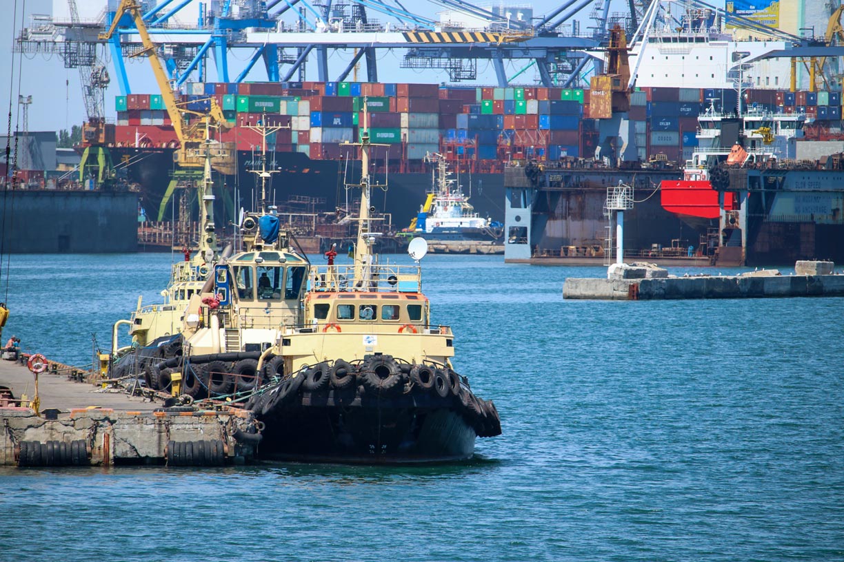 Tugboats at the Port of Odessa, Ukraine's third most populous city and a major tourism center. The port on the Black Sea is an important hub for maritime traffic; passenger ships and ferries connect Odessa with Istanbul, Haifa and Varna.
Photo: Clara Sanchiz
:
The map shows the location of the following Ukrainian cities:
Ukraine's largest cities are (with a population of over 1 million):
Kyiv (Kiev), Kharkiv (Kharkov), Dnipropetrovsk, Odesa (Odessa), and Donetsk, the capital city of the unrecognized Donetsk People's Republic (not to be confused with the Russian town of Donets'k at the Ukrainian border near Luhansk).
Oblast capitals
Ukraine is divided into 24 oblasts and the Autonomous Republic of Crimea. The capitals of the oblasts are:
Cherkasy, Chernihiv, Chernivtsi, Dnipro, Donetsk, Ivano-Frankivsk, Kharkiv, Kherson, Khmelnytskyi, Kropyvnytskyi, Kyiv, Luhansk, Lutsk, Lviv, Mykolaiv, Odessa, Poltava, Rivne, Simferopol (Crimea), Sumy, Ternopil, Uzhhorod, Vinnytsia, Zaporizhzhia and Zhytomyr.
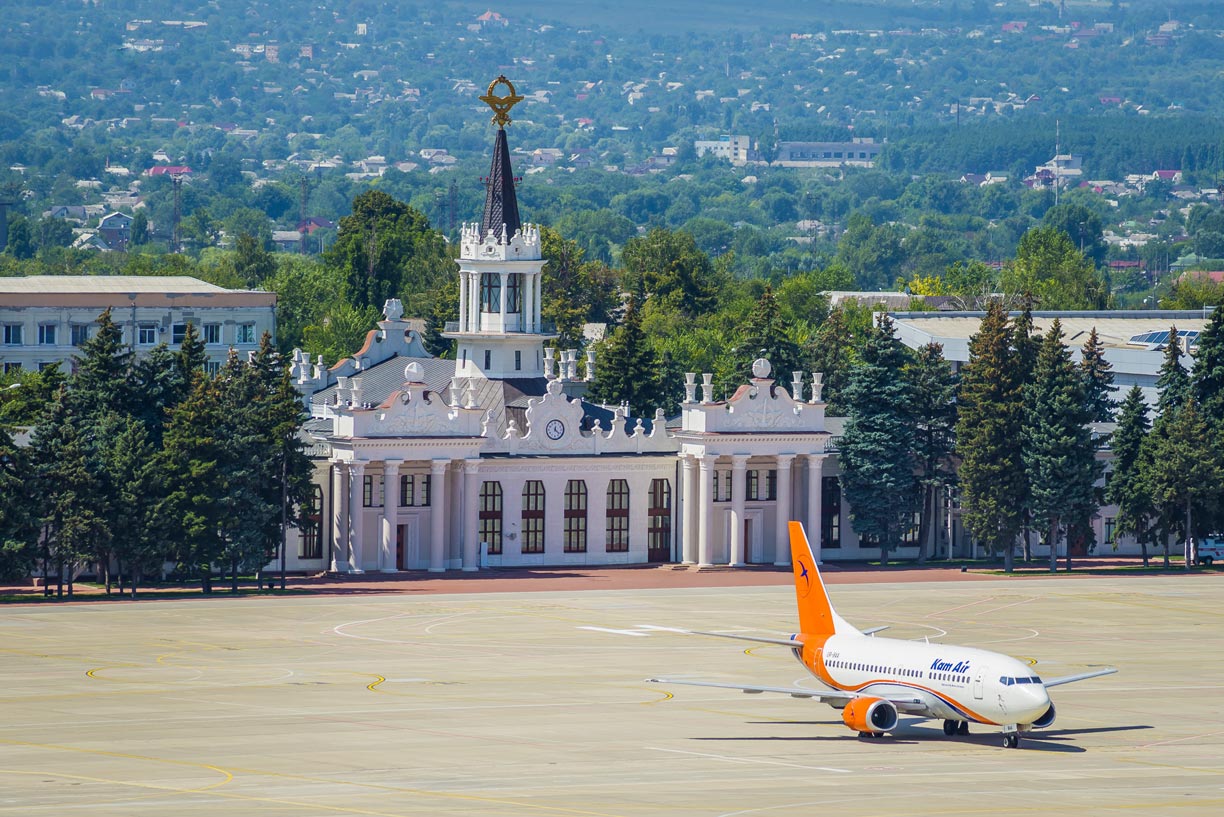 A Kam Air Boeing 737 at Kharkiv International Airport in front of the historic old terminal.
Photo: Konstantin Brizhnichenko
- Boryspil International Airport - Kyiv (IATA: KBP)
- Simferopol International Airport (IATA: SIP)
- Kyiv International Airport (Zhuliany) (IATA: IEV)
- Lviv International Airport (IATA: LWO)
- Odesa International Airport (IATA: ODS)
- Kharkiv International Airport (IATA: HRK)
- Zaporizhzhia International Airport (IATA: OZH)
- Dnipropetrovsk International Airport - Dnipro (IATA: DNK)
- Kherson International Airport (IATA: KHE)
- Ivano-Frankivsk International Airport (IATA: IFO)
- Chernivtsi International Airport (IATA: CWC)
- Havryshivka Vinnytsia International Airport - Vinnytsia (IATA: VIN)
- Mykolaiv Airport (IATA: NLV)
- Kryvyi Rih International Airport (IATA: KWG)
- Rivne International Airport (IATA: RWN)
- Poltava International Airport (IATA: PLV)
- Uzhhorod International Airport (IATA: UDJ)
Cities and towns of Ukraine on the map:
Belgorod, Berdyansk, Berdychiv, Bila Tserkva, Brașov, Cherkasy, Chernihiv, Chernivtsi, Chernobyl, Dnipro, Donetsk, Feodosia, Horlivka, Ivano-Frankivsk, Izmail, Izyum, Kamianets-Podilskyi, Kerch, Kharkiv, KhersonLuhansk, Khmelnytskyi, Konotop, Korosten, Kovel, Kramatorsk, Kremenchuk, Kropyvnytskyi, Kryvyi Rih, Kyiv, Lubny, Lutsk, Lviv, Mariupol, Melitopol, Mykolaiv, Nikopol, Nizhyn, Nova Kakhovka, Novohrad-Volynskyi, Odessa, Pervomaysk, Poltava, Pryluky, Rivne, Romny, Sarny, Sevastopol, Shostka, Sievierodonetsk, Sighetu, Simferopol, Smila, Stryi, Sumy, Ternopil, Uman, Uzhhorod, Vinnytsia, Yalta, Yevpatoriya, Zaporizhzhia, and Zhytomyr.
Advertisements:

