Nations Online
All Countries in the World
Nations Online All Countries in the World | |
Home  |
___ Satellite View and Map of the City of Kiev (Київ), Ukraine |
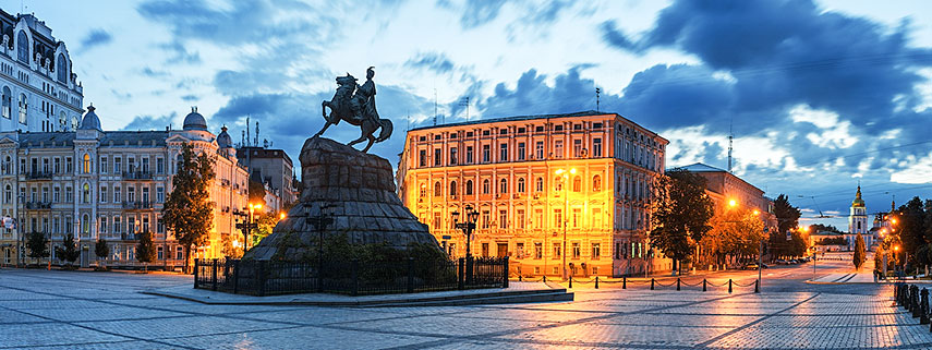 Bohdan Khmelnytsky Monument in Kiev, Sophia Square. Image: Naumenko |
About Kiev Satellite view is showing Kiev, largest city and the national capital of Satellite view is showing Kiev, largest city and the national capital of Kiev is the industrial, scientific, educational, and cultural center of Ukraine. The city has a population of about 2.85 million inhabitants (in 2013). Official language is Ukrainian. Just zoom in (+) to see Maidan Nezalezhnosti, the Independence Square, Kiev's central square and the center of public political activity. The city is home to National Taras Shevchenko University KNU, founded in 1834, ranked as the best university in Ukraine. 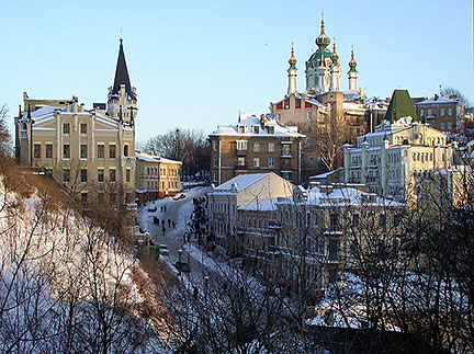 Andriyivskyy Descent, a historic area in the capital is known as the "Montmartre of Kiev", with the "Castle of Richard the Lionheart" (built 1902–1904) on the left, and the Baroque Saint Andrew's Church in the background. Image: R. Lezhoev Saint Sophia's Cathedral (Kievan Rus' Eastern Orthodox Cathedral) is a UNESCO World Heritage Site, Kiev Cave Monastery complex (Kiev-Pechersk Lavra with Great Lavra Bell Tower), a UNESCO World Heritage Site The map shows a city map of Kiev with expressways, main roads and streets, as well as the location of Kyiv International Airport (IATA code: IEV). Zoom out to find the location of Boryspil International Airport (IATA code: KBP) about 36 km (22 mi) by road (via Е40), southeast of the city center. To find a location use the form below. |
|
| To find a location type: street or place, city, optional: state, country. |
Local Time Ukraine:
Tuesday-April-16 07:15
Standard Time: UTC/GMT +2 hours.Daylight saving time from end of March till end of October: UTC/GMT +3 hours. |
One World - Nations Online .:. let's care for this planet Promote that every nation assumes responsibility for our world. Nations Online Project is made to improve cross-cultural understanding and global awareness. More signal - less NOISE |
| Site Map
| Information Sources | Disclaimer | Copyright © 1998-2023 :: nationsonline.org |

