
|
|
___ Political Map of Bulgaria | |
About Bulgaria |
|
Bulgaria (Bulgarian: България), officially the Republic of Bulgaria, is a unitary state on the Balkan Peninsula in southeastern Europe bordering the Black Sea in east. The country shares international borders with Greece, the Republic of Macedonia, Romania, Serbia, and Turkey. Airports Sofia International Airport (IATA code: SOF), is the main airport of Bulgaria, together with Varna Airport (IATA code: VAR) and Burgas Airport (IATA code: BOJ) are the major international airports in the country Seaports Bulgaria's chief ports with international significance are Varna and Burgas. Depicted on the map is the area of Bulgaria with international borders, the national capital Sofia, province capitals, major cities, main roads, railroads and major airports. |
 Bookmark/share this page |
 One World - Nations Online all countries of the world |
|
|
||
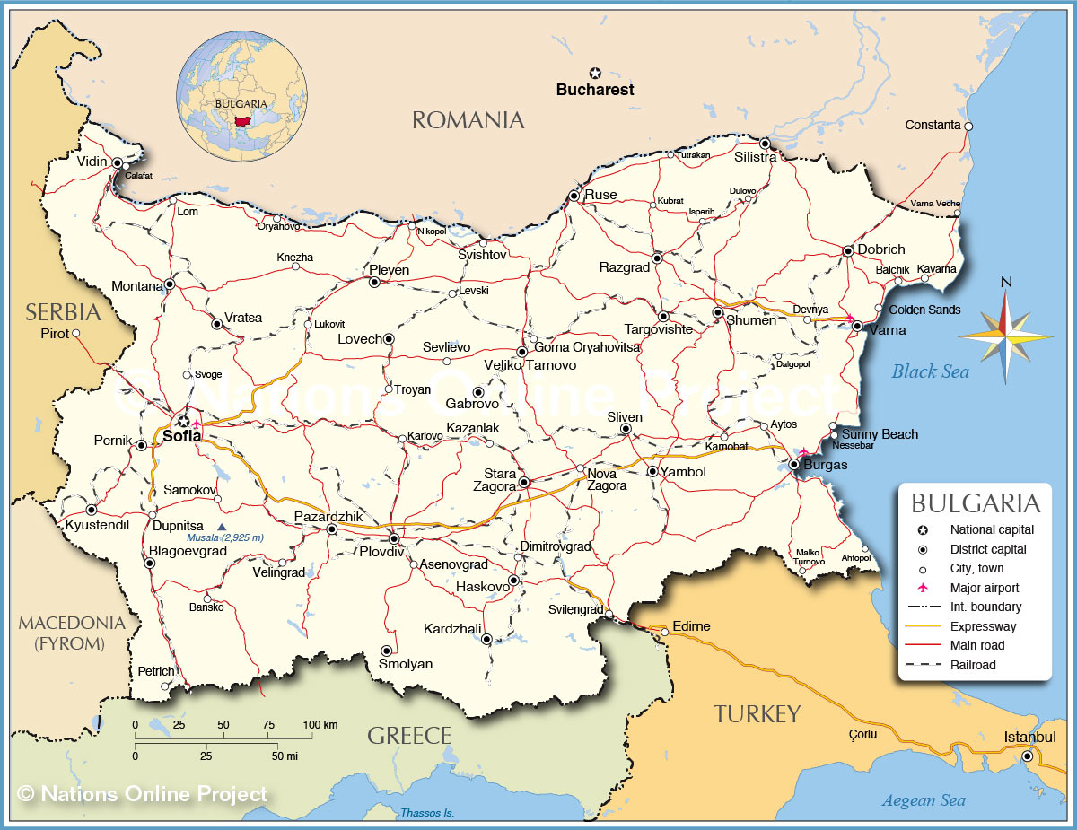 Political Map of Bulgaria Map based on a UN map. |
|||||||
| The Map shows the location of following Bulgarian cities: Ahtopol, Asenovgrad, Aytos, Balchik, Bansko, Blagoevgrad, Burgas, Dalgopol, Devnya, Dimitrovgrad, Dobrich, Dulovo, Dupnitsa, Gabrovo, Golden Sands, Gorna Oryahovitsa, Haskovo, Isperih, Kardzhali, Karlovo, Karnobat, Kavarna, Kazanlak, Knezha, Kubrat, Kyustendil, Levski, Lom, Lovech, Lukovit, Malko Turnovo, Montana, Nessebar, Nikopol, Nova Zagora, Oryahovo, Pazardzhik, Pernik, Petrich, Pleven, Plovdiv, Razgrad, Ruse, Samokov, Sevlievo, Shumen, Silistra, Sliven, Smolyan, Sofia, Stara Zagora, Sunny Beach, Svilengrad, Svishtov, Svoge, Targovishte, Troyan, Tutrakan, Varna, Veliko Tarnovo, Velingrad, Vidin, Vratsa, Yambol |
More about Bulgaria: Cities: Country: Continent: |
Sofia Current Weather Conditions
|
Related Consumer Information: | ||||
Major Cities in Central and Eastern Europe: Bratislava | Bucharest | Budapest | Chisinau | Kiev | Minsk | Moscow | Odessa Prague | Riga | Sevastopol (Crimea) | Saint Petersburg | Tallinn | Warsaw | Vilnius Maps of other countries and regions in Central and Eastern Europe Belarus Map, Czech Republic Map, Hungary Map, Moldova Map, Poland Map, Romania Map, Slovakia Map, Ukraine Map, Crimea Map Searchable Maps of other countries and regions in Central and Eastern Europe Belarus, Czech Republic, Hungary Map, Moldova, Poland Map, Romania Map, Slovakia, Ukraine Map |
One World - Nations Online .:. let's care for this planet Every nation is responsible for the current state of our world. |
| Site Map
| Information Sources | Disclaimer: Privacy Policy, etc. Contact: [email protected] | Copyright © 1998-2021 :: nationsonline.org |
