Nations Online
All Countries in the World
Nations Online All Countries in the World | |
Home  |
|
___ Satellite View and Map of the City of Surabaya, Indonesia |
|
 Internatio building (Internationale Crediten Handelvereeniging) in Surabaya, East Java. Image: Everyone Sinks Starco |
|
About SurabayaAt the beginning of the 2nd millennium Surabaya was the capital of the Javanese Kingdom of Janggala, the port city was known then as 'Hujung Galuh'. A hundred years later it merged with the Kingdom of Kediri. In 1743 the Dutch East Indies Companies took over the city from the Islamic Sultanate of Mataram. 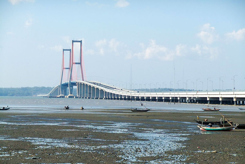 Suramadu Bridge, Indonesia's longest bridge connects Surabaya and Madura Island over the Madura Strait. Image: Midori Surabaya has a population of around 3 million, more than 6 million people live in the metropolitan area. Spoken language is Suroboyoan, a Javanese dialect. Some of the few attractions of Surabaya are: Heroes Monument, the tower is the best known landmark in the city. Ciputra Waterpark, one of the biggest waterparks in Southeast Asia. Pantai Ria amusement park, one of its main attractions is the Sanggar Agung Temple, a Chinese temple with a 20 meters tall statue of Guan Yin. Muhammad Cheng Hoo Mosque, offers Islamic and Chinese architecture. Surabaya Zoo (Bonbin Surabaya), once known as the largest zoo in South-East Asia is today just another neglected zoo in Indonesia. Suramadu Bridge, Indonesia's longest bridge. Mount Bromo volcano, part of the Tengger massif, an active volcanic complex in East Java. The map shows a city map of Surabaya with expressways, main roads and streets. Zoom out to find the location of Surabaya International Airport (IATA code: SUB). The airport is also known as Juanda International Airport, it is Indonesia’s second-largest and second-busiest airport. To find a location use the form below. |
|
| To find a location type: street or place, city, optional: state, country. |
Local Time Indonesia:
Friday-April-26 19:36
Time zone: Western Indonesian Time (WIB) UTC/GMT +7 hours |
|
φ Latitude, λ Longitude (of Map center; move the map to see coordinates): , |
||||||
| Google Earth: Searchable Map and Satellite view of Surabaya, Indonesia. City Coordinates: 7°15′55″S 112°44′33″E |
Bookmark/share this page |
|||||
| More about Indonesia: Cities: Country: Indonesia key statistical data. Continent: |
Weather Conditions Surabaya: Weather station at Juanda International Airport
External Links Surabaya Official website of the city government (in Indonesian) Pariwisata Surabaya Surabaya's official tourism website. Wikipedia: Surabaya |
Related Consumer Information:
|
||||
Other Major Cities in South East Asia: Bandar Seri Begawan, Bangkok, Hanoi, Ho Chi Minh City (Saigon), Johor Bahru, Kuala Lumpur, Manila, Phnom Penh, Singapore, Vientiane, Yangon Searchable Maps of other Countries in South East Asia: Brunei, Cambodia, Laos, Malaysia, Myanmar (Burma), Philippines, Singapore, Thailand, Vietnam Country Profiles of South East Asian Nations Brunei, Cambodia, Laos, Malaysia, Myanmar (Burma), Philippines, Singapore, Thailand, Vietnam |
||
Map Help [ show ] |
||
One World - Nations Online .:. let's care for this planet Promote that every nation assumes responsibility for our world. Nations Online Project is made to improve cross-cultural understanding and global awareness. More signal - less NOISE |
| Site Map
| Information Sources | Disclaimer | Copyright © 1998-2023 :: nationsonline.org |

