Nations Online
All Countries in the World
Nations Online All Countries in the World | |
Home  |
___ Map and Satellite View of Laos (Lao People's Democratic Republic) |
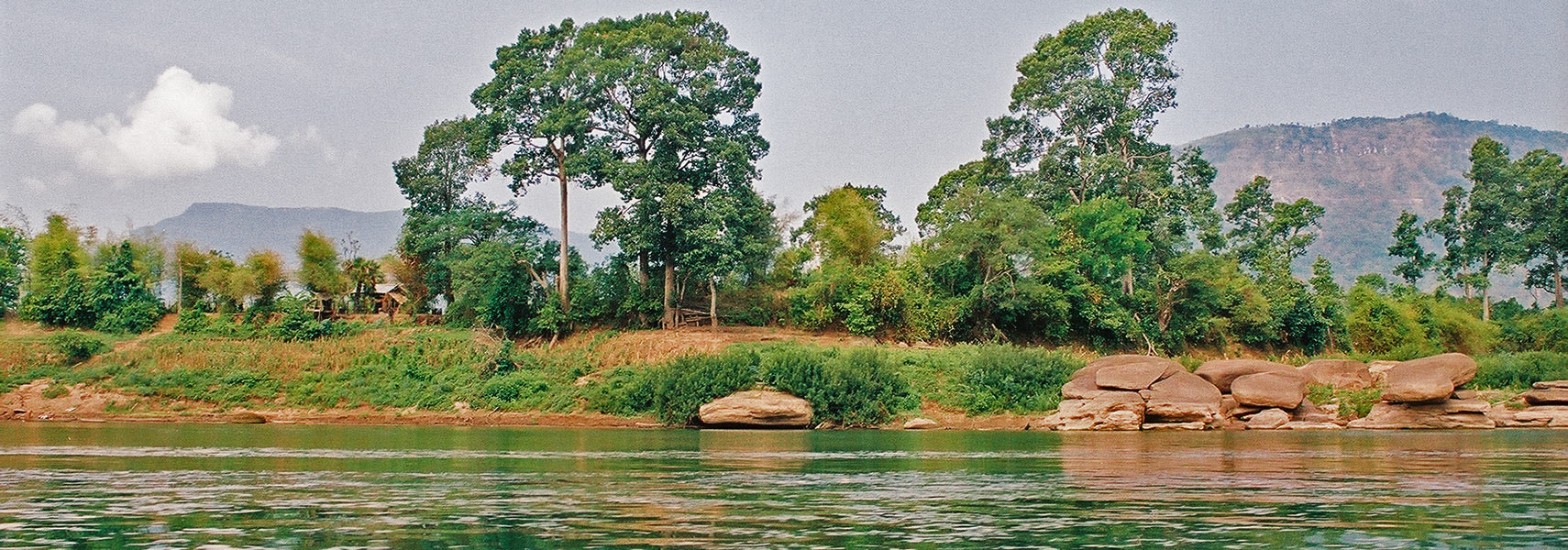 Mekong River, Lao near the city of Pakse. Image: nationsonline.org |
Searchable Map and Satellite View of Laos using Google Earth Data Satellite view shows Laos, a landlocked country in Southeast Asia on the Indochinese peninsula between Thailand and Vietnam, north of Cambodia. Satellite view shows Laos, a landlocked country in Southeast Asia on the Indochinese peninsula between Thailand and Vietnam, north of Cambodia.It shares also borders with China and Myanmar (Burma). 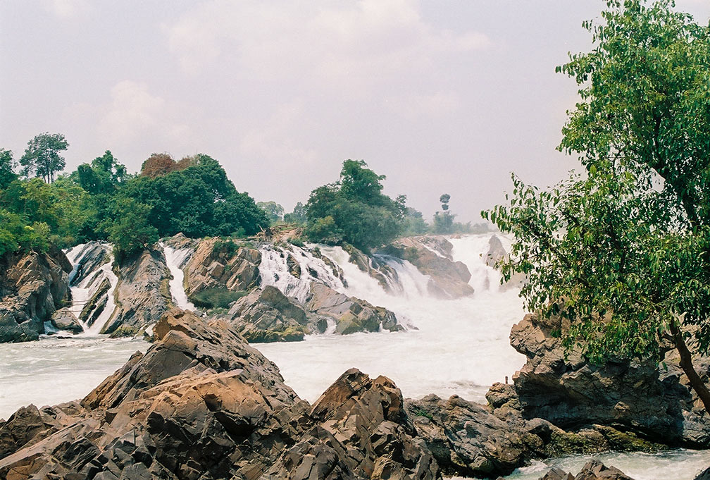 The Khone Phapheng Falls in southern Lao, a waterfall on the Mekong River in the Champasak Province near its border with Cambodia. The Khone Falls are the largest in southeast Asia and they are the main reason that the Mekong is not fully navigable into China. Image: © nationsonline.org In 1975, the Pathet Lao achieved total control, and a communist republic was established. At the end of the 20th century Laos saw a gradual return to free enterprise. The country has a population of 7 million inhabitants (UN estimate 2015). Capital city is Vientiane (Viang Chan). Spoken languages are Laotian (official) and Thai. The map shows Laos with cities, towns, and main roads. To find a location use the form below. |
|
| To find a location type: street or place, city, optional: state, country. |
Local Time Vientiane:
Sunday-April-28 10:25
Time zone: Indochina Time (ICT) :: UTC/GMT +7 hours |
|
φ Latitude, λ Longitude (of Map center; move the map to see coordinates): , |
||||||
| Google Maps: Searchable Map and Satellite View of Lao People's Democratic Republic. |
Bookmark/share this page |
|||||
| More about Laos: Landmarks: Laos' national monument. A Khmer Hindu temple complex. Cities: (capital city) Country: Lao PDR Key Statistical Data. Continent: |
Weather Conditions Vientiane:
|
Related Consumer Information:
|
||||
Searchable Maps of other Countries in South East Asia: Brunei, Cambodia, Indonesia, Laos, Malaysia, Myanmar (Burma), Philippines, Singapore, Thailand, Vietnam |
Map Help [ show ] |
One World - Nations Online .:. let's care for this planet Promote that every nation assumes responsibility for our world. Nations Online Project is made to improve cross-cultural understanding and global awareness. More signal - less NOISE |
| Site Map
| Information Sources | Disclaimer | Copyright © 1998-2023 :: nationsonline.org |

