Nations Online
All Countries in the World
Nations Online All Countries in the World | |
Home  |
___ Satellite View and Map of the Philippines |
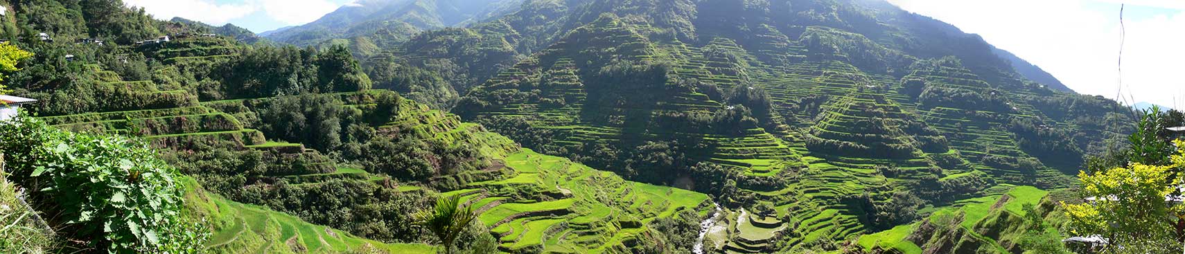 Panorama view of Banaue Rice Terraces, 2000-year old terraces carved into the mountains, they are a Philippine National Cultural Treasure located in Ifugao Province on the island of Luzon, Philippines. Image by: Niro5 |
About the Philippines The Map/Satellite view is showing the islands of the Philippines in Southeast Asia in the South China Sea, with Malaysia in south-west, Indonesia in south, and Vietnam in west, Taiwan, and mainland China to the north. The Map/Satellite view is showing the islands of the Philippines in Southeast Asia in the South China Sea, with Malaysia in south-west, Indonesia in south, and Vietnam in west, Taiwan, and mainland China to the north.The tropical island nation consists of an archipelago of 7,100 islands. Most of these islands are of volcanic origin, the country is situated on the South Asian part of the Pacific Ring of Fire, an area of strong volcanic activities. 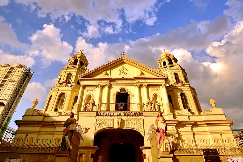 The Minor Basilica of the Black Nazarene or Quiapo Church, Manila. Image: Allan Jay Quesada With a total area of 300,000 km², the islands combined are about the size of Italy or slightly bigger than the US state of Arizona. The potentially-active stratovolcano Mount Apo on the island of Mindanao is the highest mountain in the country with an elevation of 2,954 m (9,692 ft). Capital city is Manila, with a population of 1.8 million people, it is one of the sixteen cities which make up Metro Manila, the National Capital Region with a population of 12.9 million people (in 2015). The Philippines has 8 major dialects. The languages being taught in the Philippines are Tagalog and English. Philippines tropical climate has three "seasons", from March to May it is hot and dry, rainy season is from June to October, from November to February the climate is moderate and its the best time to visit the island state. The page shows a map of the Philippines. To find a location use the form below. |
|
|
To find a location type: street or place, city, optional: state, country. |
Local Time Philippines:
Friday-June-12 01:04
Time zone: Philippine Time (PHT) UTC/GMT +8 hours |
|
φ Latitude, λ Longitude (of Map center; move the map to see coordinates): , |
||||||
| Google Earth: Searchable map/satellite view of Republic of the Philippines (Republika ng Pilipinas). |
Bookmark/share this page |
|||||
|
|
||||||
| More about the Philippines: Cities: Country: Philippines key statistical data. Continent: |
Current Weather Conditions Manila: at Clark International Airport, Angeles City, Manila
|
Related Consumer Information:
|
||||
Searchable Maps of other Countries in South East Asia: Brunei, Cambodia, Indonesia, Laos, Malaysia, Myanmar (Burma), Singapore, Thailand, Vietnam |
Map Help [ show ] |
One World - Nations Online .:. let's care for this planet Promote that every nation assumes responsibility for our world. Nations Online Project is made to improve cross-cultural understanding and global awareness. More signal - less NOISE |
| Site Map
| Information Sources | Disclaimer | Copyright © 1998-2024:: nationsonline.org |

