Nations Online
All Countries in the World
Nations Online All Countries in the World | |
Home  |
___ Satellite View and Map of the City of Stuttgart, Germany |
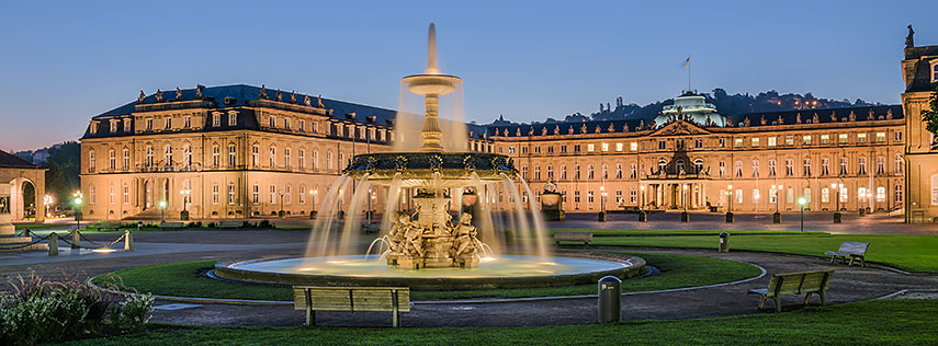 Neues Schloss (new palace) with Schlossplatzspringbrunnen (fountain), in the heart of the city. Image: Julian Herzog |
About Stuttgart Satellite view is showing Stuttgart, sixth-largest city in Satellite view is showing Stuttgart, sixth-largest city in Stuttgart has a city population of about 600,000 inhabitants (2013), 2.7 million people live in the "Stuttgart Region". 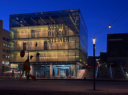 Kunstmuseum Stuttgart at Kleiner Schlossplatz, 5.000 square meter of contemporary and modern art. Image: Enslin Some points of interest in Stuttgart: Museums: Staatsgalerie Stuttgart (one of Europe's leading art museums), Kunstmuseum Stuttgart (museum for contemporary and modern art), Mercedes-Benz Museum (history of the Mercedes-Benz brand), Porsche Museum (New Porsche-Museum opened 2009), Neues Schloss (the 17th Century Baroque residence of the Kings of Württemberg) Fernsehturm Stuttgart (the landmark of Stuttgart, the 'Television tower' was the first telecommunications tower in the world), Wilhelma (Zoo and Botanical Garden since 1846) Just zoom in (+) to see Altes and Neues Schloss (Old and New Castle) in Stuttgart's city center. The Map shows a city map of Stuttgart with expressways, main roads and streets. Zoom out to find the location of Stuttgart Airport (IATA code: STR) situated in south near Echterdingen. To find a location use the form below. To view just the map, click on the "Map" button. |
|
| To find a location type: street or place, city, optional: state, country. |
Local Time Stuttgart:
Saturday-April-27 00:19
Standard Time Zone (CET): UTC/GMT +1 hourCEST (Daylight Saving Time) in use from end of March until end of October: time zone offset: UTC/GMT +2 hours |
 Map of Bavaria Map of Bavaria |
 Map of Berlin Map of Berlin |
 Map of Brandenburg Map of Brandenburg |
|
 Map of Bremen Map of Bremen |
 Map of Hamburg Map of Hamburg |
 Map of Hesse Map of Hesse |
 Map of Lower Saxony Map of Lower Saxony |
 Map of Mecklenburg-Western Pomerania Map of Mecklenburg-Western Pomerania |
 Map of North Rhine-Westphalia Map of North Rhine-Westphalia |
 Map of Rhineland-Palatinate Map of Rhineland-Palatinate |
 Map of Saarland Map of Saarland |
 Map of Saxony Map of Saxony |
 Map of Saxony-Anhalt Map of Saxony-Anhalt |
 Map of Schleswig-Holstein Map of Schleswig-Holstein |
 Map of Thuringia Map of Thuringia |
Europe's Alpha Cities Tour: Rome - Zürich - Madrid - Paris - Amsterdam London - Stockholm - Berlin - Prague - Vienna - Istanbul Other Major Cities in Western Europe Bern, Bordeaux, Brussels, Cannes, Cologne, Den Hague, Dresden, Düsseldorf, Frankfurt, Geneva, Hamburg, Luxembourg (City), Lyon, München, Monaco, Nice, Prague, Rotterdam, Strasbourg, Toulouse, Vaduz, Vienna |
Map Help [ show ] |
One World - Nations Online .:. let's care for this planet Promote that every nation assumes responsibility for our world. Nations Online Project is made to improve cross-cultural understanding and global awareness. More signal - less NOISE |
| Site Map
| Information Sources | Disclaimer | Copyright © 1998-2023 :: nationsonline.org |

