
One World
Nations Online
Countries in the World
|
|
|
One World Nations Online Countries in the World | |
Home  |
___ Satellite Viewand Map of Rotterdam (45-degree view available) |
 Rotterdam, Erasmus bridge over the Nieuwe Maas river seen from Euromast observation tower. The 800 m long bridge connects the north and south parts of the city. Image: Mlefter |
About the City of Rotterdam Satellite view is showing Rotterdam, second largest city and the principal port of the Satellite view is showing Rotterdam, second largest city and the principal port of the 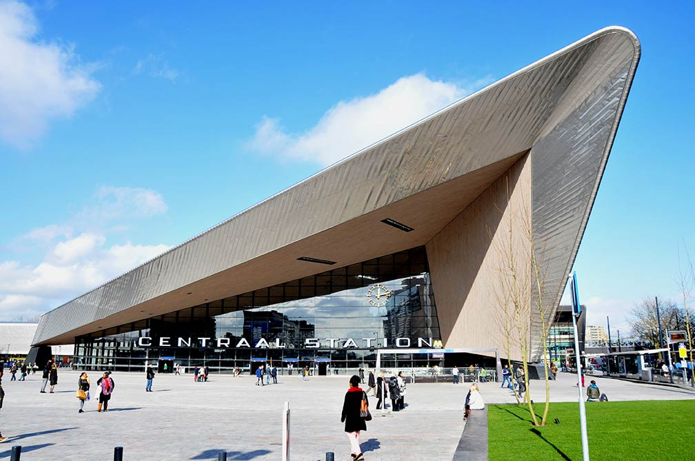 Rotterdam's new Central Station reopened in March 2014, it is designed to handle up to 320,000 passengers daily. Image: Jan Oosterhuis The city has a population of about 1 million residents, about 2,6 million people live in its metropolitan region. Official language is Dutch. The Map shows a city map of Rotterdam with expressways, main roads and streets, zoom out to find Rotterdam Airport (IATA code: RTM), located about locate 6 km (4 mi) by road (via S112 and Fairoaksbaan) northwest of the city center. To find a location use the form below. To view just the map, click on the "Map" button. |
|
| To find a location type: street or place, city, optional: state, country. |
Local Time Rotterdam:
Saturday-April-27 05:35
Standard Time Zone (CET): UTC/GMT +1 hourCEST (Daylight Saving Time) in use from end of March until end of October: time zone offset: UTC/GMT +2 hours |
|
φ Latitude, λ Longitude (of Map center; move the map to see coordinates): , |
||||||
| Sorry! Google's pricing policy has made it impossible for us to continue showing Google Maps. We apologize for any inconvenience. Google Map: Searchable Map of the City of Rotterdam, Kingdom of the Netherlands. City Coordinates: 51°55′51″N 4°28′45″E |
Bookmark/share this page |
|||||
| More about the Netherlands: Cities: Country: Continent: External Links Rotterdam Rotterdam's official web site. Port of Rotterdam Port City Wikipedia: Rotterdam Wikipedia entry Rotterdam. |
Weather Conditions Rotterdam
|
Related Consumer Information:
|
||||
Europe's Alpha Cities Tour: Rome - Zürich - Madrid - Paris - Amsterdam London - Stockholm - Berlin - Prague - Vienna - Istanbul Other Major Cities in Western Europe Bern, Bordeaux, Brussels, Cannes, Cologne, Den Hague, Dresden, Düsseldorf, Frankfurt, Geneva, Hamburg, Luxembourg (City), Lyon, München, Monaco, Nice, Strasbourg, Stuttgart, Toulouse, Vaduz |
||||||
Map Help [ show ] |
||||||
One World - Nations Online .:. let's care for this planet Promote that every nation assumes responsibility for our world. Nations Online Project is made to improve cross-cultural understanding and global awareness. More signal - less NOISE |
| Site Map
| Information Sources | Disclaimer | Copyright © 1998-2023 :: nationsonline.org |

